Maps of PYagina Peninsula
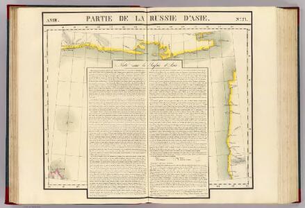
Partie, Russie d'Asie. Asie 27.
1 : 1641836 Vandermaelen, Philippe, 1795-1869
中俄交界詳圖 (第七幅)
1 : 14400000 中俄交界詳圖 宣统元年至二年[1909-1910],武昌:武昌亞新地學社出版 该图集以1幅总图15幅详图(分图)的形式,详细绘制了清末中俄边界线以及清代中俄边界的变化,空间上东起乌苏里江、图们江,向西延黑龙江、蒙古、新疆直到帕米尔地区。详图中详细标注了边界上各界牌所在位置及名称。 该图未标注成图时间,根据图上内容推测应为宣统元年至二年。详图第十幅中,吉林宁古塔标注了绥芬府,而绥芬府是宣统元年[1909]四月升绥芬厅而置,次年四月又改为宁安府,因此该图应成图于宣统元年或二年。图上其他标注也符合这一时间限定,如总图中已绘制了京张铁路,而京张铁路通车时间是1909年,表明该图应在1909年或之后;北京处则标注为“順天京師”,而顺天府于民国二年被废,京师改为京兆地方,表明该图应在1913年之前。因此,该图成图时间应在宣统元年至二年之间,其中,又以宣统二年上半年的可能性最大。 1集16图,彩印,中文,图幅为36.5 x 47.6 cm,总图比例尺1:14400000,详图比例尺1:1500000,以穿过北京的116°经线为中央经线,总图经纬度范围约为E50°-145°; N40°-60°。 Harvard-Yenching | Offsite Storage C (HD) | G2306.F2 H93 1930Z;Hollis Number:012092643 武昌:武昌亞新地學社
Ice Chart, Okhotsk Sea Region, August.
U.S. Navy
Ice Chart, Okhotsk Sea Region, June.
U.S. Navy
Ice Chart, Okhotsk Sea Region, March.
U.S. Navy
Manchuria
1 : 4000000 Mandžusko (Čína) War Office
Manchuria
1 : 4000000 Mandžusko (Čína) Royal Geographical Society
Ice Chart, Okhotsk Sea Region, January.
U.S. Navy
Ice Chart, Okhotsk Sea Region, November.
U.S. Navy
Ice Chart, Okhotsk Sea Region, April
U.S. Navy
Ice Chart, Okhotsk Sea Region, October.
U.S. Navy
Ice Chart, Okhotsk Sea Region, February.
U.S. Navy
Ice Chart, Okhotsk Sea Region, December.
U.S. Navy
Ice Chart, Okhotsk Sea Region, May.
U.S. Navy
Ice Chart, Okhotsk Sea Region, July.
U.S. Navy
Karte von Jesso und Sagalien
Hokkaidó (Japonsko)
Kamschatka
1 : 4000000 Kamčatka (Rusko)
Charte von der Nordwestküste Americas nach Vancouver
Vancouver-oblast (Britská Kolumbie) Martius, C. von Schwarzmann, I.
Mandschukuo
1 : 4000000 Mandžusko (Čína) OKH
42. Kamchatka. The World Atlas.
1 : 3000000 USSR (Union of Soviet Socialist Republics).
Suite de la carte de la Sibérie et le pays de Kamtschatka
1 : 14500000 1 Karte : Kupferdruck ; 23 x 25 cm [Bellin]
Suite de la carte de la Sibérie et le pays de Kamtschatka
1 : 14500000 1 Karte : Kupferdruck ; 23 x 25 cm [Bellin]
Discoveries made in 1787 In the Seas of China and Tartary between Manilla and Avateha.
1 : 12850000 La Perouse, Jean-Francois de Galaup, comte de, 1741-1788
Mers, Chine, Tartarie.
1 : 11400000 La Perouse, Jean-Francois de Galaup, comte de, 1741-1788
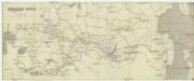
Teatr voennych dějstvīj v 1904 - 1905 godach
China Russisch-Japanischer Krieg
[Východní Asie].
Asie východní Berghaus, Heinrich Karl Wilhelm Horsburgh, James
Russia asiatica
1 : 13000000 1 Karte : Kupferdruck ; 42 x 30 cm presso Antonio Zatta, e figli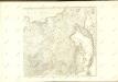
Azijatskaja Rossija
1 : 10500000 Rusko východní