Maps of Japan

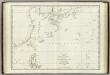
Mers, Chine, Tartarie.
1 : 11400000 La Perouse, Jean-Francois de Galaup, comte de, 1741-1788
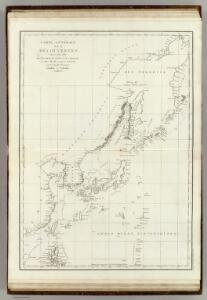
Discoveries made in 1787 In the Seas of China and Tartary between Manilla and Avateha.
1 : 12850000 La Perouse, Jean-Francois de Galaup, comte de, 1741-1788
Karten - Skizzen für die Schul - Praxis

China Veteribus Sinarum Regio nunc Incolis Tame dicta. [Karte], in: Theatrum orbis terrarum, sive, Atlas novus, Bd. 2, S. 259.
1 Karte aus Atlas Blaeu, Joan Blaeu, Willem Janszoon
Teatr voennych dějstvīj v 1904 - 1905 godach
China Russisch-Japanischer Krieg
Ostasien
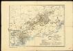
1 : 5000000 Asie východní Justus Perthes
Chinese, Japanese ports.
1 : 10000000 Philip, George
Asia (Eastern Sheet).
1 : 14606000 Fisher, Richard Swainson
China [Karte], in: Gerardi Mercatoris Atlas, sive, Cosmographicae meditationes de fabrica mundi et fabricati figura, S. 532.
1 Karte aus Atlas Mercator, Gerhard Montanus, Petrus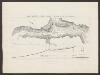
China Veteribus Sinarum Regio nunc Incolis Tame dicta. [Karte], in: Le théâtre du monde, ou, Nouvel atlas contenant les chartes et descriptions de tous les païs de la terre, Bd. 2, S. 252.
1 Karte aus Atlas Blaeu, Willem Janszoon und Blaeu, Joan Blaeu, Willem Janszoon
China Veteribus Sinarum Regio nunc Incolis Tame dicta. [Karte], in: Novus atlas absolutissimus, Bd. 6, S. 121.
1 Karte aus Atlas Janssonius Offizin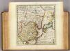
Empire of China, island of Japan.
1 : 18000000 Moll, Herman, d. 1732
China Veteribus Sinarum Regio nunc Incolis Tame dicta. [Karte], in: Novus Atlas, das ist, Weltbeschreibung, Bd. 2, S. 274.
1 Karte aus Atlas Blaeu, Joan Blaeu, Willem Janszoon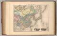
Chine et Coree.
1 : 13700000 Migeon, J.

Schauplatz der Ereignisse in Ost - Asien

General overview of the area worked by the Basel Mission in Canton province, China
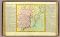
La Chine, Coree, Japon.
1 : 14300000 Clouet, J. B. L. (Jean-Baptiste Louis), b. 1730
CARTE DE LE'EMPIRE DE LA CHINE

Neue Charte von der Nordost-Küste von Asien und den Japanischen Inseln
Asie východní Vashon, T. G. Götz, J. im Verlage des Geograph. Instituts
Islands of Japan.
1 : 8553600 Fullarton, A. & Co.
Karte des ostasiatischen Kriegsschauplatzes
1 : 11000000 Asie východní Hofbuchdruckerei A. Haase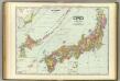
Japan.
1 : 2600000 Rand McNally and Company
Die Länder im das Gelbe und Japanische MeerDas östliche Schan-Tung
Mers, Chine, Tartarie. 1.
1 : 6250000 La Perouse, Jean-Francois de Galaup, comte de, 1741-1788
JAPON

JAPON
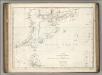
Chart of Discoveries, Made in 1787, in the Seas of China and Tartary, Sheet I.
1 : 7500000 La Perouse, Jean-Francois de Galaup, comte de, 1741-1788