Maps of Great Lakes
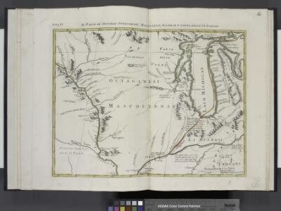
Il paese de' Selvaggi Outagamiani, Mascoutensi, Illinesi, e parte delle VI. Nazioni.
from Le colonie unite dell' America settentrle : di nuova projezione a s.s.e.e. li Signori Riformatori dello Studio di Padova.
Les États Unis de l'Amérique septentrionale
1 : 6050000 Spojené státy americké-oblast západní Bonne, Rigobert André
134-35. Mich., Wis., Minn., Ia., Mo., Ill., Ind., Ky.
1 : 3000000 Touring club italiano
U.S. West of Mississippi R. 3.
1 : 2000000 Freyhold, Edward; Warren, Gouverneur Kemble, 1830-1882; United States. Army. Corps of Engineers
Composite: Country drained by the Mississippi.
1 : 4625280 Long, Stephen H.
N.W. Territory.
1 : 8553600 Scott, Joseph
Upper Territories of the United States.
1 : 2060000 Carey, Mathew
Upper Territories of the United States.
1 : 3700000 Carey, Mathew
Sheet 1: United States of Nth. America.
1 : 1584000 Tardieu, P.F.
United States Of North America.
1 : 1550000 Arrowsmith, Aaron
Map of the Mississippi River from its Source to the Mouth of the Missouri.
1 : 1584000 Pike, Zebulon Montgomery
Plan of Captain Carvers Travels in the interior Parts of North America.
1 : 2851200 Carver, Jonathan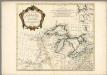
Partie occidentale du Canada et septentrionale de la Louisiane avec une partie de la Pensilvanie
1 : 3000000 Anville, Jean Baptiste Bourguignon d', 1697-1782
200-201. United States of America, North East Central. The World Atlas.
1 : 2500000 USSR (Union of Soviet Socialist Republics).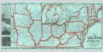
Lake Shore and Michigan So. Railway.
1 : 3431200 Lake Shore & Michigan Southern Railway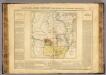
Arkansas.
1 : 4700000 Buchon, J. A. C.; Carey, H. C.; Lea, I.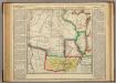
Map Of Arkansas Territory.
1 : 4752000 Lea, I.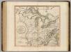
Western Terr., Kentucky, Pennsylvania, etc.
1 : 3300000 Cary, John, ca. 1754-1835
Die Staaten von Missouri, Illinois, Indiana, Ohio, Kentucky und Tennessee

G.W. Colton's Map of the Country 500 miles around Cairo
G.W. Colton's Map of the Country 500 miles around Cairo, showing the Seat of War in the West, by G.W. Colton. This Colton map from 1862 showing 500 Miles around Cairo details the western seat of the war with Illinois at the centre point and shows both Union and Confederate States. The map helps to give a sense of scale to the war as it stretched across much of the country, particularly the eastern and middle states with the southern Illinois town of Cairo close to the tempestuous Border States of Kentucky and Missouri and the northern part of the Confederacy. The map also lists fortifications in the Western and Gulf states and the principal towns and cities along the Ohio and Mississippi Rivers.
Post route map of the states of Kansas and Nebraska : showing post offices with the intermediate distances and mail routes in operation on the 1st of December, 1900 / published by order of Postmaster General Charles Emory Smith under the direction of ...
From Parts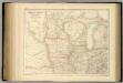
United States ... North Central Section.
1 : 2851200 Fullarton, A. & Co.
Upper Territories of the the United States.
1 : 5900000 Lucas, Fielding Jr.
Western states, territories.
1 : 6400000 Grigg, John
N. W. Territory.
1 : 8236800 Carey, Mathew
North Western and MichiganTerritories.
1 : 4400000 Lucas, Fielding Jr.
[Horní tok Mississippi]
Mississippi, řeka-oblast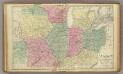
Western U.S.
1 : 3000000 Cornell, S. S. (Sarah S.)
Michigan Ter.
1 : 4435200 Lucas, Fielding Jr.