Maps of Nigeria
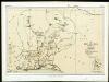
Carte des découvertis faites dans le centre de l'Afrique
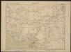
Afrika střední Oudeney Clapperton Gide fils
West Africa II.
1 : 5600000 Society for the Diffusion of Useful Knowledge (Great Britain)
Equatorial West Africa [and] surroundings of Mount Cameroon

Aequatorial-West-Afrika
1 : 3000000 Kiepert, Richard ; Sprigade, Paul Geographische Verlagshandlung Dietrich Reimer
Northern Nigeria: Native Authority Areas
169. Togo, Dahomey, Nigeria. The World Atlas.
1 : 3750000 USSR (Union of Soviet Socialist Republics).
Dritter Deutscher Kolonialkongress 1910, Sektion IV, Karte 2

The River Niger.
1 : 3400000 Arrowsmith, John
Map of the Colony and Protectorate of Nigeria 1929. Drawn and reproduced by the Nigeria Surveys March 1929
Nigeria Surveys
Nigeria (1907)
Outline map of Northern and Southern Nigeria, TSGS 2235. Shows major rivers, railways, boundaries and towns. Great Britain. General Staff. Topographical Section. [London] : [TSGS, War Office]
Schutzgebiete Kamerun und Togo [in vier Blättern] Blatt 1
Carte de l'Afrique occidentale française. Forcados
1 : 2000000 France. Service géographique des colonies [Paris] : Service géographique des colonies
Missions Protestantes au Cameroun.

Cameroon with Togo. Edited by Max Moisel

Kamerun mit Togo 1:2 000 000
1 : 2000000 Kamerun Moisel, Max Dietrich Reimer
Kamerun
Dorsch, H.
Carte du Cameroun
1 : 2000000 Kamerun
Odumase und Aussenstationen
Carte des possessions anglaises et françaises sur le Golfe de Guinée
1 : 4600000 Paris : impr. de F. Menetrier
Cameroons under United Kingdom Administration

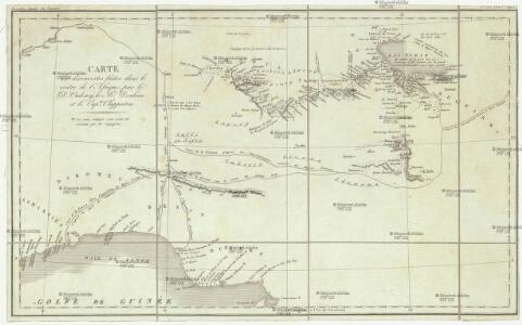
Mission du Commandant Decoeur entre le Dahomey et le Niger
1 : 100000 Decoeur [Paris] :
Partie, la Guinee. Afrique 28.
1 : 1641836 Vandermaelen, Philippe, 1795-1869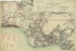
Map of the Gold Coast, Ashanti and Northern Territories
Map of the Gold Coast, Ashanti and Northern Territories, GSGS 2593. Great Britain. General Staff. Geographical Section. [London] : [GSGS, War Office]
Togo

Pays, sud de Howssa et de Bornou. Afrique 29.
1 : 1641836 Vandermaelen, Philippe, 1795-1869
Vorläufige übersicht von Zintgraff's Reise von Kamerun nach dem Benuë
1 : 3500000 Kamerun C.L. Keller
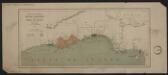
Een gedeelte van de kust van Gunea van Accara tot C. Formosa vertoonende de Bogt van Benin
Ghana Gerard van Keulen
Die Missionen auf der Gold-Küste und Sklaven-Küste

Carte du Haut-Dahomey
1 : 1180000 Chambre de commerce internationale. Comité de l'Afrique française [Paris] : Comité de l'Afrique française