Maps of powiat wadowicki

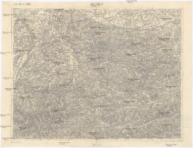
Wadowice
1 : 75000 Wadowice (Polsko) Cokorac K. u. k. Militärgeographisches Institut
Wadowice.
from Spezialkarte der osterreichisch-ungarischen Monarchie.
DVCATVS | OSWIECZENSIS, | et | ZATORIENSIS.
[Amsterdam : Joan Blaeu]
Ducatus Oswieczensis, Et Zatoriensis, Descriptio. [Karte], in: Theatrum orbis terrarum, S. 375.
1 Karte aus Atlas Ortelius, Abraham Vrients, Jan Baptista
Ducatus Oswieczensis, Et Zatoriensis, Descriptio. [Karte], in: Theatrum orbis terrarum, S. 280.
1 Karte aus Atlas Ortelius, Abraham
Coal Fields No. 8, Austria. Coal Resources of the World.
1 : 344800 Petrascheck, W.
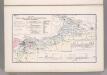
[Rechterblad], uit: Podrobná mapa Vysokých Tater
1 : 25000 Annotatie: Opname 1896/97, gedeeltelijk herzien 1931; Annotatie geografische gegevens: Inzet: Pérehled oblasti Tater. - 1:200.000 [Praag : Vojenský Zeméepisný Ústav]
Silesie de Teschen 1913
Cieszyn-oblast (Polsko) Čs. voj. zeměpis. ústav
Auschwitz u. Sator
1 : 2000000 Herzogtum Auschwitz
Krakau 107, uit: Special-Karte von Mittel-Europa / nach amtlichen Quellen bearbeitet von W. Liebenow
1 : 300000 titelvariant: W. Liebenow's Mittel-Europa; Annotatie: Titel boven de bladen: W. Liebenow's Mittel-Europa Johannes Wilhelm Liebenow 1822-1897 Frankfurt a. M. : Ludwig Ravenstein
Karta przeglądowa polskiego zagłębia węglowego
1 : 300000 Polsko Sarjusz-Makowski, Arnold
Chrzanow und Krzeszowice.
from Spezialkarte der osterreichisch-ungarischen Monarchie.
Umgebungskarte von Krakau
1 : 75000 Krakov-oblast (Polsko) K. u. k. Militärgeographisches Institut
Makow und Podvilk.
from Spezialkarte der osterreichisch-ungarischen Monarchie.
Bielitz und Biala.
from Spezialkarte der osterreichisch-ungarischen Monarchie.
Wieliczka und Myślenice
1 : 75000 Polsko Heimbach K. u. k. Militärgeographisches Institut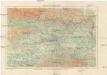
Okolice Krakowa
1 : 150000 Krakov-oblast (Polsko) Gustawicz, Bronisław
Bielitz und Biała
1 : 75000 Bielsko-Biała-oblast (Polsko) Bloschitz, R. K. u. k. Militärgeographisches Institut
Bielitz und Biała
1 : 75000 Bielsko-Biała (Polsko : oblast) Otawa K. u. k. militär-geographisches Institut
Bielitz und Biała
1 : 75000 Bielsko-Biała (Polsko : oblast) Otawa K. u. k. Militärgeographisches Institut
Silésie de Teschen
1 : 200000 Cieszyn-oblast (Polsko) Čs. voj. zeměpis. ústav
Silésie de Teschen
Cieszyn-oblast (Polsko) Čs. voj. zeměpis. ústav
Silésie de Teschen
Cieszyn-oblast (Polsko) Čs. voj. zeměpis. ústav
Generalkarte von Zentraleuropa
Karte der Kaiser Ferdinands-Nordbahn
Brno-oblast (Česko) R. v. Waldheim
Die im Stadtbuch von Zipser Neudorf genannten Orte
Zips, Spišská Nová Ves, Stadtbuch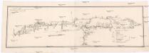
Projectirte Strasse von Billiz bis Lemberg
1 : 560000 Bielsko-Biała (Polsko) Gross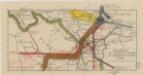
Sbírka map a diagramů použitých na mírových konferencích v Paříži v letech 1919 - 1920

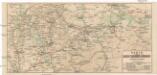
West Galizien
Bochnia (Polsko) Müller, Karl Metzburg, Georg Ignaz von im Verlage des Kunst und Industrie Comptoirs