Maps of powiat nowosądecki

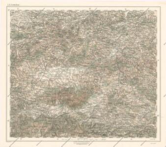
Generalkarte von Zentraleuropa

Die im Stadtbuch von Zipser Neudorf genannten Orte
Zips, Spišská Nová Ves, Stadtbuch
Orawa i Spisz
Orava (Polsko a Slovensko)
Die Central-Karpaten
1 : 200000 Karpaty Sydow, A. von Wolff
Krakau 107, uit: Special-Karte von Mittel-Europa / nach amtlichen Quellen bearbeitet von W. Liebenow
1 : 300000 titelvariant: W. Liebenow's Mittel-Europa; Annotatie: Titel boven de bladen: W. Liebenow's Mittel-Europa Johannes Wilhelm Liebenow 1822-1897 Frankfurt a. M. : Ludwig Ravenstein

[Rechterblad], uit: Podrobná mapa Vysokých Tater
1 : 25000 Annotatie: Opname 1896/97, gedeeltelijk herzien 1931; Annotatie geografische gegevens: Inzet: Pérehled oblasti Tater. - 1:200.000 [Praag : Vojenský Zeméepisný Ústav]
General-Karte des Königreiches Galizien und des Herzogthumes Bukovina

Stolice Orava a Liptov
Komitat Arva, Komitat Liptau, ethnische Gruppe
Das Zipser Gebiet
1 : 2000000 Zips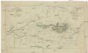
Mappa physico-geographica Carpatorum principalium e quibus Wagus et Dunajetz origines trahunt
1 : 190000 Tatry (Polsko a Slovensko) Bojtár, St.
Leutschau 121, uit: Special-Karte von Mittel-Europa / nach amtlichen Quellen bearbeitet von W. Liebenow
1 : 300000 titelvariant: W. Liebenow's Mittel-Europa; Annotatie: Titel boven de bladen: W. Liebenow's Mittel-Europa Johannes Wilhelm Liebenow 1822-1897 Frankfurt a. M. : Ludwig Ravenstein
C. Scepusiensis
Slowakei Komitat Zips
Kirchen, Klöster und Burgen in spätromanischer Zeit (nach V. Mancl)
Zips Baudenkmal
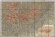
Deutsches Volksgebiet in der Zips
Zips ethnische Gruppe, Deutsche

Podrobná mapa Vysokých Tater
1 : 25000 Vysoké Tatry, pohoří-oblast (Polsko a Slovensko) Čs. voj. zeměpisný ústav
Jonction du Waag au Poprad
1 : 420000 Poprad-oblast (Slovensko)
Vysoké Tatry

Comitat-Liptau
1 : 288000 Liptov (Slovensko)
Comitat-Liptau
1 : 288000 Liptov (Slovensko)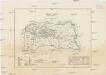
Comitat-Liptau
1 : 288000 Liptov (Slovensko)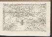
C. Liptoviensis
Slowakei Komitat Liptau
Rabka und Tymbark.
from Spezialkarte der osterreichisch-ungarischen Monarchie.
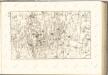
Neu-Sandez.
from Spezialkarte der osterreichisch-ungarischen Monarchie.
Makow und Podvilk.
from Spezialkarte der osterreichisch-ungarischen Monarchie.
Turdossin an der Arva.
from Spezialkarte der osterreichisch-ungarischen Monarchie.