Maps of Bielsko County

Ducatus Oswieczensis, Et Zatoriensis, Descriptio. [Karte], in: Theatrum orbis terrarum, S. 375.
1 Karte aus Atlas Ortelius, Abraham Vrients, Jan Baptista
Ducatus Oswieczensis, Et Zatoriensis, Descriptio. [Karte], in: Theatrum orbis terrarum, S. 280.
1 Karte aus Atlas Ortelius, Abraham
DVCATVS | OSWIECZENSIS, | et | ZATORIENSIS.
[Amsterdam : Joan Blaeu]
Auschwitz u. Sator
1 : 2000000 Herzogtum Auschwitz
Silesie de Teschen 1913
Cieszyn-oblast (Polsko) Čs. voj. zeměpis. ústav

Wadowice.
from Spezialkarte der osterreichisch-ungarischen Monarchie.
Bielitz und Biala.
from Spezialkarte der osterreichisch-ungarischen Monarchie.
157. Pless, uit: Topographische Uebersichtskarte des Deutschen Reiches / herausgegeben v. d. Kartogr. Abt. d. Königl. Preuß. Landesaufnahme
1 : 200000 titelvariant: Topogr. Übersichtskarte des Deutschen Reiches; Annotatie: Titel boven bladen ook: Topogr. Übersichtskarte des Deutschen Reiches; Annotatie geografische gegevens: Op elk blad twee maatstokken: 10 Kilometer = 5,5 cm; 1 geogr. Meile = 3,6 cm; Legenda onder op elk blad Königlich Preußische Landesaufnahme. Kartographische Abtheilung [S.l : Königlich Preußische Landesaufnahme, Kartographische Abtheilung]
Das Fürstenthum Teschen in Ober-Schlesien
1 : 333300 Mollova mapová sbírka Schleuen, Johann David
Maków und Podvilk
1 : 75000 Oravská Polhora-oblast (Slovensko) Adler K. u. k. Militärgeographisches Institut
Makow und Podvilk.
from Spezialkarte der osterreichisch-ungarischen Monarchie.
Saybusch.
from Spezialkarte der osterreichisch-ungarischen Monarchie.
Podrobná mapa Markrabství moravského a Vévodství slezkého
1 : 100000 Biała (Polsko : oblast) Srp, Jan Jos. R. Vilímek
Saybusch
1 : 75000 Polsko Adler K. u. k. Militärgeographisches Institut
Polhora
1 : 75000 Oravská Polhora-oblast (Slovensko) Vojenský zeměpisný ústav
Polhora a Maków
1 : 75000 Oravská Polhora (Slovensko : oblast) Vojenský zeměpisný ústav
Polhora a Maków
1 : 75000 Oravská Polhora (Slovensko : oblast) Vojenský zeměpisný ústav
III. vojenské mapování 4162
1 : 75000
Wadowice
1 : 75000 Wadowice (Polsko) Cokorac K. u. k. Militärgeographisches Institut
Maków und Podvilk
1 : 75000 Maków Podhalański, Podwilk Geripp: Offiz. Spitzer u. Assist. Irblich. Terrain: Vorst. Adler u. Oblt. Fenz
Saybusch
1 : 75000 Saybusch Schrift und Gerippe v. W. Ahl. Terrainschraffirung v. Oberlt. Hettwer
Bielitz und Biała
1 : 75000 Bielsko-Biała-oblast (Polsko) Bloschitz, R. K. u. k. Militärgeographisches Institut
Bielitz und Biała
1 : 75000 Bielsko-Biała (Polsko : oblast) Otawa K. u. k. militär-geographisches Institut
Bielitz und Biała
1 : 75000 Bielsko-Biała (Polsko : oblast) Otawa K. u. k. Militärgeographisches Institut
III. vojenské mapování 4163
1 : 75000
Hrčava
1 : 75000 Hrčava (Česko) Vojenský zeměpisný ústav
Żywiec
1 : 75000 Polsko Vojenský zeměpisný ústav
Żywiec
1 : 75000 Polsko Čs. voj. zeměpisný ústav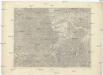
![Ducatus Oswieczensis, Et Zatoriensis, Descriptio. [Karte], in: Theatrum orbis terrarum, S. 375.](https://images-2.georeferencer.com/images/iiif/020044440007/full/,300/0/native.jpg)

