Maps of Lesser Poland Voivodeship

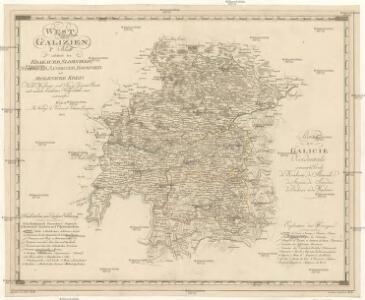
West Galizien
Bochnia (Polsko) Müller, Karl Metzburg, Georg Ignaz von im Verlage des Kunst und Industrie Comptoirs
West Galizien
Halič (Polsko a Ukrajina) Müller, Karl Metzburg, Georg Ignaz von im Verlage des Kunst und Industrie Comptoirs
Miechow 93, uit: Special-Karte von Mittel-Europa / nach amtlichen Quellen bearbeitet von W. Liebenow
1 : 300000 titelvariant: W. Liebenow's Mittel-Europa; Annotatie: Titel boven de bladen: W. Liebenow's Mittel-Europa Johannes Wilhelm Liebenow 1822-1897 Frankfurt a. M. : Ludwig Ravenstein
Krakau 107, uit: Special-Karte von Mittel-Europa / nach amtlichen Quellen bearbeitet von W. Liebenow
1 : 300000 titelvariant: W. Liebenow's Mittel-Europa; Annotatie: Titel boven de bladen: W. Liebenow's Mittel-Europa Johannes Wilhelm Liebenow 1822-1897 Frankfurt a. M. : Ludwig Ravenstein
[Rechterblad], uit: Podrobná mapa Vysokých Tater
1 : 25000 Annotatie: Opname 1896/97, gedeeltelijk herzien 1931; Annotatie geografische gegevens: Inzet: Pérehled oblasti Tater. - 1:200.000 [Praag : Vojenský Zeméepisný Ústav]
Generalkarte von Zentraleuropa
Orawa i Spisz
Orava (Polsko a Slovensko)
Die vom 2. bis 7. Mai 1915 abends erreichten Linien
1 : 515000 Polen Tarnów Weltkrieg <1914-1918> Verl. Gerhard Stalling, Oldenburg

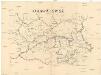
Karta okręgu wolnego miasta Krakowa
1 : 183000 Krakov-oblast (Polsko) Żebrawski, Theofil Friedlein, D. E. nakładem D.E. Friedleina
Karta okręgu wolnego miasta Krakowa
1 : 183000 Krakov-oblast (Polsko) Żebrawski, Theofil Friedlein, D. E. nakładem D.E. Friedleina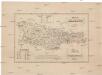
Karta okręgu wolnego miasta Krakowa
1 : 183000 Krakov-oblast (Polsko) Żebrawski, Theofil Friedlein, D. E. nakładem D.E. Friedleina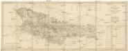
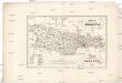
Karte des Gross-Herzogthums Krakau
1 : 114700 Krakov-oblast (Polsko) Liechtenstern, Joseph Marx von Kummersberg, Carl von Julius Wildt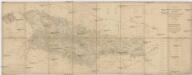
Karte des Gross-Herzogthums Krakau
1 : 114700 Krakov-oblast (Polsko) Liechtenstern, Joseph Marx von Kummersberg, Carl von Julius Wildt

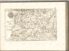
Ducatus Oswieczensis, Et Zatoriensis, Descriptio. [Karte], in: Theatrum orbis terrarum, S. 280.
1 Karte aus Atlas Ortelius, Abraham
Auschwitz u. Sator
1 : 2000000 Herzogtum Auschwitz
Crybow und Corlice.
from Spezialkarte der osterreichisch-ungarischen Monarchie.
Rabka und Tymbark.
from Spezialkarte der osterreichisch-ungarischen Monarchie.
Reliefkarte Gorlice-Tarnów
Polen Tarnów Weltkrieg <1914-1918> Verl. Gerhard Stalling, Oldenburg
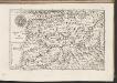
Ducatus Oswieczensis, Et Zatoriensis, Descriptio. [Karte], in: Theatrum orbis terrarum, S. 375.
1 Karte aus Atlas Ortelius, Abraham Vrients, Jan Baptista

DVCATVS | OSWIECZENSIS, | et | ZATORIENSIS.
[Amsterdam : Joan Blaeu]
Vom Dunajec bis zum Wislok
1 : 160000 Polen Dunajec-Gebiet Weltkrieg <1914-1918> Verl. Gerhard Stalling, Oldenburg
C. Arvensis
Slowakei Polen Komitat Arva
Neu-Sandez.
from Spezialkarte der osterreichisch-ungarischen Monarchie.