Maps of Angola

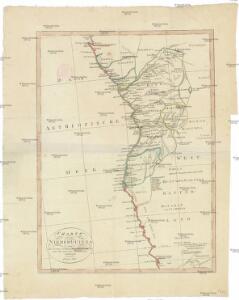
Charte von Nieder Guinea
Angola
CHARTE von NIEDER GUINEA
Angola
Nieder Guinea, W. Mittel-Africa.
1 : 5500000 Weiland, C. F. (Carl Ferdinand), d. 1847
Nieder-Guinea und das Innere des Westlichen Mittel-Africa's oder Westrand von Hoch-Africa
1 : 5480000 entworfen und gezeichnet von C.F. Weiland gestochen von Karl Mädel sen. Weimar : Geographisches Institut
Regna Congo et Angola. [Karte], in: Novus atlas absolutissimus, Bd. 6, S. 180.
1 Karte aus Atlas Janssonius Offizin
Spezial - karte von AfricaSekt. Congo (7)
1 : 4000000 1 full d'1 mapa en 10 fulls i estoig Hermann Habenicht; Justus Perthes
Spezial-Karte von Afrika
1 : 4000000 Blatt 7 Habenicht, Hermann Perthes
REGNA | CONGO | et | ANGOLA.
[Amsterdam : Joan Blaeu]
Deutsch-Südwest-Afrika
1 : 3000000 Kiepert, Richard ; Sprigade, Paul Geographische Verlagshandlung Dietrich Reimer
Deutsch-Südwestafrika
1 : 2000000 Namibie Sprigade, Paul Fischer, R. Dietrich Reimer (Ernst Vohsen)
Western half of Equatorial Africa and the expeditions on land and sea by Henry M. Stanley during 1874-77

Gross-Namaqua-Land und das Gebiet des Hauses F.A. Lüderitz
1 : 1750000 Durynsko (Německo) Hassenstein, Bruno Hahn, Th. Justus Perthes
Deutsche Kolonien
1 : 12000000 Kamerun Meyer, Joseph Bibliographisches Institut
Carta do Sul de Angola compreendendo a regiao situada ao sul do paralello 14\00BA
1 : 500000 Angola Ministerio das Colonias, Comissao de Cartografia
Carta de Angola
1 : 2000000 Wall Map Junta de Investigações do Ultramar Governo Geral de Angola
Carte de Angola: esboço / Ministerio das Colonias, Comissâo de Cartografia
1 Mapa. Ministerio das Colonias (Portugal). Comissâo de Cartografia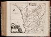
Regna Congo et Angola
1 : 3000000 Annotatie: Origineel is Blad 209 in atlas factice; Annotatie geografische gegevens: Schaalstok op kaart: 2 Milliaria Germanica Communia (=7,2 cm) [Amstelædami] : [Labore et Sumptibus Ioannis Blaev]
Anzico. Afrique 38.
1 : 1641836 Vandermaelen, Philippe, 1795-1869
Congo et Angola. Afrique 41.
1 : 1641836 Vandermaelen, Philippe, 1795-1869
Benguela. Afrique 44.
1 : 1641836 Vandermaelen, Philippe, 1795-1869
Cote Deserte. Afrique 48.
1 : 1641836 Vandermaelen, Philippe, 1795-1869
Partie, Pays des Hottentots. Afrique 50.
1 : 1641836 Vandermaelen, Philippe, 1795-1869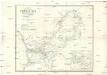
Carte d'une partie de l'Afrique équinoxiale
1 : 3300000 Angola Brué, A. M. Jules Renouard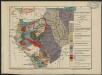
Carte géologique de l'Afrique équatoriale française. Planche sud
1 : 5000000 Loir, Erasme, géologue 18..-19.. Paris : Larose
Afrique équatoriale Francaise
1 : 5000000 Afrika střední Barralier, Emmanuel Emile Larose
Afrique equatoriale Française
1 : 2000000 Kongo (Brazzaville) Meunier, A. Courtier
Angola
1 : 500000 Angola jižní Ministério das colonias comissao de cartografia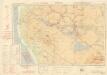
Ondangua

Carte internationale du monde au 1.000.000 E
1 : 1000000 Kinshasa (Kongo) Service géographique du Ministere des colonies