Maps of Kinshasa

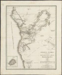
Nieder-Guinea und das Innere des Westlichen Mittel-Africa's oder Westrand von Hoch-Africa
1 : 5480000 entworfen und gezeichnet von C.F. Weiland gestochen von Karl Mädel sen. Weimar : Geographisches Institut
Congo
1 : 15000000 1 mapa, col. Full d'un atles en llengua castellana no identificat, que conté mapes físics, polítics i sobre el servei de correus. Datat al 1890 aproximadament.
Nieder Guinea, W. Mittel-Africa.
1 : 5500000 Weiland, C. F. (Carl Ferdinand), d. 1847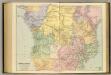
Central Africa.
1 : 5977362 Stanford, Edward
Spezial - karte von AfricaSekt. Congo (7)
1 : 4000000 1 full d'1 mapa en 10 fulls i estoig Hermann Habenicht; Justus Perthes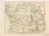
Äquatorial - Afrika

Western half of Equatorial Africa and the expeditions on land and sea by Henry M. Stanley during 1874-77
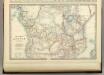
Central Africa.
1 : 10300000 Johnston, Alexander Keith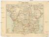
Inner-Afrika
Afrika střední Riemer, C. Geographisches Institut
Charte von Nieder Guinea
Angola
CHARTE von NIEDER GUINEA
Angola
Inner-Afrika und der Kongo-Staat
1 : 8000000 Afrika střední Kettler, I. J. Geographisches Institut
Mapa Afriky střední
1 : 12500000 Afrika střední
Congo Belge / comp. at the Royal Geographical Society under the dir. of the Geographical Section, General Staff ; drawn at the War Office
1 : 4000000 Royal Geographical Society, Verenigd Koninkrijk; General Staff, Verenigd Koninkrijk. Geographical Section; War Office, Verenigd Koninkrijk [S.l. : s.n.] / ([Bruxelles : I.C.M.])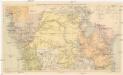
Übersichtskarte zum Zuge der Emin Pascha - Entsatzexpedition quer durch Afrika
1 : 5800000 Afrika střední F.A. Brockhaus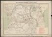
Carte des missions catholiques du centre africain
1 : 4000000 Vuillot, Paul 18..-19.. [Lyon : Oeuvre de la propagation de la foi]
Spezial-Karte von Afrika
1 : 4000000 Blatt 7 Habenicht, Hermann Perthes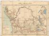
Carte du bassin du Congo
1 : 4000000 Kongo (Kinshasa) Kiepert, Richard Droysen, Wilhelm Dietrich Reimer
Regna Congo et Angola. [Karte], in: Novus atlas absolutissimus, Bd. 6, S. 180.
1 Karte aus Atlas Janssonius Offizin
Carte du Congo Belge
1 : 4000000 Belgie Falk fils
Der Congo-Staat nach seiner Districts-Eintheilung
1 : 8000000 Kongo (Kinshasa) A. Hartleben
Congo Belge
1 : 4000000 Afrika střední I.C.M.
Congo Belge
1 : 5000000 Kongo (Kinshasa) Institut cartographique militaire
Carte de l'Etat indépendant du Congo [et] Carte du Bassin du Congo
1 : 8000000 Wauters, A.-J. 1845-1916; Institut national de géographie. Belgique Bruxelles : Institut national de géographie
Triangulations principales du Congo Belge
1 : 4000000 Ministére des colonies, Service cartographique
Carte politique de l'Afrique centrale
1 : 10000000 Institut national de géographie. Belgique Bruxelles : Institut national de géographie
Croquis hydrographique de l'Afrique centrale
1 : 10000000 Institut national de géographie. Belgique Bruxelles : Institut national de géographie
[Recto], uit: Congo physique, économique et administratif / dressé par A. Michiels
1 : 6000000 titelvariant: Nouvelle carte du Congo au 1:6.000.000; Notre colonie; Annotatie: Omslagtitel: Nouvelle carte du Congo au 1:6.000.000; Suppl. bij: Notre colonie : géographie et notice historique / Albert Michiels. - 4e éd. - Bruxelles : Mertens ; [etc.], 1913 Michiels, Albert Bruxelles : Mertens [etc.]
Central-Afrika
1 : 5000000 Afrika střední Chavanne, Joseph A. Hartleben's Verlag