Maps of Wartburgkreis

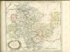
Hennebergensis Ditionis. vera delineatio [Karte], in: Theatrum orbis terrarum, S. 133.
1 Karte aus Atlas Ortelius, Abraham
Hennebergensis Ditionis. vera delineatio [Karte], in: Theatrum orbis terrarum, S. 225.
1 Karte aus Atlas Ortelius, Abraham Vrients, Jan Baptista
COMITATVS | HENNEBER- | GENSIS.
[Amsterdam : Joan Blaeu]
Principatus Hennenbergensis. [Karte], in: Novus atlas absolutissimus, Bd. 2, S. 177.
1 Karte aus Atlas Janssonius Offizin
Herzogtum Sachsen-Coburg und Gotha 1834 Verwaltungsstruktur
Sachsen-Coburg-Gotha Verwaltung Kunz, Andreas ; Moeschl, Joachim Robert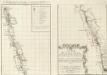
Inter Mayerianvm ad Mvsas Goettingenses
1 : 390000 Mollova mapová sbírka Mayer, Tobias Homann, Johann Baptista - dědici
Herzogtum Sachsen-Coburg und Gotha 1826 Verwaltungsstruktur
Sachsen-Coburg-Gotha Verwaltung Kunz, Andreas ; Moeschl, Joachim Robert
Herzogtum Sachsen-Coburg und Gotha 1830 Verwaltungsstruktur
Sachsen-Coburg-Gotha Verwaltung Kunz, Andreas ; Moeschl, Joachim Robert
Principatus Hennenbergensis
1 : 300000 Mollova mapová sbírka Hondius, Henricus Schenk, Peter I
Principatus Hennenbergensis
1 : 300000 Mollova mapová sbírka Hondius, Henricus Janssonius, Johannes I
S. R. I. Comitatvs Henneberg
1 : 150000 Mollova mapová sbírka Zinck, Johann Jacob Homann, Johann Baptista - dědici
S. R. I. Comitatvs Henneberg
1 : 150000 Mollova mapová sbírka Zinck, Johann Jacob Homann, Johann Baptista - dědici
Principatus Isenacensis cum adjacentibus vicinorum statuum ditionibus exhibitus
1 : 190000 Durynsko (Německo) Homann, Johann Baptist J. B. Homann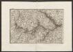
Militair Karte von Süd-Deutschland in 20 Sectionen
1 : 400000 2. Section Coulon, Alois von A. von Coulon
Thuringer-Wald-Gebirges.
1 : 380000 Grassl, J. (Joseph)
Karte des Thüringer-Wald-Gebirges zugleich special Karte des Herzogthums Sachs-Meiningen-Hildburghausen des Fürstenthums Coburg und der Schwarzburgischen Fürstenthümer Rudolstadt und Sondershausen
Grosser Hand-Atlas über alle Theile der Erde in 170 Karten Meyer, J. Verlag des Bibliographischen Instituts
Principatus Isenacensis
1 : 210000 Mollova mapová sbírka Homann, Johann Baptist Homann, Johann Baptista

Special Charte von dem Thüringer Walde
Durynský les (Německo) von dem Geographischen Institute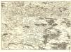
S.R.Imp. Circuli Franconici Geographica Delineatio Francken-Land mit Seinen Gräntzen
Mollova mapová sbírka Endter, Wolfgang Moritz Endter, Wolfgang Moritz
Herzogtum Sachsen-Meiningen 1820 Verwaltungsstruktur
Sachsen-Meiningen Verwaltung Kunz, Andreas ; Moeschl, Joachim Robert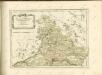

Reverendissimo Et Celsissimo S. R. I. Principi Constantino Sanctae Fuldensis Ecclesiae Abbati Augustissimae Romanorum Imperatricis Archi-Cancellario Per Germaniam Galliamque Primati Hanc Novam Veteris Buchoniae Tabulam Unacum Suis Confinys Dedicat Consecratque
1 : 340000 Mollova mapová sbírka Schannat, Johann Friedrich Puschner, Johann Georg
Charte von dem Grosgerzogthum Würzburg, nebst dem Fürstenthum Schwarzenberg, den Grafschafften Castell und Limpurg-Speckfeld, der Herrschafft Wiesentheid &c
1 : 188000 Bavorsko (Německo) Hammer, C. F. bey Homanns Erben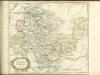

Carte pour servir de suite a la partie meridionale du landgraviat de Hesse-Cassel avec les pays voisins de la Thuringe
Durynsko (Německo) Brönner, Heinrich Ludwig chez Henry Louis Broenner
Landgrafiatvs Hasso-Cassellanvs typo geographico quatuor Foliorum expressus Cura Homannianorum Heredum Norimb: 1761
1 : 160000 Mollova mapová sbírka Homann, Johann Baptist Homann, Johann Baptista - dědici
Geognostische Uebersichtskarte des Thüringer Waldes
1 : 100000 Beyschlag, Franz ; Pütz, M. Simon Schropp
![Hennebergensis Ditionis. vera delineatio [Karte], in: Theatrum orbis terrarum, S. 133.](https://images-2.georeferencer.com/images/iiif/091455414762/full/,300/0/native.jpg)

