Carte cataloguée


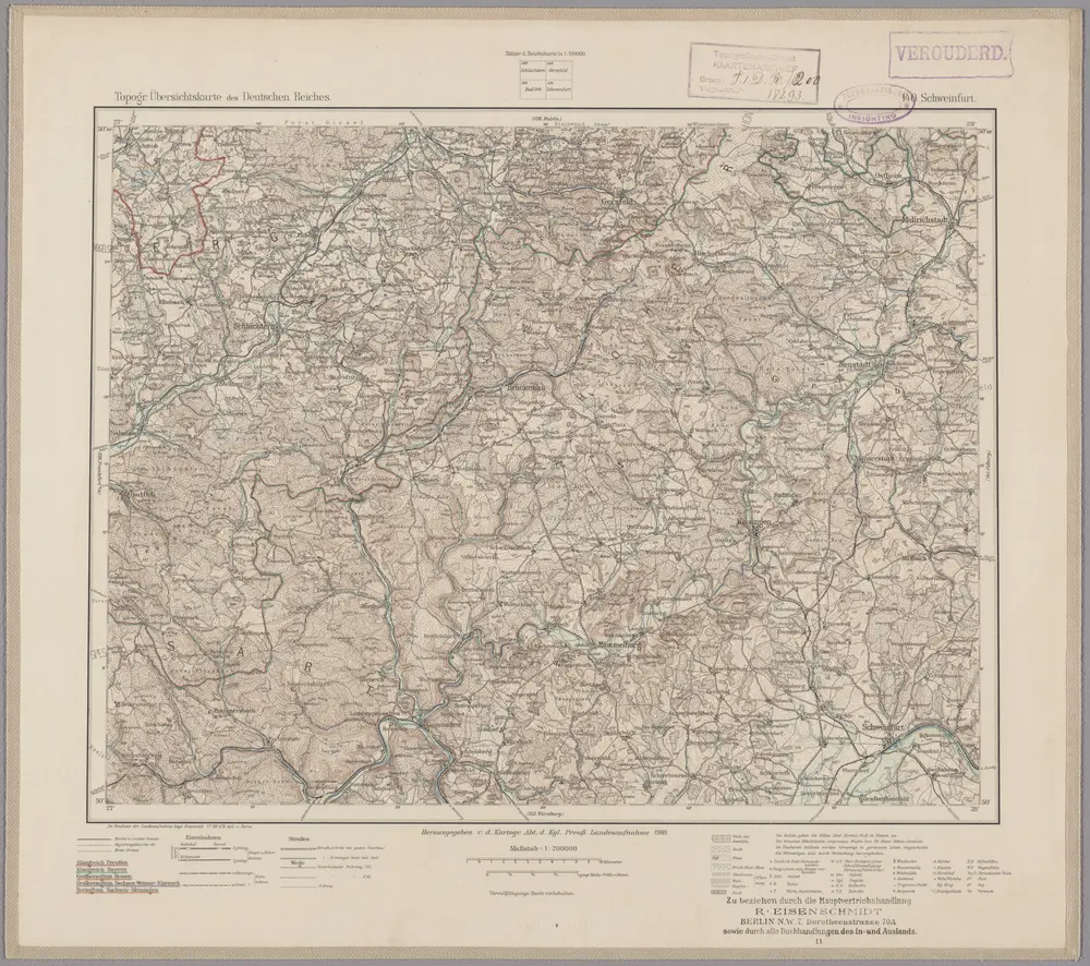
140. Schweinfurt, uit: Topographische Uebersichtskarte des Deutschen Reiches / herausgegeben v. d. Kartogr. Abt. d. Königl. Preuß. Landesaufnahme
1899
Königlich Preußische Landesaufnahme. Kartographische Abtheilung
1:200k
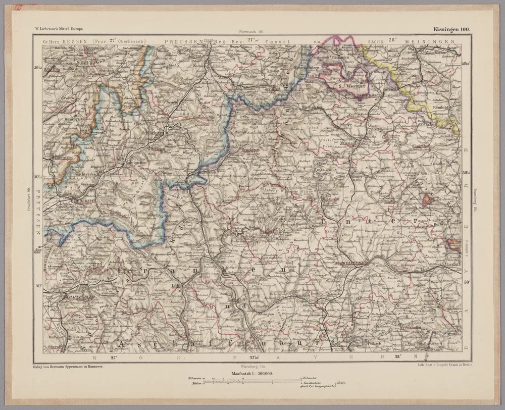
Kissingen 100, uit: [W. Liebenow's Special-Karte von Mittel-Europa]
1870
Johannes Wilhelm Liebenow 1822-1897
1:300k

Neuer Atlas Uber die Gantze Welt, mapa ze strany: [182]
1714
Homann Johann Baptist
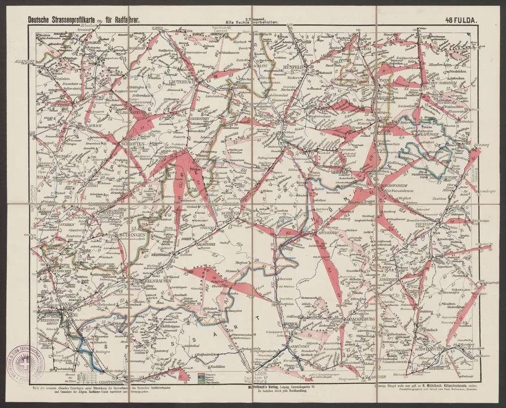
Fulda
1890
R. Mittelbach
1:300k
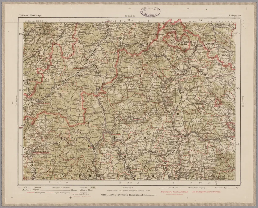
Kissingen 100, uit: Special-Karte von Mittel-Europa / nach amtlichen Quellen bearbeitet von W. Liebenow
1899
Johannes Wilhelm Liebenow 1822-1897
1:300k
Bvchaviae, siue Fvldensis ditionis typvs
1574
Regerwyl; Ortelius
Meßtischblatt 5924 : Gemünden, 1939
1939
1:250k
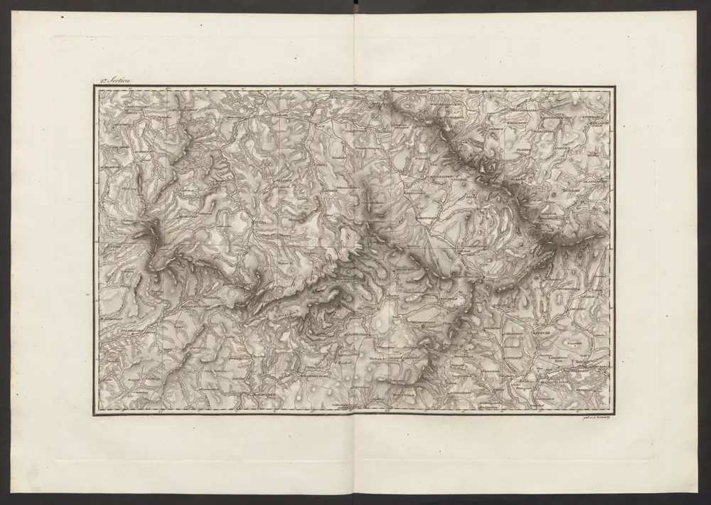
Militair Karte von Süd-Deutschland in 20 Sectionen
1818
Coulon, Alois von
1:400k
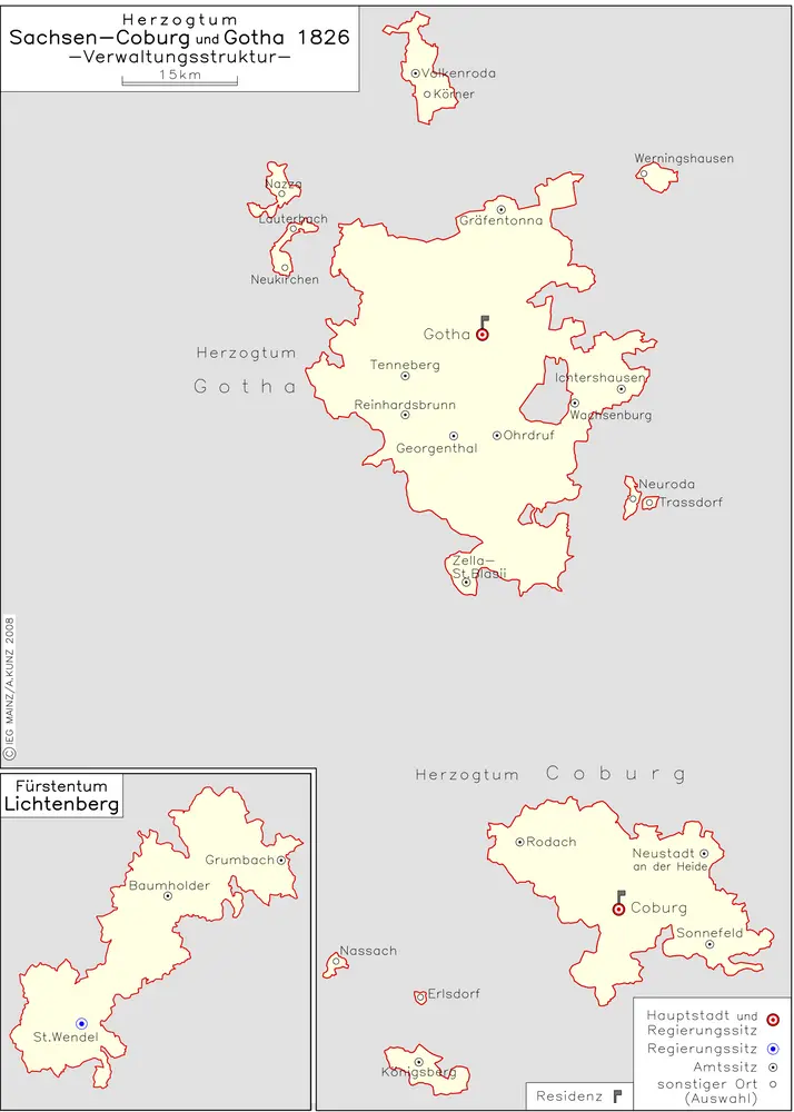
Herzogtum Sachsen-Coburg und Gotha 1826 Verwaltungsstruktur
1826
Kunz, Andreas ; Moeschl, Joachim Robert
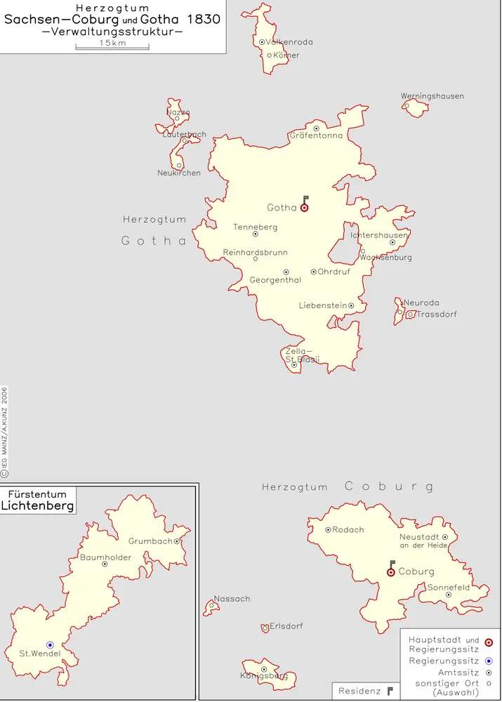
Herzogtum Sachsen-Coburg und Gotha 1830 Verwaltungsstruktur
1830
Kunz, Andreas ; Moeschl, Joachim Robert