Maps of Piemonte

Annexion von Savoyen
1 : 1100000 1 Karte [von Paul Chaix] [Wurster], [Winterthur]
[Helvetia antiqua]
1 : 2300000 4 Karten [Johann Ulrich Müller] [Andrea], [Frankfurt a. M.]
Annexion de la Savoie
1 : 1100000 1 Karte P. Chaix Wurster, Winterthur
Guide topographique des chemins de fer Suisses
1 Atlas (48 Bl.) Wurster, Winterthur
Helvetiae descriptio
1 : 900000 1 Karte Aegidio Tschudo auct. ; [Abraham Ortelius fecit] [apud Aegid. Coppenium Diesth], [Antverpiae]
Switzerland &c. and the passes of the Alps
1 : 665280 1 Karte by J. Arrowsmith Arrowsmith, London
Illustrations of the Glacier Systems of the Alps and of Glacial Phenomena in general
The physical atlas Johnston, Alexander Keith William Blackwood & Sons
<<Die>> Schweiz
1 : 1575000 1 Karte A.H. Payne A.H. Payne, Dresden
Helvetiae descriptio
1 : 900000 1 Karte Aegidio Tschudo auct. ; [Abraham Ortelius fecit] [apud Ioannem Bapt. Vrintium], [Antverpiae]
Karta öfver Helvetien
1 : 910000 1 Karte sammandragen och grav. af E. Åkerland på A. Wiborgs förlag, Stockholm
Carte de la Suisse, ou l'on a marqué les routes suivies par Wil. Coxe
1 : 450000 1 Karte in 2 Teilen [par William Coxe] [Verlag nicht ermittelbar], [Erscheinungsort nicht ermittelbar]
Schweiz
1 : 1000000 1 Karte bearbeitet von [Johannes] Randegger ; Topogr. Anstalt von Wurster, Randegger & Cie. in Winterthur Verlag der Erziehungs-Direction, Zürich
Helvetiae Descriptio
1 : 1200000 Mollova mapová sbírka Tschudi, Ägidius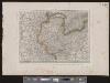
[Deutschland und der gröste Theil der umliegenden Staaten oder Mittel-Europa]
1 : 1100000 35 Karten [nach astronomischen Ortsbestimmungen und den besten Special-Karten, mit Rücksicht auf die neuesten Grenz-Bestimmungen entworfen, zufolge der Wiener Congress-Akte, des Pariser Friedens vom 21ten Nov. 1815, und der neuesten Austauschungen 1816 von H.H. Gotthold] ; [geschrieben und gestochen von H. Kliewer] ; sämtliche Gebürge im Atlas sind gezeichnet und gestochen von Paulus Schmidt, so wie auch die Sectionen 3,11,16,18,19,21,25,26,31 von demselben gestochen worden [Simon Schropp & Co.], [Berlin]
Karta öfver Helvetien
1 : 910000 1 Karte sammandragen och grav. af E. Åkerland på A. Wiborgs förlag, Stockholm

<<Die>> Entwicklung der Eidgenossenschaft von dem Eintritt Zürichs in den Bund 1351 bis zur Eroberung des Aargau's 1415
1 : 1050000 1 Karte entworfen von J. Steiner Wurster, Randegger & Cie., Winterthur
Schweiz
1 : 1000000 1 Karte bearbeitet von [Johannes] Randegger ; Topogr. Anstalt von Wurster, Randegger & Cie. in Winterthur Verlag der Erziehungs-Direction, Zürich
Carte de France, 8
2 Blätter : Kupferdruck ; 53 x 45 cm Crepy
Taschen-Atlas der Schweiz
1 Atlas (25 S., 20 Taf.) gezeichnet und gestochen von Emil Wagner = Atlas de poche de la Suisse : 26 cartes en couleurs / dessinées et gravées par Émile Wagner Eggimann, Genf
Schweiz, Liechtenstein.
1 : 2600000 Brudin, J. L.; Stieler, Adolf
Switzerland.
1 : 1700000 Seaman, James V.
(Schweitz, Italia, Danemarck, Schweden, Norwegen)
Hubner, Johann, 1688-1731
<<La>> Suisse
1 Karte par P. Du Val ; Somer sculp. et l'Alleman chez l'autheur, Paris
Geologische Übersichtskarte de Schweiz
1 : 760000 1 Karte von B. Studer u. A. Escher Wurster, Winterthur
Schweiz
1 : 1000000 1 Karte [bearbeitet von Johannes Randegger] ; Topogr. Anstalt von Wurster, Randegger & Cie. in Winterthur Topogr. Anstalt von Wurster, Randegger & Cie. in Winterthur, Winterthur
Schweiz
Neuer Handatlas über alle Theile der Erde Kiepert, Heinrich Verlag von Dietrich Reimer
Schweiz
1 : 1000000 1 Karte bearbeitet von [Johannes] Randegger ; Topogr. Anstalt von Wurster, Randegger & Cie. in Winterthur Verlag der Erziehungs-Direction, Zürich
Schweiz
1 : 1000000 1 Karte bearbeitet von [Johannes] Randegger ; Topogr. Anstalt von Wurster, Randegger & Cie. in Winterthur Verlag der Erziehungs-Direction, Zürich


