Maps of Switzerland

Helvetiae Descriptio
1 : 1200000 Mollova mapová sbírka Tschudi, Ägidius
H. Keller's Reisecharte der Schweiz.
From Switzerland
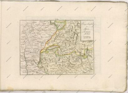
Annexion de la Savoie
1 : 1100000 1 Karte P. Chaix Wurster, Winterthur
Schweiz, Liechtenstein.
1 : 2600000 Brudin, J. L.; Stieler, Adolf
Switzerland.
1 : 1700000 Seaman, James V.
(Schweitz, Italia, Danemarck, Schweden, Norwegen)
Hubner, Johann, 1688-1731
Karte der Schweiz
1 : 760000 1 Karte bearb. mit besonderer Rücksicht auf Sekundar- und Ergänzungsschulen = Carte de la Suisse / à l'usage des écoles secondaires et des collèges Wurster, Zürich
[Helvetia antiqua]
1 : 2300000 4 Karten [Johann Ulrich Müller] [Andrea], [Frankfurt a. M.]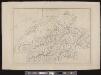
[Schweiz]
1 : 520000 1 Karte [Keller?], [Zürich?]
Regenkarte vom 10.-12. Juni 1876
1 : 1400000 1 Karte [Verlag nicht ermittelbar], [Erscheinungsort nicht ermittelbar]
<<Die>> Helvetische Republik in Cantone und Districte eingetheilt
1 : 630000 1 Karte gedruckt bey Wilhelm Haas dem Sohne, Basel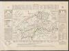
Historisch-Geographischer Atlas der Schweiz in 15 Blättern
1 : 770000 Helvetien 450 - 879 Voegelin, Johann Conrad ; Meyer von Knonau, Gerold ; Wyss, Georg von ; Meyer von Knonau, Gerold Schulthess
<<La>> Suisse divisée en ses treze cantons, ses alliéz & ses sujets
1 Karte par le Sr. Sanson, géographe du roy chez P. Mortier et Compagnie, Amsterdam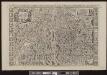
<<La>> Suisse divisée en ses treze cantons, ses alliéz & ses sujets
1 : 480000 1 Karte par le Sr. Sanson, géographe du roy chez H. Jaillot, Paris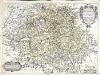
Charte de la Svisse, de la Rhetie, ov des Grisons, de la Valteline, dv Valay, [et] autres seigneuries voisines
1 Karte : Kupferdruck ; 38 x 51 cm Tavernier; Baudoin chez Melchior Tauernier demeurant en lisle du Palais sur le quaÿ qui regarde la Megiserie
Karta öfver Helvetien
1 : 910000 1 Karte sammandragen och grav. af E. Åkerland på A. Wiborgs förlag, Stockholm
Helvetiae, Rhaetiae & Valesiae cum omnibus finitimis regionibus tabula nova & exacta
1 : 500000 1 Karte operâ & curâ Ioh. Conradi Gygeri Tigurini delineata et excusa, anno Christi MDCXXXV [Verlag nicht ermittelbar], [Zürich]
Atlas novus Reipublicae Helveticae
1 Atlas ([40] Bl., 97 S.) bey Orell, Gessner und Compagnie, Zürich
Potentissimae Helvetiorum reipublicae cantones tredecim
1 : 2900000 1 Karte Tobias Lobeck del. et exc. ; Tob. Conr. Lotter sc. [Lotter], Aug. Vind.
Kurtz verzeichnete Vorstellung dess alten Helvetier-Lands mit ihren Anstoessen nach Iulii Caesaris Beschreibung
1 : 700000 1 Karte [Johannes Stumpf] [Verlag nicht ermittelbar], [Zürich?]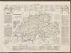
Historisch-Geographischer Atlas der Schweiz in 15 Blättern
1 : 770000 Eidgenossenschaft 1412 - 1481 Voegelin, Johann Conrad ; Meyer von Knonau, Gerold ; Wyss, Georg von ; Meyer von Knonau, Gerold Schulthess
<<L'>>Helvetia o Paese de Svizzeri con li stati, che sono à medesimi collegati e soggetti, divisa ne suoi tredici cantoni, et altre iurisdittioni
1 Karte da Giacomo Cantelli da Viga Gio. Giacomo Rossi, Roma
Carte physique et politique de la Suisse
1 : 900000 1 Karte par E. Mentelle et P.G. Chanlaire an VI ; gravé par [Alexandre] Blondeau P.G. Chanlaire et E. Mentelle, Paris
Tableau des chemins de fer et des routes de la Suisse
Mit Legende in französischer Sprache. Briques et fils, Genf Imp. Lith. de J. Dajoz, Genf
<<La>> Suisse
1 Karte par P. Du Val ; Somer sculp. et l'Alleman chez l'autheur, Paris
<<Die>> Schweiz
1 : 1000000 1 Karte Geograph. Anstalt Wagner & Debes Epprecht, Affoltern a.A.
<<Die>> Helvetische Republik in Cantone und Districte eingetheilt
1 : 630000 1 Karte gedruckt bey Wilhelm Haas dem Sohne, Basel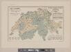
Karte der Schweiz mit Angabe der Kantons- und der Bezirksgrenzen
1 : 1050000 1 Karte vom eidg. statistischen Bureau ; Lith. Gebr. Kümmerly Eidg. statist. Bureau, [Bern]