Maps of Piemonte

[Helvetia antiqua]
1 : 2300000 4 Karten [Johann Ulrich Müller] [Andrea], [Frankfurt a. M.]
Annexion de la Savoie
1 : 1100000 1 Karte P. Chaix Wurster, Winterthur
Annexion von Savoyen
1 : 1100000 1 Karte [von Paul Chaix] [Wurster], [Winterthur]
Karte der Schweiz für den ersten geographischen Unterricht
1 : 1600000 1 Karte [von David Bürkli?] bey D. Bürkli, Zürich
Guide topographique des chemins de fer Suisses
1 Atlas (48 Bl.) Wurster, Winterthur
Karte der Schweiz
1 : 1200000 1 Karte Topogr. Anst. v. Wurster, Randegger & Cie. in Winterthur Verlag v. J. Wurster & Cie., Zürich
Switzerland &c. and the passes of the Alps
1 : 665280 1 Karte by J. Arrowsmith Arrowsmith, London
Verbreitungsweise der Alpen-Fündlinge
1 : 1200000 1 Karte Topogr. Anst. v. J. Wurster u. Comp. [Kiesling], [Zürich]
Helvetiae Descriptio [Karte], in: Theatrum orbis terrarum, S. 277.
1 Karte aus Atlas Ortelius, Abraham Vrients, Jan Baptista
Helvetiae Descriptio [Karte], in: Theatrum orbis terrarum, S. 77.
1 Karte aus Atlas Ortelius, Abraham
Helvetiae descriptio
1 : 900000 1 Karte Aegidio Tschudo auct. ; [Abraham Ortelius fecit] [apud Aegid. Coppenium Diesth], [Antverpiae]
Helvetiae Descriptio [Karte], in: Theatrum orbis terrarum, S. 182.
1 Karte aus Atlas Ortelius, Abraham
General-Carte der Schweiz
1 : 1200000 1 Karte entworfen und gestochen von J. Scheurmann bey Orell Füssli & Compagnie, Zürich
<<Die>> Schweiz mit den projectirten Eisenbahnen und Telegraphen
1 : 1200000 1 Karte Topogr. Anstalt von Joh. Wurster u. Comp., Winterthur
Sabaudiae, Et Burgundiae Comitatus descriptio [Karte], in: Theatrum orbis terrarum, S. 38.
1 Karte aus Atlas Ortelius, Abraham
<<Die>> Schweiz
1 : 1575000 1 Karte A.H. Payne A.H. Payne, Dresden
Helvetiae descriptio
1 : 900000 1 Karte Aegidio Tschudo auct. ; [Abraham Ortelius fecit] [apud Ioannem Bapt. Vrintium], [Antverpiae]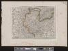
[Deutschland und der gröste Theil der umliegenden Staaten oder Mittel-Europa]
1 : 1100000 35 Karten [nach astronomischen Ortsbestimmungen und den besten Special-Karten, mit Rücksicht auf die neuesten Grenz-Bestimmungen entworfen, zufolge der Wiener Congress-Akte, des Pariser Friedens vom 21ten Nov. 1815, und der neuesten Austauschungen 1816 von H.H. Gotthold] ; [geschrieben und gestochen von H. Kliewer] ; sämtliche Gebürge im Atlas sind gezeichnet und gestochen von Paulus Schmidt, so wie auch die Sectionen 3,11,16,18,19,21,25,26,31 von demselben gestochen worden [Simon Schropp & Co.], [Berlin]
[Chemins de fer en Suisse]
1 : 1200000 1 Karte J. Wurster et Comp., Winterthur
Illustrations of the Glacier Systems of the Alps and of Glacial Phenomena in general
The physical atlas Johnston, Alexander Keith William Blackwood & Sons
Taschen-Atlas der Schweiz
1 Atlas (25 S., 20 Taf.) gezeichnet und gestochen von Emil Wagner = Atlas de poche de la Suisse : 26 cartes en couleurs / dessinées et gravées par Émile Wagner Eggimann, Genf
Helvetiae Descriptio
1 : 1200000 Mollova mapová sbírka Tschudi, Ägidius
Carte de la Suisse, ou l'on a marqué les routes suivies par Wil. Coxe
1 : 450000 1 Karte in 2 Teilen [par William Coxe] [Verlag nicht ermittelbar], [Erscheinungsort nicht ermittelbar]
Carte de la Savoie ou supplément a la carte de frontieres de la République Française
1 : 1000000 Piemonte (Itálie) Delamarche, Charles François Dien C. F. Delamarche
<<Die>> Schweiz
1 : 1470000 1 Karte Perthes, Gotha
Karta öfver Helvetien
1 : 910000 1 Karte sammandragen och grav. af E. Åkerland på A. Wiborgs förlag, Stockholm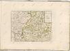

<<Die>> Schweiz
1 : 960000 1 Karte entw. u. gez. von Lieut. Hoffmann ; Lith. v. Bernh. Wohlmuth Verlag von Carl August Eyraud, Neuhaldensleben
Schweiz
1 : 1000000 1 Karte bearbeitet von [Johannes] Randegger ; Topogr. Anstalt von Wurster, Randegger & Cie. in Winterthur Verlag der Erziehungs-Direction, Zürich
![[Helvetia antiqua]](https://images-2.georeferencer.com/images/iiif/180909643365/full/,300/0/native.jpg)

