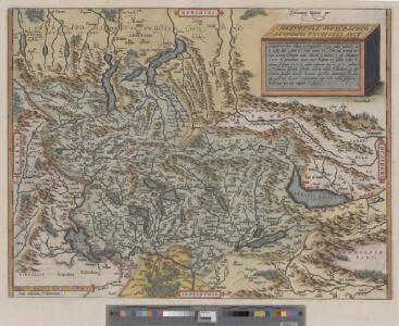
Maps of Switzerland

Helvetiae descriptio
1 : 900000 1 Karte Aegidio Tschudo auct. ; [Abraham Ortelius fecit] [apud Ioannem Bapt. Vrintium], [Antverpiae]
<<Die>> Schweiz
1 : 1575000 1 Karte A.H. Payne A.H. Payne, Dresden
Helvetiae descriptio
1 : 900000 1 Karte Aegidio Tschudo auct. ; [Abraham Ortelius fecit] [apud Aegid. Coppenium Diesth], [Antverpiae]
Helvetiae Descriptio [Karte], in: Theatrum orbis terrarum, S. 182.
1 Karte aus Atlas Ortelius, Abraham
[Chemins de fer en Suisse]
1 : 1200000 1 Karte J. Wurster et Comp., Winterthur
Helvetiae Descriptio [Karte], in: Theatrum orbis terrarum, S. 277.
1 Karte aus Atlas Ortelius, Abraham Vrients, Jan Baptista
General-Carte der Schweiz
1 : 1200000 1 Karte entworfen und gestochen von J. Scheurmann bey Orell Füssli & Compagnie, Zürich
Helvetiae Descriptio [Karte], in: Theatrum orbis terrarum, S. 77.
1 Karte aus Atlas Ortelius, Abraham
Schweiz
1 : 1000000 1 Karte bearbeitet von [Johannes] Randegger ; Topogr. Anstalt von Wurster, Randegger & Cie. in Winterthur Verlag der Erziehungs-Direction, Zürich
<<Die>> Schweiz
1 : 960000 1 Karte entw. u. gez. von Lieut. Hoffmann ; Lith. v. Bernh. Wohlmuth Verlag von Carl August Eyraud, Neuhaldensleben
<<Die>> Schweiz mit den projectirten Eisenbahnen und Telegraphen
1 : 1200000 1 Karte Topogr. Anstalt von Joh. Wurster u. Comp., Winterthur
Atlas de la Suisse
1 : 450000 1 Atlas (19 Bl.) dessiné par MM. H. Keller, Scheurmann, Pfyffer d'Altishofen, Osterwald, etc. ; gravé par M. Scheurmann Orell Füssli & Co., Zürich
Charte von der Republik Schweiz
1 : 1600000 1 Karte bei Ioh. Walch, Augsburg
<<Die>> Schweiz und das Fürstenthum Liechtenstein
1 : 1480000 1 Karte Perthes, Gotha
<<La>> Suisse
1 : 800000 1 Karte nach H.K. [i.e. Heinrich Keller] Hch. Keller's geogr. Verlag, untere Zäune 23, Zürich
Verbreitungsweise der Alpen-Fündlinge
1 : 1200000 1 Karte Topogr. Anst. v. J. Wurster u. Comp. [Kiesling], [Zürich]
General-Charte der Schweiz in XXII Cantone abgetheilt
1 : 1200000 1 Karte gez. u. gest. v. J. Scheurman bey Orell, Füssli und Compagnie, Zürich
Carte de Suisse et de Savoye
1 : 2000000 1 Karte [par Claude Buffier] [Giffart], [Paris]
<<Die>> Schweiz 1849
1 : 1520000 1 Karte entworf. u. gezeichnet v. [C.Ch.F.] Radefeld Bibliograph. Institut, Hildburghausen
Helvetische Republik eingetheilt in Cantone und Districte
1 : 1300000 1 Karte [Johann Jakob Scheurmann] [Orell Füssli & Co.], [Zürich]
<<Die>> Schweiz
1 : 1470000 1 Karte Perthes, Gotha
Geologische Karte der Schweiz 1843
1 : 1210000 1 Karte gez. v. Max Daffner Verlag des Literarischen Comptoirs, Winterthur
Atlas für die Heimathskunde der Schweiz
1 : 19000000 1 Atlas (12, 12 Bl.) von J.S. Gerster ; gestochen von R. Leuzinger Dalp, Bern
Atlas für die Heimathskunde der Schweiz
1 : 19000000 1 Atlas (12, 12 Bl.) von J.S. Gerster ; gestochen von R. Leuzinger Dalp, Bern
Helvetiae conterminarumque terrarum antiqua descriptio
1 : 2000000 1 Karte [Stich von Girolamo Porro] ; [hrsg. von Giovanni Antonio Magini] [Verlag nicht ermittelbar], [Erscheinungsort nicht ermittelbar]
Atlas für die Heimathskunde der Schweiz
1 : 19000000 1 Atlas (12, 12 Bl.) von J.S. Gerster ; gestochen von R. Leuzinger Dalp, Bern
Guide topographique des chemins de fer Suisses
1 Atlas (48 Bl.) Wurster, Winterthur
Karta öfver Helvetien
1 : 910000 1 Karte sammandragen och grav. af E. Åkerland på A. Wiborgs förlag, Stockholm
Nova totius Helvetiae cum suis subditis ac sociis tab. geogr
1 : 1400000 1 Karte studio manu ac sumtibus Matth. Seutter ; Tob. Conr. Lotter sc. Seutter, Aug. Vindel.