Maps of Jura

Carte de France, 8
2 Blätter : Kupferdruck ; 53 x 45 cm Crepy
Carte de la Suisse, ou l'on a marqué les routes suivies par Wil. Coxe
1 : 450000 1 Karte in 2 Teilen [par William Coxe] [Verlag nicht ermittelbar], [Erscheinungsort nicht ermittelbar]
Schweiz, Liechtenstein.
1 : 2600000 Brudin, J. L.; Stieler, Adolf
Switzerland.
1 : 1700000 Seaman, James V.
(Schweitz, Italia, Danemarck, Schweden, Norwegen)
Hubner, Johann, 1688-1731
Illustrations of the Glacier Systems of the Alps and of Glacial Phenomena in general
The physical atlas Johnston, Alexander Keith William Blackwood & Sons
Sabavdiae, Et Bvrgvndiae Comitatus descriptio
1 : 1000000 Mollova mapová sbírka Boileau de Buillon, Gilles
Annexion de la Savoie
1 : 1100000 1 Karte P. Chaix Wurster, Winterthur
Helvetiae Descriptio
1 : 1200000 Mollova mapová sbírka Tschudi, Ägidius
Potentissimae Helvetiorum reipublicae cantones tredecim
1 : 2900000 1 Karte Tobias Lobeck del. et exc. ; Tob. Conr. Lotter sc. [Lotter], Aug. Vind.
[Helvetia antiqua]
1 : 2300000 4 Karten [Johann Ulrich Müller] [Andrea], [Frankfurt a. M.]
Nova Rhaetiae atque totius Helvetiae descriptio
1 Karte per Aegidium Tschudum Glaronensem [Hofer & Burger], [Zürich]
Fragment de l'Atlas de la Suisse par Tschudi 1538
Tschudi, Aegidius Hofer & Burger
Sabavdiae, et Bvrgvndiae comitatus descriptio
1 Karte : Kupferdruck ; 30 x 21 cm Ortelius; Boileau de Bouillon s.n.
Annexion von Savoyen
1 : 1100000 1 Karte [von Paul Chaix] [Wurster], [Winterthur]
Nouvelle carte illustrée de la Suisse indiquant les divisionis physiques et politiques, les routes de postes, les canaux et rivières navigables, les établissements d'eaux minérales ainsi que les endroits remarquables par des sites pittoresques ou des curiosités naturelles
1 : 490000 1 Karte dressée par A. Vuillemin d'après Keller et le Général Dufour Langlumé, Paris
Geographische Karte der Schweizerischen Gewerbsthätigkeit
1 : 600000 1 Karte J.M. Ziegler Wurster u. Comp., Winterthur
Carte topographique et routière de la Suisse et des contrées limitrophes
1 : 400000 1 Karte dressée et dessinée par Jean Frédéric d'Osterwald ; gravée à Paris par Delsol ; écrit par Hacq Chardon aîné, Paris
Carte générale des trèze cantons de Suisse, Vallay, ligues Grise, Maison-Dieu & Valteline
1 : 725000 1 Karte [Nicolas Tassin] [chez Melchior Tavernier], [Paris]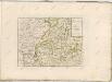

Neue Karte von der Schweiz oder Helvetien in die XIII Eidgenossenschaften, ihre Bundsverwandten und Unterthanen eingetheilt
1 Karte in 2 Bl nach den zuverlässigsten Nachrichten und neuesten astronomischen Beobachtungen, London 1778 bei W. Faden [, neu hrsg. von F.A. Schraembl] Schalbacher, Wien
[Helvetia antiqua]
1 : 2300000 4 Karten [Johann Ulrich Müller] [Andrea], [Frankfurt a. M.]
Carte genérale de la Suisse, oder, Die Helvetische Republik in XIX Cantone eingetheilt, beschlossen in Paris, den 19. Februar 1803
1 : 525000 1 Karte [Verlag nicht ermittelbar], [Erscheinungsort nicht ermittelbar]
Tableau des chemins de fer et des routes de la Suisse
Mit Legende in französischer Sprache. Briques et fils, Genf Imp. Lith. de J. Dajoz, Genf
Carte genérale de la Suisse, oder, Die Helvetische Republik in XXII Cantone eingetheilt
1 : 525000 1 Karte Joh. Walch bei Joh. Walch, Augsburg
Carte de la Suisse
1 : 400000 1 Karte auf 2 Blättern de R. Leuzinger = Karte der Schweiz : Gewässer & Gebirge / von R. Leuzinger Verlag der Dalp'schen Buchhandlung, Bern
Atlas novus Reipublicae Helveticae
1 Atlas ([40] Bl., 97 S.) bey Orell, Gessner und Compagnie, Zürich
Geographische Karte der schweizerischen Gewerbsthätigkeit
1 : 600000 1 Karte J.M. Ziegler Joh. Wurster u. Comp., Winterthur
<<L'>>Helvetia o Paese de Svizzeri con li stati, che sono à medesimi collegati e soggetti, divisa ne suoi tredici cantoni, et altre iurisdittioni
1 Karte da Giacomo Cantelli da Viga Gio. Giacomo Rossi, Roma


