Maps of Côtes-d'Armor

Wester Deel van 't Canaal [Karte], in: De Nieuwe Groote Vermeerderde Zee-Atlas ofte Water-Werelt, S. 45.
1 Karte aus Atlas Doncker, Hendrick
Carte de France, 1
2 Blätter : Kupferdruck ; 53 x 45 cm Crepy
7) IV.N.O. ''Morlaix'', uit: Carte géologique de France
1 : 500000 Annotatie: Voor aanwezige bladen zie bladoverzicht [S.l : s.n.]
Carte reduite des isles de Jersey, Grenesey et d'Aurigny
1 Karte : Kupferdruck ; 54 x 40 cm Bellin s.n.
England
1 : 778000 under the superintendence of the Society for the Diffusion of Useful Knowledge J. & C. Walker sculpt. London : Baldwin and Cradock
Carte de la France, no. 3
1 Blatt : 59 x 41 cm s.n.
delineation of the strata of England and Wales, with part of Scotland
1 : 320000 Blatt 13 Smith, William Cary
1) I.O. ''Plymouth'', uit: Carte géologique de France
1 : 500000 Annotatie: Voor aanwezige bladen zie bladoverzicht [S.l : s.n.]
delineation of the strata of England and Wales, with part of Scotland
1 : 320000 Blatt 12 Smith, William Cary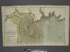
The coast of BRETAGNE from GRANVILLE to CAPEFREHEL
from The sea-atlas : containing an hydrographical description of most of the sea-coasts of the known parts of the world.
Jersey, Guernsey.
1 : 364000 Faden, William, 1750?-1836
Een gedeelte vant Kanaal van Kingsbudg tot Big Berrij
England Gerard van Keulen
Carte générale, des isles Grenesey, Jersey, Aurigny, Chausey, &c
1 Karte : Kupferdruck ; 50 x 43 cm Beaurain chez le chevalier de Beaurain rue Git-le cœur la 1.ere porte en entrant par le quai des Augustins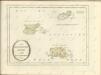
Sheets 3-4. (Cary's England, Wales, and Scotland).
1 : 360000 Cary, John, ca. 1754-1835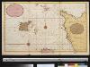
Een gedeelte van het Kanaal van Cherborgh tot t eijland Jerseij
France Gerard van Keulen
Diocese de Coutances, [feuille 1 et 3]
2 Blätter : Dezauche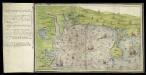
Ottermouth Haven [Coasts of Devon and Dorset from Dartmouth to Weymouth with a written description of Ottermouth Haven]
This is a map of the coast of Devon and Cornwall from Dartmouth to Weymouth which forms part of an atlas that belonged to William Cecil Lord Burghley, Secretary of State to Elizabeth I. Burghley used this atlas to illustrate domestic matters. This map shows the coastline in a pictorial fashion, with buildings indicated by generic, rather than individualized images of various building types. In the left hand margin is a written description of Ottermouth haven, which also features on the map itself. A dominating feature of the map in the compass rose in the centre which has lines radiating from it, each with a direction written along side it. From the style of the lettering and the depiction of the ships the map can be dated to the around 1540. Lord Burghley has annotated the map, adding a we’y of xviii foot brod’ to a narrow bridge of land and adding Sandfoot castle to the coastline to the right of the Isle Portland. The map may have originally been drawn in connection with the 1539-40 invasion scare caused by the alliance against England of France and Spain. The fortification of the Dorset coast was an essential part of the defensive preparations and in April 1539 Lord Russell surveyed the area, sending a plat’ to Cromwell which suggested a much more ambitious fortification program than was actually carried out. Sandfoot, which Lord Burghley has inserted onto this map, was in commission by 1541-1542. The fact that it does not originally appear on the map suggests that it was not built at the time of the maps execution. This is curious however as Portland Castle, built at the same time as Sandfoot, was included by the original draughtsman. The castles were intended to be able to cross fire over the important anchorage known as Portland Roads. Lord Burghley’s interest in the area can be attributed to a new invasion threat from Spain. This threat was also rooted in religious ideology as the Catholic Philip II of Spain wanted to remove the ardently Protestant Elizabeth I from the English Throne. Unfortunately, the coastal forts in Dorset, as with others in England, had been allowed to fall into disrepair. Finally in 1584 action to repair the Dorset forts was authorised by the Privy Council. William Cecil, Lord Burghley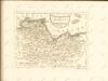
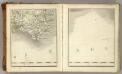
South Devon, Sheet 36 - Bartholomew's "Half Inch to the Mile Maps" of England & Wales
1 : 126720 Topographic maps Bartholomew, John George John Bartholomew & Co
Carte des isles Jersey Grenesey Aurigny et Cers
1 Karte auf 2 Blättern : Kupferdruck ; 67 x 89 cm Lattré chez Lattré graveur ordinaire du roi de M. le Duc d'Orléans et de la ville rue St. Jacques la porte cochere vis-à-vis celle de la parcheminerie à la ville de Bordeaux
Remote British Isles: Jersey and Guernsey, Scilly Isles, Shetland Isles.
1 : 196000 Pinkerton, John, 1758-1826
Devonia Vulgo Devon-Shire. [Karte], in: Theatrum orbis terrarum, sive, Atlas novus, Bd. 4, S. 136.
1 Karte aus Atlas Blaeu, Joan Blaeu, Willem Janszoon
Devonia Vulgo Devon-Shire. [Karte], in: Theatrum orbis terrarum, sive, Atlas novus, Bd. 4, S. 136.
1 Karte aus Atlas Blaeu, Joan Blaeu, Willem Janszoon
Devonia vulgo Devon-Shire. [Karte], in: Le théâtre du monde, ou, Nouvel atlas contenant les chartes et descriptions de tous les païs de la terre, Bd. 4, S. 120.
1 Karte aus Atlas Blaeu, Willem Janszoon und Blaeu, Joan Blaeu, Willem Janszoon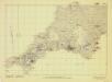
Britain, defences South of England and Wales
[London] : Ministry of Home Security
Devoniae Descriptio. The Description of Devon-Shire [Karte], in: Novus atlas absolutissimus, Bd. 7, S. 199.
1 Karte aus Atlas Janssonius Offizin
DEVONIA | vulgo | DEVON-SHIRE.
[Amsterdam : Joan Blaeu]
South west coast of England from Exeter to Land's End, 1539-40
This is a map of the south-west coast of England, from Exeter to Land’s End. It dates from 1539-40 and its creation can be imputed to the threat of invasion which became probable in 1538 after a peace treaty was signed by Francis I of France and Charles V, Holy Roman Emperor and King of Spain. England and France were ancient enemies and the Catholic Charles V, nephew of Catherine of Aragon, was angered by Henry VIII’s decision to divorce her. Henry’s dissolution of the monasteries provided him with enormous wealth with which he was able to commission surveys of the vulnerable coastline and build defence fortifications. This map is the result of the order sent out by Thomas Cromwell in 1539 for the coasts to be surveyed by local people. These surveys, which were often just sketches or even text, were sent to London and in Greenwich they were edited, compiled and copied out for presentation to the King, who displayed them in Whitehall. The style of the map is pictorial with details such as ships, town views and fortifications shown in accurate detail. However, it contains vital practical information such as the state of defences and the distance between points along the coast and measurements at sea. Measurements at sea appear to be the estimated distance at which the navigator could discern features of the coastline. These are given in Dutch kennings probably due to the fact that the draftsmen in Greenwich included Flemish artists. The purpose of the map was to indicates, as if from the viewpoint of an invader, where landings could be made. Therefore, the cliffs, where landings would have been impossible are foreshortened, while the sandy beaches, where landings would have been easy are exaggerated in size. The sites for possible forts were then added to the map. The annotations on this map were made in about 1541 and record the state of fortifications, annotating made’ or not made’ over several fortification and half made’ over St Mawes Castle. Although this map contains measurements for use by sailors it is very unlikely that it would ever have been used at sea as it is almost 10 feet long and thus highly impractical for use within the confined space onboard ship. Thomas Cromwell
![Wester Deel van 't Canaal [Karte], in: De Nieuwe Groote Vermeerderde Zee-Atlas ofte Water-Werelt, S. 45.](https://images-0.georeferencer.com/images/iiif/923452392321/full/,300/0/native.jpg)

