Maps of Spain

Typus Hispaniae [Karte], in: Gerardi Mercatoris et I. Hondii Newer Atlas, oder, Grosses Weltbuch, Bd. 2, S. 168.
1 Karte aus Atlas Mercator, Gerhard und Hondius, Jodocus Jansson, Jan
Regnorum Hispaniae nova descriptio. [Karte], in: Theatrum orbis terrarum, sive, Atlas novus, Bd. 2, S. 192.
1 Karte aus Atlas Blaeu, Joan Blaeu, Willem Janszoon
Spanien und Portugal
Handatlas über alle Theile der Erde und über das Weltgebäude Stieler, Adolf Justus Perthes
Regnorum Hispaniae nova descriptio. [Karte], in: Novus Atlas, das ist, Weltbeschreibung, Bd. 2, S. 196.
1 Karte aus Atlas Blaeu, Joan Blaeu, Willem Janszoon
Spanien und Portugal
Hand-Atlas über alle Theile der Erde nach dem neuesten Zustande und über das Weltgebäude Stieler, Adolf bei Justus Perthes
L'Espagne
1 Karte : Kupferdruck ; 40 x 52 cm Sanson; Mariette; Cordier chez Pierre Mariette rüe S. Iacques à l'esperance
Totius regnorum Hispaniae et Portugaliae descriptio / auct. F. de Wit
1 : 2500000 Annotatie: Origineel is Blad 5 in atlas factice Wit, Frederik de Gedruckt tot Amsterdam : by Frederick de Wit ...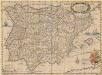
Typus Hispaniae ab Hesselo Gerardo delineata [...] [Karte], in: Novus atlas absolutissimus, Bd. 6, S. 15.
1 Karte aus Atlas Janssonius Offizin
Spanien und Portugal
Adolf Stieler's Handatlas über alle Theile der Erde und über das Weltgebäude Stieler, Adolf Justus Perthes
Spanien und Portugal
1 : 2260000 entworfen und gezeichnet von C. F. Weiland Weimar : Verlag des Geographischen Instituts
Hispaniarum Portugalliæque coronarum typus novus
1 Karte : Kupferdruck ; 48 x 59 cm Valck s.n.
Regnorum Hispaniae nova descriptio. [Karte], in: Le théâtre du monde, ou, Nouvel atlas contenant les chartes et descriptions de tous les païs de la terre, Bd. 2, S. 189.
1 Karte aus Atlas Blaeu, Willem Janszoon und Blaeu, Joan Blaeu, Willem Janszoon
Spanien und Portugal
Schul-Atlas über alle Theile der Erde nach dem neuesten Zustande, und über das Weltgebäude Stieler, Adolf bei Justus Perthes
Spanien und Portugal
1 : 2300000 entworfen und gezeichnet von C. F. Weiland L.G. Jaeger sc. Weimar : Verlag des Geograph. Instituts
Hispania augustiniana
1 Karte : Kupferdruck ; 48 x 55 cm Lotter; Höggmayr; Seutter anjezo im Verlag beÿ Tob: Conr: Lotter
Spanien und Portugal
Hand-Atlas über alle Theile der Erde nach dem neuesten Zustande und über das Weltgebäude Stieler, Adolf bei Justus Perthes
L'Espagne
1 Karte : Kupferdruck ; 44 x 58 cm Jaillot; Ottens; Ottens chez R. et J. Ottens
L'Espagne
1 Karte : Kupferdruck ; 44 x 58 cm Jaillot s.n.
L'Espagne
1 Karte : Kupferdruck ; 44 x 58 cm Jaillot s.n.
Accuratissima totius regni Hispaniæ et Portugalliæ tabula
1 Karte : Kupferdruck ; 45 x 57 cm Schenk; Sanson s.n.
Weg-wyzer der legertogten in Spanje en Portugaal
1 Karte : Kupferdruck ; 49 x 57 cm Allard Abraham Allard
Accuratissima totius regni Hispaniæ Portugalliæ[que] tabula et typus novissimus
1 Karte : Kupferdruck ; 48 x 57 cm Wit ex officina Frederici de Witt
Novissima regnorum Hispaniæ et Portugalliæ tabula
1 Karte : Kupferdruck ; 48 x 56 cm Homann; Funck edita per Davidem Funcken
Hispaniae et Portugalliae regna [et]c
1 Karte : Kupferdruck ; 48 x 56 cm Homann; Funck ex officina Davidis Funckii
Hispaniæ et Portugalliæ regna
1 Karte : Kupferdruck ; 45 x 55 cm Visscher s.n.
Accuratissima totius regni Hispaniæ tabula
1 Karte : Kupferdruck ; 48 x 56 cm Danckerts ex officina Justi Danckerts
Accuratissima totius regni Hispaniae tabula
1 : 2400000 1 Karte : Kupferdruck ; 48 x 56 cm Danckerts, Justus [Danckerts]
Spanien und Portugal

Španiely a Portugaly.

![Typus Hispaniae [Karte], in: Gerardi Mercatoris et I. Hondii Newer Atlas, oder, Grosses Weltbuch, Bd. 2, S. 168.](https://images-2.georeferencer.com/images/iiif/254140386709/full/,300/0/native.jpg)

