Maps of Switzerland
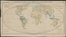
Le Grand Teatre De La Guerre En Italie [Karte], in: Atlas nouveau, contenant toutes les parties du monde [...], Bd. 2, S. 129.
1 Karte aus Atlas Sanson, Nicolas Jaillot, Alexis Hubert und Mortier, Pieter
Karte der Militärkreise der Schweiz
Karte in französischer Sprache. Mit Erklärung der Farben und mit Übersichten der Truppenkontingente pro Kanton sowie des Generalstabs und der Divisionskommandanten.
Taschen-Atlas der Schweiz
1 Atlas (25 S., 20 Taf.) gezeichnet und gestochen von Emil Wagner = Atlas de poche de la Suisse : 26 cartes en couleurs / dessinées et gravées par Émile Wagner Eggimann, Genf
Guide topographique des chemins de fer Suisses
1 Atlas (48 Bl.) Wurster, Winterthur
[Helvetia antiqua]
1 : 2300000 4 Karten [Johann Ulrich Müller] [Andrea], [Frankfurt a. M.]
Karte der Schweiz mit Rücksicht auf die Post-Strassen
1 : 1350000 1 Karte nach Hrch. Keller ; Lith. von J. Kull bei J.H. Locher, Zürich
Switzerland &c. and the passes of the Alps
1 : 665280 1 Karte by J. Arrowsmith Arrowsmith, London
Uebersichts-Karte der Schweiz
1 : 1050000 1 Karte für den Schulgebrauch bearbeitet von Rudolph Gross ; gestochen von Rixinger u. Graf Ch. Beyel, Frauenfeld
Taschen-Atlas der Schweiz
1 Atlas (25 S., 20 Taf.) gezeichnet und gestochen von Emil Wagner = Atlas de poche de la Suisse : 26 cartes en couleurs / dessinées et gravées par Émile Wagner Eggimann, Genf
Helvetia Prima Rheni et V. Nova Tabula. [Karte], in: Claud. Ptolemaeus. Geographia lat. cum mappis [...], S. 344.
1 Karte aus Atlas Münster, Sebastian [und Ptolemaeus, Claudius]
Atlas de la Suisse
1 : 450000 1 Atlas (19 Bl.) dessiné par MM. H. Keller, Scheurmann, Pfyffer d'Altishofen, Osterwald, etc. ; gravé par M. Scheurmann Orell Füssli & Co., Zürich
Helvetiae descriptio
1 : 900000 1 Karte Aegidio Tschudo auct. ; [Abraham Ortelius fecit] [apud Ioannem Bapt. Vrintium], [Antverpiae]
Schweiz
1 : 1000000 1 Karte [bearbeitet von Johannes Randegger] ; Topogr. Anstalt von Wurster, Randegger & Cie. in Winterthur Topogr. Anstalt von Wurster, Randegger & Cie. in Winterthur, Winterthur
Dvcatvs Mediolanensis, finitimarvmq[ue] regionv[m] descriptio
1 Karte : Kupferdruck ; 34 x 47 cm Settala; Ortelius s.n.
Dvcatvs Mediolanensis, finitimarvmq[ue] regionv[m] descriptio
1 Karte : Kupferdruck ; 35 x 47 cm Settala; Ortelius s.n.
Schweiz
1 : 1000000 1 Karte bearbeitet von [Johannes] Randegger ; Topogr. Anstalt von Wurster, Randegger & Cie. in Winterthur Verlag der Erziehungs-Direction, Zürich

Schweiz
1 : 1000000 1 Karte bearbeitet von [Johannes] Randegger ; Topogr. Anstalt von Wurster, Randegger & Cie. in Winterthur Verlag der Erziehungs-Direction, Zürich
Schweiz
1 : 1000000 1 Karte Topogr. Anstalt von Wurster, Randegger & Cie., Winterthur
Ducatus Mediolanensis, Finitimarumque Regionum Descriptio [Karte], in: Theatrum orbis terrarum, S. 293.
1 Karte aus Atlas Ortelius, Abraham Vrients, Jan Baptista
<<La>> Suisse
1 : 800000 1 Karte nach H.K. [i.e. Heinrich Keller] Hch. Keller's geogr. Verlag, untere Zäune 23, Zürich
Charte von der Republik Schweiz
1 : 1600000 1 Karte bei Ioh. Walch, Augsburg
Schweiz
1 : 1000000 1 Karte bearbeitet von [Johannes] Randegger ; Topogr. Anstalt von Wurster, Randegger & Cie. in Winterthur Verlag der Erziehungs-Direction, Zürich
Helvetia prima Rheni et V. nova tabula
1 : 750000 1 Karte [Sebastian Münster] [apud Henricum Petrum], [Basilea]
General-Charte der Schweiz
1 : 1200000 1 Karte entworfen u. gestochen v. J. Scheurmann bey Orell, Füssli & Compagnie, Zürich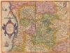
Ducatus Mediolanensis, Finitimarumque Regionum Descriptio [Karte], in: Theatrum orbis terrarum, S. 198.
1 Karte aus Atlas Ortelius, Abraham
Carte pluviométrique de la Suisse établie d'après les relevés de toutes les stations de 1864-93
1 : 1000000 1 Karte par R. Billwiller Wurster, Randegger & Co., Winterthur
Regenkarte der Schweiz vom Jahre 1891
1 : 1000000 1 Karte entworfen von R. Kepler Wurster, Randegger & Co., Winterthur
Ducatus Mediolanensis, Finitimaruque Regionum Descriptio [Karte], in: Theatrum orbis terrarum, S. 81.
1 Karte aus Atlas Ortelius, Abraham
![Le Grand Teatre De La Guerre En Italie [Karte], in: Atlas nouveau, contenant toutes les parties du monde [...], Bd. 2, S. 129.](https://images-2.georeferencer.com/images/iiif/019492595684/full/,300/0/native.jpg)

