Maps of Switzerland

Atlas de la Suisse
1 : 450000 1 Atlas (19 Bl.) dessiné par MM. H. Keller, Scheurmann, Pfyffer d'Altishofen, Osterwald, etc. ; gravé par M. Scheurmann Orell Füssli & Co., Zürich
[Chemins de fer en Suisse]
1 : 1200000 1 Karte J. Wurster et Comp., Winterthur
Charte von der Republik Schweiz
1 : 1600000 1 Karte bei Ioh. Walch, Augsburg
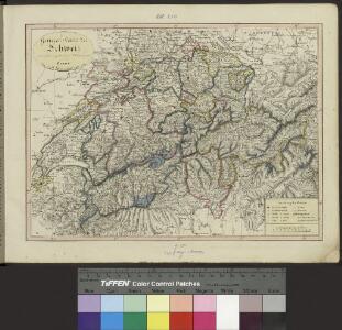
<<Die>> Schweiz
1 : 1575000 1 Karte A.H. Payne A.H. Payne, Dresden
Schweiz
1 : 1000000 1 Karte bearbeitet von [Johannes] Randegger ; Topogr. Anstalt von Wurster, Randegger & Cie. in Winterthur Verlag der Erziehungs-Direction, Zürich
Schweiz
1 : 1000000 1 Karte bearbeitet von [Johannes] Randegger ; Topogr. Anstalt von Wurster, Randegger & Cie. in Winterthur Verlag der Erziehungs-Direction, Zürich
Helvetische Republik eingetheilt in Cantone und Districte
1 : 1300000 1 Karte [Johann Jakob Scheurmann] [Orell Füssli & Co.], [Zürich]
<<Die>> Schweiz mit den projectirten Eisenbahnen und Telegraphen
1 : 1200000 1 Karte Topogr. Anstalt von Joh. Wurster u. Comp., Winterthur
General-Carte der Schweiz
1 : 1200000 1 Karte entworfen und gestochen von J. Scheurmann bey Orell Füssli & Compagnie, Zürich
General-Charte der Schweiz in XXII Cantone abgetheilt
1 : 1200000 1 Karte gez. u. gest. v. J. Scheurman bey Orell, Füssli und Compagnie, Zürich
<<La>> Suisse
1 : 800000 1 Karte nach H.K. [i.e. Heinrich Keller] Hch. Keller's geogr. Verlag, untere Zäune 23, Zürich
General-Charte der Schweiz
1 : 1200000 1 Karte entworfen u. gestochen v. J. Scheurmann bey Orell, Füssli & Compagnie, Zürich
Karte der Schweiz
1 : 1000000 1 Karte von C.G. Wenng Verlag von Caesar Schmidt, Zürich
<<La>> Suisse
1 : 800000 1 Karte Hch. Keller's geogr. Verlag, Zürich
<<Die>> Schweiz
1 : 960000 1 Karte entw. u. gez. von Lieut. Hoffmann ; Lith. v. Bernh. Wohlmuth Verlag von Carl August Eyraud, Neuhaldensleben
Helvetiae descriptio
1 : 900000 1 Karte Aegidio Tschudo auct. ; [Abraham Ortelius fecit] [apud Ioannem Bapt. Vrintium], [Antverpiae]
<<Die>> Schweiz 1849
1 : 1520000 1 Karte entworf. u. gezeichnet v. [C.Ch.F.] Radefeld Bibliograph. Institut, Hildburghausen
<<Die>> Schweiz und das Fürstenthum Liechtenstein
1 : 1480000 1 Karte Perthes, Gotha
Verbreitungsweise der Alpen-Fündlinge
1 : 1200000 1 Karte Topogr. Anst. v. J. Wurster u. Comp. [Kiesling], [Zürich]
Carte de Suisse avec ses alliéz et ses sujets et des trois ligues des Grisons et de leurs sujets &c
1 : 1500000 1 Karte par. M. [i.e. David-François de Merveilleux] [chez Samuel Harding], [Londres]
Helvetiae seu Suiciae quae multis confoederatorum terra dicitur, primae Germanorum provinciae, Galliae, Italiaequae contiguae chorographia vera et elegans
1 Karte autore [Gerard de Jode] ; Ioannes à Deutecum, Lucas à Deutecum fecerunt [Gerard de Jode], [Antwerpen]
General-Charte der Schweiz in XXII Cantone abgetheilt
1 : 1200000 1 Karte gez. u. gest. v. J. Scheurman bey Orell, Füssli und Compagnie, Zürich
Carte de Suisse et de Savoye
1 : 2000000 1 Karte [par Claude Buffier] [Giffart], [Paris]
<<Les>> Suisses, leurs alliez, avec les sujets des Suisses et des alliéz
1 Karte selon les mémoires de Sjmler, de Gyger, et de plusieurs autres autheurs, par le Sr. Tillemon chez I.B. Nolin sur le Quay de l'Horloge du palais proche la Rue de Harlay à l'enseigne de la Place des Victoires, Paris
Helvetiae descriptio
1 : 900000 1 Karte Aegidio Tschudo auct. ; [Abraham Ortelius fecit] [apud Aegid. Coppenium Diesth], [Antverpiae]
Helvetiae Descriptio [Karte], in: Theatrum orbis terrarum, S. 277.
1 Karte aus Atlas Ortelius, Abraham Vrients, Jan Baptista
Helvetiae Descriptio [Karte], in: Theatrum orbis terrarum, S. 182.
1 Karte aus Atlas Ortelius, Abraham
Helvetiae Descriptio [Karte], in: Theatrum orbis terrarum, S. 77.
1 Karte aus Atlas Ortelius, Abraham
Karte der Schweizerischen Gewerbsthätigkeit
1 : 900000 1 Karte J.M. Ziegler Wurster & Comp., Winterthur