Maps of Seven Seas (Open Ocean)

Atlas über die Entwicklung von Industrie und Handel der Schweiz in dem Zeitraume vom Jahr 1770 bis zum Jahr 1870
1 : 45000000 1 Atlas ([3], VIII Bl.) im Auftrage der schweizerischen Commission für die additionellen Ausstellungen in Wien, bearbeitet von Dr. Hermann Wartmann Wurster Randegger & Co., Winterthur
Animals - World.
Woodbridge, William C.
Inhabited World.
1 : 93000000 Woodbridge, William C.
Die Vulkanischen Erscheinungen Der Atlen Welt.
1 : 65000000 Berghaus, Heinrich
Isothermal chart, productions.
1 : 80000000 Woodbridge, William C.
Isothermal chart.
1 : 95000000 Woodbridge, William C.
Le monde ou panorama géographique du globe terrestre, représentant les terres et les mers du globe, ses accidents physiques, les phénomènes, les règnes de la nature [...]
1 : 177600000 réd. d'après Mr. De Humbold et les savans les plus distingués par E. Hocquart [S.l.] : [s.n.]
Allgemeine Weltcharte
1 : 45400000 nach Mercators Projection entworfen von A.I. Krusenstern, Capitain der Russischen Marine J. Walker sculpt. ; verb. bis zum Jahre 1818. London : [s.n.]
Mappe-Monde = Geo-Hydrographique, ou Descritption Generale Du Globe Terrestre Et Aquatique En Deux-Plans-Hemispheres. [Karte], in: Atlas nouveau, contenant toutes les parties du monde [...], Bd. 1, S. 32.
1 Karte aus Atlas Sanson, Nicolas Jaillot, Alexis Hubert und Mortier, Pieter
Composite: Pacific Ocean.
1 : 25000000 John Bartholomew and Son
Longueurs du pendule.
1 : 75000000 L'Isle, Guillaume de, 1675-1726
Hydrographical chart of the world on Wright or Mercator projection
země světa Thomson, John Scott, R.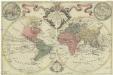
Mappa totius mundi
země světa Delisle, Guillaume Lotter, Tobias Conrad apud Tobiam Conradum Lotter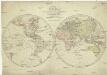
Karte von der Erde oestlicher und westlicher Halbkugel
země světa Reilly, Franz Johann Josef von Alberti, Ignaz von Franz Ioh. Ios. von Reilly
Orbis terrae compendiosa descriptio
země světa Mercator, Rumold Porro, Girolamo Rumoldus Mercator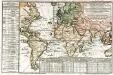
Carte des lieux où les differentes longueurs du pendule à secondes ont été observées
1 Karte : Kupferdruck ; 24 x 37 cm, Blattgrösse 46 x 61 cm Buache Philippe Buache
Umrisse der Pflanzengeographie
Zweiter Band, enthaltend in vier Abtheilungen die Vertheilung der Organismen: 5. Pflanzen-Geographie, 6. Thier-Geographie, 7. Anthropographie, 8. Ethnographie Humboldt, Alexander von Verlag von Justus Perthes
Atlantic Ocean.
1 : 95000000 Huntington, Hezekiah, 1795-1865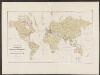
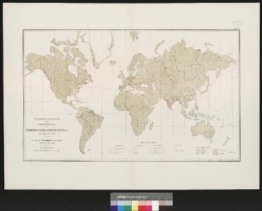
Atlas über die Entwicklung von Industrie und Handel der Schweiz in dem Zeitraume vom Jahr 1770 bis zum Jahr 1870
1 : 500000 Orientierungsblatt Absatzgebiete Wartmann, Hermann Wurster Randegger & Co.

Vorstellvng der in der Nacht zwischen den 8. u. 9. Aug; 1748
Mollova mapová sbírka Mayer, Tobias Homann, Johann Baptista - dědici
Die verfinsterte Erdkugel :
Mollova mapová sbírka Lowitz, Georg Moriz Schneider, Ruprecht Adam Homann, Johann Baptista - dědici
Atlas über die Entwicklung von Industrie und Handel der Schweiz in dem Zeitraume vom Jahr 1770 bis zum Jahr 1870
1 : 500000 Absatzgebiete des Schweizerischen Ausfuhrhandels 1820 Wartmann, Hermann Wurster Randegger & Co.
Verbreitung der Vögel I.
Atlas der Tierverbreitung Marshall, William Justus Perthes
Atlas über die Entwicklung von Industrie und Handel der Schweiz in dem Zeitraume vom Jahr 1770 bis zum Jahr 1870
1 : 500000 Absatzgebiete des Schweizerischen Ausfuhrhandels 1770 Wartmann, Hermann Wurster Randegger & Co.
Charte über die verschiedenen jezt auf der Erde herrschenden Religionen
země světa im Verlage des Landes Industrie Comptoirs
Carte réduite d'apres celle de Laperouse
1 : 90000000 země světa La Pérouse, Jean-François de Galaup
Linien gleicher magnetischer Inklination (Isoklinen)
Atlas des Erdmagnetismus Neumayer, Georg Justus Perthes
Atlas über die Entwicklung von Industrie und Handel der Schweiz in dem Zeitraume vom Jahr 1770 bis zum Jahr 1870
1 : 500000 Absatzgebiete des Schweizerischen Ausfuhrhandels 1870 Wartmann, Hermann Wurster Randegger & Co.