Maps of Seven Seas (Open Ocean)

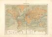
Mappe-Monde = Geo-Hydrographique, ou Descritption Generale Du Globe Terrestre Et Aquatique En Deux-Plans-Hemispheres. [Karte], in: Atlas nouveau, contenant toutes les parties du monde [...], Bd. 1, S. 32.
1 Karte aus Atlas Sanson, Nicolas Jaillot, Alexis Hubert und Mortier, Pieter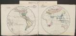
Pflanzengeographische Eintheilung der Erdoberfläche
1 : 50000000 Schouw, Joakim Frederik [Reimer?]
Verschiedenes zur Anthropographie
Zweiter Band, enthaltend in vier Abtheilungen die Vertheilung der Organismen: 5. Pflanzen-Geographie, 6. Thier-Geographie, 7. Anthropographie, 8. Ethnographie Humboldt, Alexander von Verlag von Justus Perthes
Hyetographische Karte der Erde
Erster Band, enthaltend in vier Abtheilungen die Erscheinungen der anorganischen Natur: 1. Meteorologie und Klimatographie. 2. Hydrologie und Hydrographie. 3. Geologie. 4. Tellurischer Magnetismus Humboldt, Alexander von Verlag von Justus Perthes
Florenreiche der Erde auf der Grundlage von W. Köppens Wärmegürteln nach der Dauer der heissen, gemässigten und kalten Zeit
1 : 120000000 Drude, Oscar Engelhorn
Nova Totius Terrarum Orbis Tabula
Danckerts, Justus
Übersicht der Mittleren Barometerstände am Meere und der Oscillation des Luftdrucks
Erster Band, enthaltend in vier Abtheilungen die Erscheinungen der anorganischen Natur: 1. Meteorologie und Klimatographie. 2. Hydrologie und Hydrographie. 3. Geologie. 4. Tellurischer Magnetismus Humboldt, Alexander von Verlag von Justus Perthes
Erdkarte
Neuer Handatlas über alle Theile der Erde Kiepert, Heinrich Verlag von Dietrich Reimer
Welt-Karte in Mercators Projektion
Grosser Hand-Atlas über alle Theile der Erde in 170 Karten Meyer, J. Verlag des Bibliographischen Instituts
[Planiglob zur Übersicht der Verbreitung der Deutschen in beiden Hemisphären über den ganzen Erdboden]
Zweiter Band, enthaltend in vier Abtheilungen die Vertheilung der Organismen: 5. Pflanzen-Geographie, 6. Thier-Geographie, 7. Anthropographie, 8. Ethnographie Humboldt, Alexander von Verlag von Justus Perthes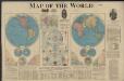
Map of the world
1 : 65000000 Rand McNally and Company Rand McNally and Company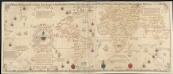
Carta universal en que se contiene todo lo que del mundo se ha descubierto fasta agora
1 : 30000000 Ribero, Diego Griggs, William
Middleton's pioneer map of the world, [as a?] plane and immoveable
Judd & Co.
[System der Isotherm-Kurven]
Erster Band, enthaltend in vier Abtheilungen die Erscheinungen der anorganischen Natur: 1. Meteorologie und Klimatographie. 2. Hydrologie und Hydrographie. 3. Geologie. 4. Tellurischer Magnetismus Humboldt, Alexander von Verlag von Justus Perthes
MAPPE MONDE ou Description DU GLOBE Terrestre & Aquatique
země světa Jaillot, Alexis-Hubert H. Jaillot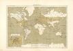
Atlas für Industrie- und Handelsgeographie: Für commercielle und technische Lehranstalten, für Kaufleute und Industrielle
Atlas für Industrie- und Handelsgeographie: Für commercielle und technische Lehranstalten, für Kaufleute und Industrielle
Nouveau planisphère indiquant les grandes divisions physiques et politiques de la terre, la géographie statistique et industrielle des differents états, les colonies européenes et l'époque des principales découvertes
1 : 47000000 dressé par A. Vuillemin gravé par Langevin Paris [etc.] : Turgis
[Neuer Atlas der ganzen Erde nach den neuesten Bestimmungen ... : I.] Oestliche und Westliche Halbkugel der Erde
Neu entworfen und gezeichnet von M. Riedig H. Leutemann sc. Leipzig : J.C. Hinrichs'sche Buch- und Landkartenhandlung
Carte générale du voyage pittoresque autour du monde : sur laquelle l'Océanie a été reduite d'après la carte de Mr. d'Urville & sous sa direction / gravé par Ambroise Tardieu
1 : 100000000 Dumont d'Urville, Jules Sébastian César; Tardieu, Ambroise [S.l. : s.n.]
Planisphère illustré présentant la description géographique des parties connues de la terre : indiquant l'époque des grandes découvertes et le nom des navigateurs, les colonies des diverses nations ainsi que le parcours des bateaux à vapeur, l'époque des départs, la durée du trajet &c. / dressé par Vuillemin ; gravé par Langevin
1 : 34000000 Annotatie: Met diverse kostuumfiguren, overzicht van de hoogste bergen en overzicht van de langste rivieren Vuillemin, A.; Langevin, ... Paris : Fatout
Vorstellvng der in der Nacht zwischen den 8. u. 9. Aug; 1748
Mollova mapová sbírka Mayer, Tobias Homann, Johann Baptista - dědici
Die verfinsterte Erdkugel :
Mollova mapová sbírka Lowitz, Georg Moriz Schneider, Ruprecht Adam Homann, Johann Baptista - dědici
The World
A new general atlas of modern geography, consisting of a complete collection of maps of the four quarters of the globe Wyld, James James Wyld
[Erdkarte in Mercators Projektion, Übersicht der Meeresströmungen und der Weltverkehrlinien]
Volksschul-Atlas über alle Teile der Erde Lange, Henry Druck und Verlag von Georg Westermann
Pharmacognostische Karte zur Pharmacopoea Germanica
1 : 85000000 Schelenz, H. E. [Buchh. des Waisenhauses]
Hyetographic or Rain Map of the World
The physical atlas Johnston, Alexander Keith William Blackwood & Sons
Übersichts-Karte für die wichtigsten Culturpflanzen der Erde, mit Angabe ihres Vaterlandes und ihrer geographischen Verbreitung
Atlas der Pflanzengeographie über alle Theile der Erde Rudolphi, Ludwig Verlag der Nicolaischen Buchhandlung
Polokoule
země světa
Polokoule zemské
1 : 100000000 země světa Köke, Friedrich C. k. školní kněhosklad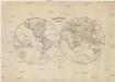
![Mappe-Monde = Geo-Hydrographique, ou Descritption Generale Du Globe Terrestre Et Aquatique En Deux-Plans-Hemispheres. [Karte], in: Atlas nouveau, contenant toutes les parties du monde [...], Bd. 1, S. 32.](https://images-2.georeferencer.com/images/iiif/933783002416/full/,300/0/native.jpg)

