Maps of Seven Seas (Open Ocean)
Le monde ou panorama géographique du globe terrestre, représentant les terres et les mers du globe, ses accidents physiques, les phénomènes, les règnes de la nature [...]
1 : 177600000 réd. d'après Mr. De Humbold et les savans les plus distingués par E. Hocquart [S.l.] : [s.n.]
Atlantic Ocean.
1 : 95000000 Huntington, Hezekiah, 1795-1865
Hydrographical chart of the world on Wright or Mercator projection
země světa Thomson, John Scott, R.
Mappa totius mundi
země světa Delisle, Guillaume Lotter, Tobias Conrad apud Tobiam Conradum Lotter
Mappe-Monde = Geo-Hydrographique, ou Descritption Generale Du Globe Terrestre Et Aquatique En Deux-Plans-Hemispheres. [Karte], in: Atlas nouveau, contenant toutes les parties du monde [...], Bd. 1, S. 32.
1 Karte aus Atlas Sanson, Nicolas Jaillot, Alexis Hubert und Mortier, Pieter
Atlas über die Entwicklung von Industrie und Handel der Schweiz in dem Zeitraume vom Jahr 1770 bis zum Jahr 1870
1 : 500000 Absatzgebiete des Schweizerischen Ausfuhrhandels 1870 Wartmann, Hermann Wurster Randegger & Co.
Vorstellvng der in der Nacht zwischen den 8. u. 9. Aug; 1748
Mollova mapová sbírka Mayer, Tobias Homann, Johann Baptista - dědici
Die verfinsterte Erdkugel :
Mollova mapová sbírka Lowitz, Georg Moriz Schneider, Ruprecht Adam Homann, Johann Baptista - dědici
Nova Totius Terrarum Orbis Geographica Ac Hydrographica Tabula. [Karte], in: Novus atlas absolutissimus, Bd. 1, S. 14.
1 Karte aus Atlas Janssonius Offizin
The "time and tide" map of the Atlantic charter / [cartography] London Geographical Institute
1 : 450000 Annotatie: Bevat de 8 punten van het Atlantisch charter The London Geographical Institute, London London : Philip & Son
Nova Totius Terrarum Orbis Gepgraphica Ac Hydrographica Tabula. [Karte], in: Gerardi Mercatoris et I. Hondii Newer Atlas, oder, Grosses Weltbuch, Bd. 1, S. 25.
1 Karte aus Atlas Mercator, Gerhard und Hondius, Jodocus Jansson, Jan
Planisphère terrestre
1 : 70000000 écrit par P. Rousset. Paris : J. Andriveau-Goujon, Éditeur, Rue du Bac, 21
Atlas über die Entwicklung von Industrie und Handel der Schweiz in dem Zeitraume vom Jahr 1770 bis zum Jahr 1870
1 : 45000000 1 Atlas ([3], VIII Bl.) im Auftrage der schweizerischen Commission für die additionellen Ausstellungen in Wien, bearbeitet von Dr. Hermann Wartmann Wurster Randegger & Co., Winterthur
Karte von der Erde oestlicher und westlicher Halbkugel
země světa Reilly, Franz Johann Josef von Alberti, Ignaz von Franz Ioh. Ios. von Reilly
Orbis terrae compendiosa descriptio
země světa Mercator, Rumold Porro, Girolamo Rumoldus Mercator
[Erdkarte in Mercators Projektion, Übersicht der Meeresströmungen und der Weltverkehrlinien]
Volksschul-Atlas über alle Teile der Erde Lange, Henry Druck und Verlag von Georg Westermann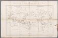
Carte générale du voyage pittoresque autour du monde : sur laquelle l'Océanie a été reduite d'après la carte de Mr. d'Urville & sous sa direction / gravé par Ambroise Tardieu
1 : 100000000 Dumont d'Urville, Jules Sébastian César; Tardieu, Ambroise [S.l. : s.n.]
Geographical Distribution of the Currents of Air
The physical atlas Johnston, Alexander Keith William Blackwood & Sons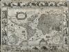
Nova Totius Terrarum Orbis Geographica Ac Hydrographica Tabula
Blaeu, Willem Janszoon; Ende, Josua van den
America
Neuester Schul-Atlas Walch, Johann im Verlag bei Joh. Walch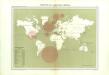
Atlas du Comité central des houilleres de France: Cartes des bassins houillers de la France, de la Grande-Bretagne, de la Belgique et de l'Allemagne
Atlas über die Entwicklung von Industrie und Handel der Schweiz in dem Zeitraume vom Jahr 1770 bis zum Jahr 1870
1 : 500000 Absatzgebiete des Schweizerischen Ausfuhrhandels 1820 Wartmann, Hermann Wurster Randegger & Co.
Umrisse der Pflanzengeographie
Zweiter Band, enthaltend in vier Abtheilungen die Vertheilung der Organismen: 5. Pflanzen-Geographie, 6. Thier-Geographie, 7. Anthropographie, 8. Ethnographie Humboldt, Alexander von Verlag von Justus Perthes
Planiglob in Mercators Projection
země světa Berra, Marco bei Marco Berra
Windkarte der Erde
Erster Band, enthaltend in vier Abtheilungen die Erscheinungen der anorganischen Natur: 1. Meteorologie und Klimatographie. 2. Hydrologie und Hydrographie. 3. Geologie. 4. Tellurischer Magnetismus Humboldt, Alexander von Verlag von Justus Perthes
Verschiedenes zur Anthropographie
Zweiter Band, enthaltend in vier Abtheilungen die Vertheilung der Organismen: 5. Pflanzen-Geographie, 6. Thier-Geographie, 7. Anthropographie, 8. Ethnographie Humboldt, Alexander von Verlag von Justus Perthes
[Terra]
země světa
America
A new general atlas of modern geography, consisting of a complete collection of maps of the four quarters of the globe Wyld, James James Wyld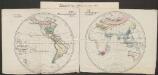
Pflanzengeographische Eintheilung der Erdoberfläche
1 : 50000000 Schouw, Joakim Frederik [Reimer?]
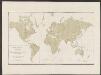
Charte über die verschiedenen jezt auf der Erde herrschenden Religionen
země světa im Verlage des Landes Industrie Comptoirs
![Le monde ou panorama géographique du globe terrestre, représentant les terres et les mers du globe, ses accidents physiques, les phénomènes, les règnes de la nature [...]](https://images-2.georeferencer.com/images/iiif/412903310932/full/,300/0/native.jpg)

