Maps of Northumberland County

Reedville
1 : 24000
Reedville
1 : 24000
Reedville
1 : 24000
Reedville
1 : 24000
Reedville
1 : 24000
Reedville
1 : 31680
Heathsville
1 : 62500
Heathsville
1 : 48000
Heathsville
1 : 62500
Heathsville
1 : 62500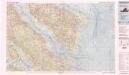
Tappahannock
1 : 100000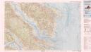
Tappahannock
1 : 100000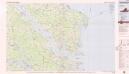
Tappahannock
1 : 100000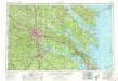
Richmond
1 : 250000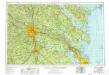
Richmond
1 : 250000
Richmond
1 : 250000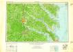
Richmond
1 : 250000
Richmond
1 : 250000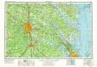
Richmond
1 : 250000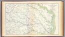
SE Virginia, Ft. Monroe.
1 : 316800 U.S. War Department, Topographical Engineers
A map and chart of those parts of the Bay of Chesapeak, York and James rivers which are at present the seat of war / Jno. Lodge, sc.
from Revolutionary War, 1775-1783
Maryland and Delaware.; The cerographic atlas of the United States. By Sidney E. Morse, A.M., and Samuel Breese, A.M.
from Supplement to the New York observer. Morse, Sidney E. (Sidney Edwards); Breese, Samuel,
The states of Maryland and Delaware, from the latest surveys
1 : 800000 Wayland, Reid & Smith
Maryland.
1 : 1774080 Scott, Joseph
Composite: New Map Of The Peninsula Embracing Delaware And The Eastern Shores Of Maryland And Virginia
1 : 346480 MacCormac, Walter S.
States of Maryland and Delaware.
1 : 800000 Winterbotham, W.
Virginia and Maryland.
1 : 1340000 Moll, Herman, d. 1732
A Chart of the Chesapeake And Delaware Bays.
1 : 354816 Lucas, Fielding Jr.
Bird's-eye view of the Seat of War
Bird's-eye view of the Seat of War, arranged after the latest Surveys. This Bird’s Eye View of the Seat of War, published by Prang, displays the region around the Chesapeake Bay and Potomac River, showing Washington, D.C., Baltimore, Harper’s Ferry, Richmond, Manassas Junction (Bull Run), Fort Monroe and Norfolk Harbour. The map also details railroad lines. It is possible to see a drawing of the Capitol building where Washington, D.C. is labelled. L. Prang & Co.

