Maps of Delaware

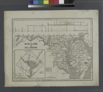
Maryland and Delaware.; The cerographic atlas of the United States. By Sidney E. Morse, A.M., and Samuel Breese, A.M.
from Supplement to the New York observer. Morse, Sidney E. (Sidney Edwards); Breese, Samuel,
States of Maryland and Delaware.
1 : 800000 Winterbotham, W.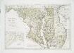
Maryland und Delaware / entworfen von D.F. Sotzmann ; W. Sander, sculp.
from Charts and maps
The states of Maryland and Delaware, from the latest surveys
1 : 800000 Wayland, Reid & Smith
Maryland and Delaware.
Rand McNally and Company
Delaware And Maryland. (with) District of Columbia.
1 : 970000 Colton, G.W.
Maryland, Delaware.
1 : 1300000 Cram, George Franklin; Davis, Ellis Arthur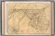
Maryland and Delaware.
1 : 602000 Rand McNally and Company
Delaware and Maryland.
1 : 2000000 Colton, G.W.
Maryland.
1 : 1380000 Tanner, Henry S.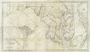
Map of the state of Maryland : laid down from an actual survey of all the principal waters, public roads, and divisions of the counties therein : describing the situation of the cities, towns, villages, houses of worship and other public buildings, furna
from Maryland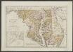
Maryland und Delaware
1 : 500000 Sotzmann, D. F Bey Carl Ernst Bohn
Maryland and Delaware.
1 : 1190000 Tanner, Henry S.
Delaware, Maryland.
1 : 975000 Johnson, A.J.
Delaware and Maryland.
1 : 1000000 Colton, G.W.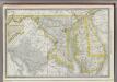
Maryland.
1 : 720000 Rand McNally and Company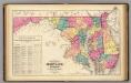
New railroad map of the states of Maryland, Delaware, & District of Columbia.
1 : 633600 Gray, Frank Arnold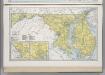
Maryland. Delaware.
1 : 874643 Hammond, C.S.
Maryland.
from Charts and maps M. (Mathew) Carey: [Philadelphia],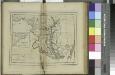
Maryland / W. Barker sculp.; Carey's American pocket atlas; containing nineteen maps... with a brief description of each state.
from Carey's American pocket atlas; containing nineteen maps... with a brief description of each state. Carey, Mathew; Sweitzer, Henry,
The states of Maryland and Delaware, from the latest surveys, 1795 / D. Martin, sculpt. N. York.
from Charts and maps D. Martin,
A New map of the province of Maryland in North America.
from Cartographic materials from the Emmet Collection of Manuscripts Etc. Relating to American History. Hinton, John,
Maryland and Delaware.
1 : 1130000 Mitchell, Samuel Augustus
Maryland and Delaware.
1 : 1130000 Mitchell, Samuel Augustus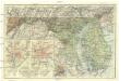
Maryland, Delaware and District of Columbia
1 : 900000 Baltimore (Maryland : oblast) National Geographic Society
Maryland, Washington D.C., and Delaware.
1 : 697000 Rand McNally and Company
Delaware Maryland and Washington D.C
1 : 2000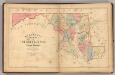
Martenet's Map of Maryland, Atlas Edition.
1 : 950400 Martenet, Simon J.
Maryland.
1 : 1100000 Lucas, Fielding Jr.