Maps of Hanover County
SE Virginia, Ft. Monroe.
1 : 316800 U.S. War Department, Topographical Engineers
(Seat of the Civil War - Virginia).
1 : 412000 Schonberg & Co.
Richmond
1 : 250000
Richmond
1 : 250000
Richmond
1 : 250000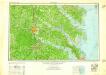
Richmond
1 : 250000
Richmond
1 : 250000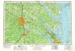
Richmond
1 : 250000
Übersichts-Karte zum Feldzuge 1864 und 1865 in Virginien

Region embraced in the Operations of the Armies against Richmond and Petersburg.
1 : 80000 United States. War Dept. Engineer Bureau
Vicinity of Richmond, and Peninsular Campaign in Virginia (American Civil War).
1 : 189000 Johnson, A.J.
Vicinity of Richmond.
1 : 180000 Johnson, A.J.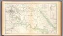
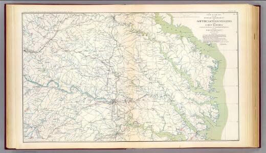
SE Virginia, Ft. Monroe, approaches to Richmond, Petersburg.
1 : 145000 U.S. War Department, Topographical Engineers
Hughes Military Map Of Richmond & Petersburgh, Va.
1 : 101376 Hughes, W.C. Major
Richmond
1 : 100000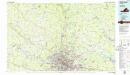
Richmond
1 : 100000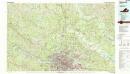
Richmond
1 : 100000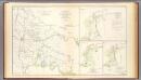
Battle-grounds Richmond, Va.
1 : 240000 United States. War Department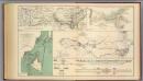
Potomac Army operations.
1 : 370000 United States. War Department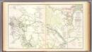
White House-Harrison's Landing.
1 : 130000 United States. War Department
White House To Harrisons Landing.
1 : 63360 Abbot, Henry L.
Map of the Seat of War: Map of the Vicinity of Richmond
Map of the Seat of War: Map of the Vicinity of Richmond L. Prang & Co.
Palmyra
1 : 125000
Palmyra
1 : 125000
Palmyra
1 : 125000
Palmyra
1 : 125000
Palmyra
1 : 125000
Palmyra
1 : 125000
Palmyra
1 : 125000
Palmyra
1 : 125000
Goochland
1 : 125000
Goochland
1 : 125000
Goochland
1 : 125000
Goochland
1 : 125000
Goochland
1 : 125000
Goochland
1 : 125000
Goochland
1 : 125000
Goochland
1 : 125000
Palmyra
1 : 125000