Maps of Bavaria

Charte des Bayrischen Kreises
1 Karte : Kupferdruck ; 55 x 44 cm Schmidburg; Zach; Amman; Cassini de Thury; David; Humboldt im Verlage des privil. Landes-Industrie-Compt
Bavaria.
1 : 1650000 Bowen, Frances
Karte vom Königreich Baiern
1 : 1100000 Bavorsko (Německo) in A.G. Schneider u. Weigels k. priv. Kunst- u. Landkartenhandlung
Teutschlandes Bayerischer Creiss samt dazu gehörigen Provintzen
1 : 2500000 Mollova mapová sbírka Weigel, Johann Christoph Weigel, Christoph I.
Boioaria aetate romanorvm collata cvm hodierna
1 Karte : Kupferdruck ; 24 x 29 cm Braun; Zimmermann Ruprecht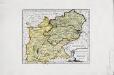
Das Herzogthum Ober und Nieder Bayern
1 Karte : Kupferdruck ; 22 x 27 cm Reilly F. J. J. von Reilly
CHARTE vom KÖNIGREICHE BAYERN
Bavorsko (Německo)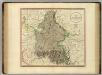
Bavaria.
1 : 835000 Cary, John, ca. 1754-1835
Königreich Bayern
1 : 1284000 Bavorsko (Německo) Tranquillo Mollo
Circulus Bavaricus
1 Karte : Kupferdruck ; 56 x 48 cm Valck; Valck Valck
Bavaria.
1 : 660000 Robert Laurie & James Whittle
Chur-Bayern im Jahr 1804
1 : 1083000 Bavorsko (Německo) Herdegen, J. C. F. Leizel, Balthasar Friedrich J.L.C. Rheinwald
Chur-Bairn Samt demselben incorporirten und angrenzenden Landen
1 : 730000 Mollova mapová sbírka Riegel, Christoph Riegel, Christoph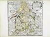
Bayern
1 Karte : Kupferdruck ; 41 x 41 cm Sanson; Cordier chez l'autheur
Le theatre de la guerre d'Allemagne dans les cercles de Baviere de Souabe de Franconie [et]c
1 Karte : Kupferdruck ; 45 x 53 cm Reichelt; Berey chez Berey graveur rue St. Jacque devant la fontaine St. Severin a la princesse de Savoye
Das Königreich Baiern nach Mannert und andern vorzüglichen Hülfsmitteln
1 : 690000 Bavorsko (Německo) Dirwald, Joseph Mannert, Conrad T. Mollo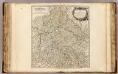
Cercle de Baviere.
1 : 640000 Robert de Vaugondy, Gilles, 1688-1766
Cercle de Baviere
1 : 1100000 Bavorsko (Německo) Mentelle, Edme Tardieu, Pierre François
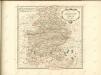
Novissima et Accuratissima Delineatio Geographica Superioris et inferioris Ducatus Bavariae Vnacum adjecentium Provinciarum Limitibus
1 : 750000 Mollova mapová sbírka Sedelmayer, Johann Paul Sedlmayr, Johann Paul
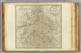
Le cercle de Baviere Divisée en touts les estats qui le Composent &c.
1 : 575000 Mollova mapová sbírka Covens, Johannes I
Geographische Mauth=Charte von Baÿern
1 Karte : Kupferdruck ; 55 x 65 cm Kohlbrenner; Lotter s.n.
Baiern mit Ausschluss des Rheinkreises
1 : 1154000 Bavorsko (Německo) Berthe Gleditsch
BAVARIAE CIRCULUS ET ELECTORAT[US] IN SUAS QUASQUE DITIONES tam cum ADIACENTIBUS QUAM INSERTIS REGIONIBUS accuratißime divisus
1 : 650000 Bavorsko (Německo) Homann, Johann Baptist per Io. Baptistam Homannum
Historia circuli Bavarici, nec non finitimarum, ac insertarum regionum
1 Karte : Kupferdruck ; 54 x 47 cm + Lotter Tobias Konrad Lotter
Le Cercle De Baviere. subdivisé en tous les Estats qui le Composent [Karte], in: Atlas nouveau, contenant toutes les parties du monde [...], Bd. 1, S. 264.
1 Karte aus Atlas Sanson, Nicolas Jaillot, Alexis Hubert und Mortier, Pieter
Imperii circulus Bavaria, titulô electoratus insignis ea pro ut in ducatum, ac palatinatum, alisques eorundem status hic politice divisa
1 : 630000 Bavorsko (Německo) Carmine, Joseph apud Ioseph Carmine
Salisbvrgensis Ivrisdictionis, locorumque vicinorum vera descriptio
1 : 730000 Mollova mapová sbírka Setznagel, Marx Rade, Gillis van den
Le cercle de Baviere
1 Karte auf 2 Blatt : Kupferdruck ; 80 x 54 cm Sanson; Jaillot chez H. Iaillot joignant les grands Augustins aux deux globes


