Maps of Bavaria


Bavaria.
1 : 1650000 Bowen, Frances
Imperii circulus Bavaria, titulô electoratus insignis ea pro ut in ducatum, ac palatinatum, alisques eorundem status hic politice divisa
1 : 630000 Bavorsko (Německo) Carmine, Joseph apud Ioseph Carmine
Le cercle de Baviere Divisée en touts les estats qui le Composent &c.
1 : 575000 Mollova mapová sbírka Covens, Johannes I
Teutschlandes Bayerischer Creiss samt dazu gehörigen Provintzen
1 : 2500000 Mollova mapová sbírka Weigel, Johann Christoph Weigel, Christoph I.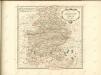

Circulus Bavaricus
1 Karte : Kupferdruck ; 49 x 57 cm Danckerts Danckerts
Circulus Bavaricus
1 : 720000 1 Karte : Kupferdruck ; 48 x 57 cm Danckerts, Justus [Danckerts]
Geographische Mauth=Charte von Baÿern
1 Karte : Kupferdruck ; 55 x 65 cm Kohlbrenner; Lotter s.n.
Novissima et Accuratissima Delineatio Geographica Superioris et inferioris Ducatus Bavariae Vnacum adjecentium Provinciarum Limitibus
1 : 750000 Mollova mapová sbírka Sedelmayer, Johann Paul Sedlmayr, Johann Paul
Boioaria aetate romanorvm collata cvm hodierna
1 Karte : Kupferdruck ; 24 x 29 cm Braun; Zimmermann Ruprecht
Le cercle de Baviere, subdivisé en touts les estats qui le composent
1 : 600000 Bavorsko (Německo) Sanson, Guillaume Jaillot, Alexis-Hubert H. Iaillot

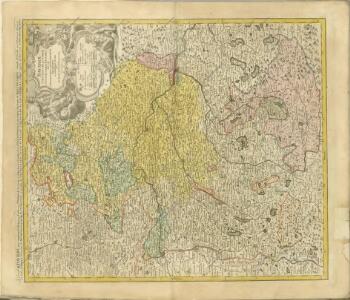
BAVARIAE CIRCULUS ET ELECTORAT[US] IN SUAS QUASQUE DITIONES tam cum ADIACENTIBUS QUAM INSERTIS REGIONIBUS accuratißime divisus
1 : 650000 Bavorsko (Německo) Homann, Johann Baptist per Io. Baptistam Homannum
Le cercle de Baviere
1 Karte : Kupferdruck ; 59 x 44 cm Jaillot; Ottens; Ottens chez R. et J. Ottens
Le cercle de Baviere
1 Karte : Kupferdruck ; 59 x 44 cm Drogenham; Jaillot chez H. Jaillot
Charte des Bayrischen Kreises
1 Karte : Kupferdruck ; 55 x 44 cm Schmidburg; Zach; Amman; Cassini de Thury; David; Humboldt im Verlage des privil. Landes-Industrie-Compt
Circulus Bavaricus in quo sunt ducatus electoratus et palatinatus Bavariae, Neoburgi archiepiscopatus Salisburgi etc
1 : 760000 Bavorsko (Německo) Danckerts, Justus per Iustinum Danckerum
Le cercle de Baviere...

Le cercle de Baviere
1 Karte auf 2 Blatt : Kupferdruck ; 80 x 54 cm Sanson; Jaillot chez H. Iaillot joignant les grands Augustins aux deux globes
Le cercle de Baviere
1 Karte : Kupferdruck ; 64 x 44 cm Sanson; Jaillot; Cordier chez le Sr. Iaillot geographe de Sa Maj.té joignant les gr. Augustins aux 2. globes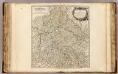
Cercle de Baviere.
1 : 640000 Robert de Vaugondy, Gilles, 1688-1766
Circulus Bavaricus
1 Karte : Kupferdruck ; 56 x 48 cm Valck; Valck Valck
Cours du Danube
1 : 660000 Bavorsko (Německo) Homann, Johann Baptist Le Rouge, Georges-Louis le Rouge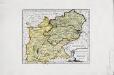
Das Herzogthum Ober und Nieder Bayern
1 Karte : Kupferdruck ; 22 x 27 cm Reilly F. J. J. von Reilly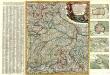
Neue und vollständige Land-Karten Des gantzen Chür-Baÿrischen Reichs Creÿses in specie Das Hertzogthüm Baÿern, die Obere Pfaltz, das Ertz-Stifft Saltzbürg, die Büsthümer Freising und Passaü wie äuch einen mercklichen Theil des daran stoßenden Franckens, Böhmens ünd Ober Oesterreichs vorstellend in dere[n] noch flienere inländische Gräntzen, Stationen deren Posten ünd anderen Nothwendigkeite aüf das genaüeste eingetheilet aüch mit großer Mühe und Fleiß an das Licht gebracht
1 : 650000 Mollova mapová sbírka Lidl, Johann Jakob Lidl, Johann Jacob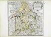
Bayern
1 Karte : Kupferdruck ; 41 x 41 cm Sanson; Cordier chez l'autheur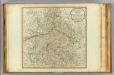
Bavaria.
1 : 660000 Robert Laurie & James Whittle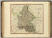
Bavaria.
1 : 835000 Cary, John, ca. 1754-1835
Circulus Bavariae in suas quasque ditiones tam cum finitimis, quam insertis regionibus accuratissime divisus
1 : 632000 Bavorsko (Německo) Seutter, Matthäus a Matthaeo Seutter