Maps of Sudetes Mountains
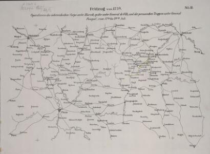
Operationen des österreichischen Corps unter Harsch, später unter General de Ville, und der preussischen Truppen unter General Fouqué, vom 17ten bis 29ten Juli
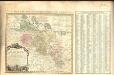
Strassen und Eisenbahnkarte des oesterreichischen Kaiserthumes

Mapa války 1778-1779
1 : 1600000
Mapa války 1778-1779
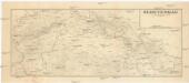
Sudetengau
1 : 600000 Protektorát Čechy a Morava Landesplanungsgemeinschaft Sudetengau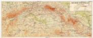
Sudetengau
1 : 600000 Protektorát Čechy a Morava Sudetendeutsche Anstalt für Landes- und Volksforschung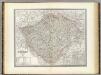
Bohmen.
1 : 675000 Weiland, C. F. (Carl Ferdinand), d. 1847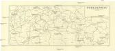
Sudetengau
1 : 1000000 Čechy (Česko) Landesplanungsgemeinschaft Sudetengau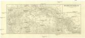
Sudetengau
1 : 1000000 Čechy (Česko) Landesplanungsgemeinschaft Sudetengau
Partie du Royaume de Boheme
1 : 570000 Mollova mapová sbírka Mortier, Pieter Covens, Johannes I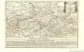
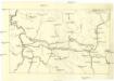
March Königlich-Preussischen Armée nach Böhmen in 4. verschiedenen Corps 1757
Mollova mapová sbírka Fridrich, Jacob Andreas Fridrich, Jacob Andreas
Position des toute les deux armée en Bohéme de l'anne 1778 depuis le 5. juin jusq' au 10. aout
Česko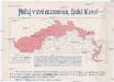
[Sudety]
1 : 1120000 Sudety (Česko) Národní jednota severočeská
Des Königreiches Böhmen mitteler und östlich. Theil
1 : 750000 Čechy (Česko) Berghaus, Heinrich Karl Wilhelm Schilling, Theodor Justus Perthes
March der königlich-preussischen Armée nach Böhmen in 4. verschiedenen Corps 1757
Česko Friedrich, Jacob Andreas Jacob Andreas Friedrich
Copia ab antiquissima Mappa Regni Bohemiae
Amplissimi Episcopatvs Wratislaviensis primum in suos IV Archidiaconatus deinde in Circulos Archipresbyteriales divisi Tabula Geographica :
1 : 730000 Mollova mapová sbírka Felbiger, Johann Ignaz Homann, Johann Baptista - dědici
Uebesichts Karte des Eisenbahnzuges...Pardubitz nach Reichenberg

Post Charte vom Königreiche Böhmen.verlegt im Jahr 1802
mapa VKOL s.n.]
Silesiae dvcatvs
1 : 1050000 Mollova mapová sbírka Scultetus, Johannes Danckerts, Cornelis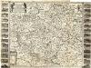
Bohemia in suas partes geograph. distinc
1 : 512000 Mollova mapová sbírka Sandrart, Jakob von Sandrart, Jacob von
Přehledná mapa střední Evropy
1 : 500000 Sasko (Německo) Vojenský zeměpisný ústav
Znázornění hlásné služby a prognosní o stavu vysokých vod v Čechách

Netz der trigonometrischen Vermessung der Gegend um Neuschloss
Nové Hrady (Ústí nad Orlicí, Česko)
Partie meridionale de la Silesie
1 : 408000 Mollova mapová sbírka Le Rouge, Georges-Louis Le Rouge, Georges-Louis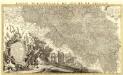
Partie Meridionale du Duché de Silesie /
1 : 400800 Mollova mapová sbírka Covens, Johannes Condet, Johannes Covens, Johannes I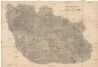
Detail-Operations-Karte für den Krieg in Böhmen 1866
1 : 290000 Česko
Übersichtskarte der Aerarialstrassen, Eisenbahnen, dann der floss... in Böhmen

III. vojenské mapování 3957/3
1 : 25000