Maps of Sachsen

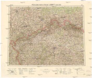
Přehledná mapa střední Evropy
1 : 500000 Sasko (Německo) Vojenský zeměpisný ústav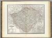
Bohmen.
1 : 675000 Weiland, C. F. (Carl Ferdinand), d. 1847
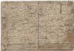
COPIA ab antiquissima MAPPA REGNI BOHEMIAE quae asservatur in Bibliotheca episcopali Litomeric
Čechy (Česko) Kreibich, František Jakub Jindřich Klaudyán, Mikuláš
Copia ab antiquissima Mappa Regni Bohemiae quae asservatur in bibliotheca episcopali Litomeric
Česko Kreibich, František Jakub Jindřich Bílejovský, Bohuslav
[Mapa Čech]
Čechy (Česko) Brosch, Winzenz Klaudyán, Mikuláš
Mapa války 1778-1779
1 : 1600000
Mapa války 1778-1779
March der königlich-preussischen Armée nach Böhmen in 4. verschiedenen Corps 1757
Česko Friedrich, Jacob Andreas Jacob Andreas Friedrich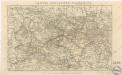
Leipzig - Kohlfurth - Pardubitz

Sídliště pokolení skrčených koster v Čechách
Čechy (Česko)
Hroby se skrčenými kostrami v Čechách
Čechy (Česko)
[Sudety]
1 : 1120000 Sudety (Česko) Národní jednota severočeská
Haupt-Kriegs-Plan in Sachsen und den angränzenden Ländern
Sasko (Německo) Verlage des Thadé Weigl am Graben
March Königlich-Preussischen Armée nach Böhmen in 4. verschiedenen Corps 1757
Mollova mapová sbírka Fridrich, Jacob Andreas Fridrich, Jacob Andreas
Topographische Specialkarte vom Koenigreich Sachsen
1 : 250000 Sasko (Německo) Süssmilch, Moritz von Königl. Hof-Buchhandlung von Hermann Burdach
Sudetengau
1 : 600000 Protektorát Čechy a Morava Landesplanungsgemeinschaft Sudetengau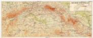
Sudetengau
1 : 600000 Protektorát Čechy a Morava Sudetendeutsche Anstalt für Landes- und Volksforschung
Position des toute les deux armée en Bohéme de l'anne 1778 depuis le 5. juin jusq' au 10. aout
Česko
Historische Charte Böhmens als Beilage zur Bohemia des Gr. Künigl
1 : 2000000 Čechy (Česko)
Post Charte vom Königreiche Böhmen.verlegt im Jahr 1802
mapa VKOL s.n.]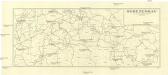
Sudetengau
1 : 1000000 Čechy (Česko) Landesplanungsgemeinschaft Sudetengau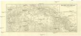
Sudetengau
1 : 1000000 Čechy (Česko) Landesplanungsgemeinschaft Sudetengau
Evanjelická cirkev [sic] česká
Čechy (Česko) Gräf, K. Müller, A.
Nordwestlicher Theil von Boehmen, enthaltend den Pilsner, Ellbogner, Saazer, Leutmeritzer und Rakonitzer Kreis
1 : 540000 Litoměřice-oblast (Česko) Kindermann, Joseph Karl Kunst und Industrie Comptoir
Bohemia in suas partes geograph. distinc
1 : 512000 Mollova mapová sbírka Sandrart, Jakob von Sandrart, Jacob von
Čechy
Čechy (Česko)
Geognostische Charte von Böhmen
Česko Riepl, Franz Richard, Albert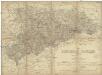
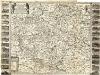
Das Königreich Sachsen
1 : 375000 Sasko (Německo) Gräf, C.