Maps of Northeast

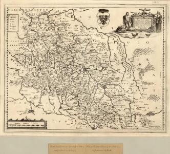
Silesiae dvcatvs
1 : 1050000 Mollova mapová sbírka Scultetus, Johannes Danckerts, Cornelis
Netz der trigonometrischen Vermessung der Gegend um Neuschloss
Nové Hrady (Ústí nad Orlicí, Česko)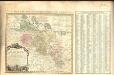
Amplissimi Episcopatvs Wratislaviensis primum in suos IV Archidiaconatus deinde in Circulos Archipresbyteriales divisi Tabula Geographica :
1 : 730000 Mollova mapová sbírka Felbiger, Johann Ignaz Homann, Johann Baptista - dědici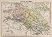
Provinz Schlesien
1 : 1660000 Schlesien
Partie meridionale de la Silesie
1 : 408000 Mollova mapová sbírka Le Rouge, Georges-Louis Le Rouge, Georges-Louis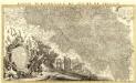
Partie Meridionale du Duché de Silesie /
1 : 400800 Mollova mapová sbírka Covens, Johannes Condet, Johannes Covens, Johannes I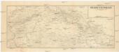
Sudetengau
1 : 600000 Protektorát Čechy a Morava Landesplanungsgemeinschaft Sudetengau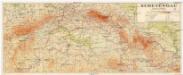
Sudetengau
1 : 600000 Protektorát Čechy a Morava Sudetendeutsche Anstalt für Landes- und Volksforschung
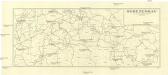
Sudetengau
1 : 1000000 Čechy (Česko) Landesplanungsgemeinschaft Sudetengau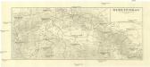
Sudetengau
1 : 1000000 Čechy (Česko) Landesplanungsgemeinschaft Sudetengau
Das Hertzogthum Schlesien mit seinen abgetheilten Fürstenthümern und Herrschafften
1 : 2200000 Mollova mapová sbírka Weigel, Christoph Weigel, Christoph I.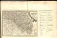
Dvcatvs Silesiae Tabvla Altera Svperiorem Silesiam =
1 : 575000 Mollova mapová sbírka Hase, Johann Matthias Homann, Johann Baptista - dědici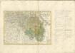

Dvcatvs Silesiae Tabvla Altera Svperiorem Silesiam
1 : 585000 Mollova mapová sbírka Homann, Johann Baptista - dědici
Strassen Karte der Margrafschaft Maehren und des Herzogthums Schlesien
1 : 432000 Morava (Česko)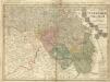
Dvcatvs Silesiae Tabvla Altera Svperiorem Silesiam -
1 : 580000 Mollova mapová sbírka Hase, Johann Matthias Homann, Johann Baptista - dědici
Dvcatvs Silesiae tabvla altera Svperiorem Silesiam
1 : 610000 Horní Slezsko Hase, Johann Matthias Homannianos Heredes
Dvcatvs Silesiae tabvla altera Svperiorem Silesiam exhibens
1 : 610000 Horní Slezsko Hase, Johann Matthias per Homannianos Heredes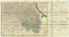
Dvcatvs Silesiae tabvla altera Svperiorem Silesiam
1 : 610000 Horní Slezsko Hase, Johann Matthias Homannianos Heredes
Dvcatvs Silesiae tabvla altera Svperiorem Silesiam
1 : 610000 Horní Slezsko Hase, Johann Matthias Homannianos Heredes
Dvcatvs Silesiae tabvla altera Svperiorem Silesiam
1 : 610000 Horní Slezsko Hase, Johann Matthias per Homan[n]ianos Heredes
Dvcatvs Silesiae tabvla altera Svperiorem Silesiam
1 : 610000 Horní Slezsko Hase, Johann Matthias per Homan[n]ianos Heredes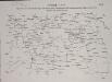
Operationen des österreichischen Corps unter Harsch, später unter General de Ville, und der preussischen Truppen unter General Fouqué, vom 17ten bis 29ten Juli

Sheet III: Karte Des Oesterreichischen Kaiserstaates.
1 : 576000 Scheda, Josef
III, uit: General-Karte des oesterreichischen Kaiserstaates mit einem grossen Theile der angrenzenden Länder / durch Josef Scheda ... bearb. und hrsg
1 : 576000 Annotatie geografische gegevens: Maatstokken: oesterreichische Meilen, geografische oder deutsche Meilen, preussische Meilen, türkische Berri, französische Lieues, russische Werste; Maatstok per blad: wiener Klafter, öster. Meilen; Blad XIX: statistische en taalkundige informatie; Blad XIX: legenda [Wien : K.K. Militärisch-Geografisches Institut]
III. vojenské mapování 3957/3
1 : 25000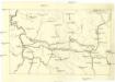
[Nordostböhmen]
1 : 750000 Čechy severovýchodní (Česko)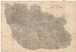
Detail-Operations-Karte für den Krieg in Böhmen 1866
1 : 290000 Česko