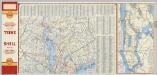
Maps of Town of Clarkstown
(Metropolitan New York and Long Island) Northern Section. To and Through Manhattan.
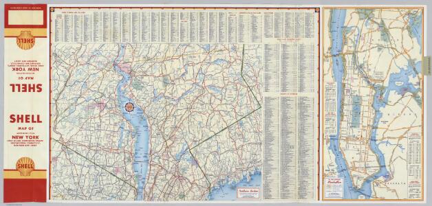
Shell Oil Company
The Hudson by daylight map : showing the prominent residences, historic landmarks, old reaches of the Hudson, Indian names, &c.
from Hudson River
Country from Frog's Point to Croton River shewing the American and British Armies 1776.
1 : 120000 Marshall, John
Shell Greater New York City, Manhattan, Bronx, Brooklyn, Queens.
1 : 50688 Shell Oil Company
Map of the Hudson ... from Spuyten Duyvil to P. Livingston's.
from Map of the Hudson between Sandy Hook & Sandy Hill : with the post road between New York and Albany / Bridges delt. ; Rollinson sct.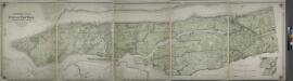
Topographical atlas of the city of New York, including the annexed territory showing original water courses and made land.
from Topographical atlas of the city of New York, / including the annexed territory showing original water courses and made land / prepared under the direction of Egbert L. Viele.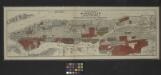
Map of the borough of Manhattan and part of the Bronx showing location and extent of racial colonies.
From Manhattan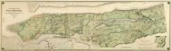
Composite: Topographical Atlas Of The City Of New York
1 : 12000 Viele, Egbert L.
TheHeart of New York: Grand Central Terminal: Only Railway Station on the Subway, Elevated, and Surface Lines.
From Manhattan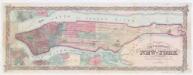
Colton's city & county map of New-York
1 : 20000 G.W. & C.B. Colton & Co G.W. and C.B. Colton
Map of the city and county of New York : with the adjacent country / by David H. Burr.
from An atlas of the state of New York : containing a map of the state and of the several counties / by David H. Burr.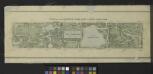
Plan of The Central Park, City of New York, 1860
from Manhattan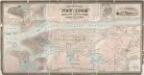
City & county map of New-York, Brooklyn, Williamsburgh, Jersey City & the adjacent waters / by J.H. Colton, N.Y. ; engraved by D.G. Johnson, N. York.
from Manhattan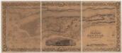
Topographical map of the city and county of New-York and the adjacent country : with views in the border of the principal buildings and interesting scenery of the island
1 : 16000 S. Stiles & Co Sherman & Smith
New York City, County.
1 : 31680 Vermeule, C. C. (Cornelius Clarkson), 1858-1950
New handy map of New York City.
From Manhattan
Geologic map and sections of Manhattan Island, State of New York
From Manhattan
Colton's Map of the City of New York, prepared for the Department of Street Cleaning.
From Manhattan
Map of the city and county of New York : with the adjacent country / by David H. Burr.
from An atlas of the state of New York : containing a map of the state and of the several counties. / Projected and drawn under the superintendence and direction of Simeon de Witt ... And also the physical geography of the State ...
New York City.
1 : 41000 Rand McNally and Company
Map of the city and county of New York : with the adjacent country / by David H. Burr.
from An atlas of the state of New York, designed for the use of engineers, containing a map of the state and of the several counties. / Projected and drawn ... under the superintendence and direction of Simeon de Witt.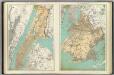
N.Y. City, Brooklyn.
1 : 41500 Bien, Joseph Rudolf
Plaines Blanches et Armees Americaine et Britannique, 12 Octobre1776.
1 : 130000 Marshall, John
Manhattan public and publicly aided housing
From The Borough
1907 library map of Manhattan, City of New York.
From Manhattan
Heart of New York.
1 : 29800 New York Central Railroad Company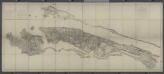
Facsimile of the unpublished British head quarters coloured manuscript map of New York & environs / reproduced from the original drawing in the War Office, London.
from Whole
New York City.
1 : 43500 Rand McNally and Company
Map of the city and county of New York : with the adjacent country / by David H. Burr.
from Whole