Maps of Hudson County
City & county map of New-York, Brooklyn, Williamsburgh, Jersey City & the adjacent waters / by J.H. Colton, N.Y. ; engraved by D.G. Johnson, N. York.
from Manhattan
Map of the city and county of New York : with the adjacent country / by David H. Burr.
from An atlas of the state of New York, designed for the use of engineers, containing a map of the state and of the several counties. / Projected and drawn ... under the superintendence and direction of Simeon de Witt.
Map of the city and county of New York : with the adjacent country / by David H. Burr.
from An atlas of the state of New York : containing a map of the state and of the several counties. / Projected and drawn under the superintendence and direction of Simeon de Witt ... And also the physical geography of the State ...
Topographical map of the city and county of New-York and the adjacent country : with views in the border of the principal buildings and interesting scenery of the island
1 : 16000 S. Stiles & Co Sherman & Smith
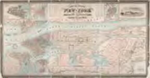
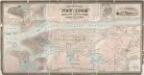
Colton's Map of the City of New York, prepared for the Department of Street Cleaning.
From Manhattan
TheRand McNally map of the Borough of Manhattan.
From Manhattan
Map of the city and county of New York : with the adjacent country / by David H. Burr.
from An atlas of the state of New York : containing a map of the state and of the several counties / by David H. Burr.
Ile de New York et Positions des Armees Americaine et Britannique, 27 Aout 1776.
1 : 100000 Marshall, John
Map of the five cities of New York, Brooklyn, Jersey City, Hoboken & Hudson City : Northern sheet
Dripps, M. (Matthew) Common Council
Map of the five cities of New York, Brooklyn, Jersey City, Hoboken & Hudson City : Southern sheet
Dripps, M. (Matthew) Common Council
Manhattan Borough and part of Bronx Borough of the City of New York.
From Manhattan
Manhattan land use policy
From The Borough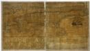
Map of the city and county of New York : with the adjacent country / by David H. Burr.
from Whole
TheRand McNally map of the Borough of Manhattan.
From Manhattan
Manhattan public and publicly aided housing
From The Borough
Map of the Borough of Manhattan, New York City, centering on the campus of Columbia University.
From Manhattan
Outline map of large scale real estate atlases of New York City, Borough of Manhattan.
from Atlas of the city of New York, borough of Manhattan / from actual surveys and official plans by George W. and Walter S. Bromley.
Outline Map of Large Scale Real Estate Atlases of New York City, Borough of Manhattan.
from Atlas of the city of New York, borough of Manhattan. From actual surveys and official plans / by George W. and Walter S. Bromley.
Map of New York City showing portions of Brooklyn, Jersey City, and Westchester Co. on enlarged scale.
From Manhattan
BLOCK INDEX. Includes the map of Manhattan, Sections 1-8.
from Atlas of the city of New York, Manhattan Island. From actual surveys and official plans / by George W. and Walter S. Bromley.
Shell Greater New York City, Manhattan, Bronx, Brooklyn, Queens.
1 : 50688 Shell Oil Company
New York City.
1 : 43000 Rand McNally and Company
Map of New York City showing portions of Brooklyn, Jersey City, and Westchester Co.
From Manhattan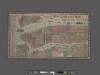
New York City Map. Extracted from Phelps' strangers and citizens' guide to New York City, with maps and engravings.
From Manhattan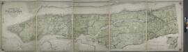
Topographical atlas of the city of New York, including the annexed territory showing original water courses and made land.
from Topographical atlas of the city of New York, / including the annexed territory showing original water courses and made land / prepared under the direction of Egbert L. Viele.
TheHome Life Publishing Co.' s map of the City of New York.
From Manhattan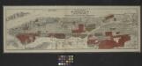
Map of the borough of Manhattan and part of the Bronx showing location and extent of racial colonies.
From Manhattan
Map of part of New York City, showing underground mains of the Edison Electric Illuminating Co. of New York.
From Manhattan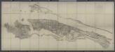
Facsimile of the unpublished British head quarters coloured manuscript map of New York & environs / reproduced from the original drawing in the War Office, London.
from Whole