Maps of gmina Złotów

Composite: 192. Flatow. (Germany)
1 : 100000 Reichsamt fur Landesaufnahme
Meßtischblatt 2668 : Flatow, 1934
1 : 250000 Flatow. - Aufgen. 1928. - 1:25000. - [Berlin]: Reichsamt für Landesaufnahme, 1934. - 1 Kt.
Meßtischblatt 2667 : Tarnowke, 1933
1 : 250000 Tarnowke. - Aufgen. 1928. - 1:25000. - [Berlin]: Reichsamt für Landesaufnahme, 1933. - 1 Kt.
Meßtischblatt 2567 : Flederborn, 1934
1 : 250000 Flederborn. - Aufgen. 1928, hrsg. 1933, einz. Nachtr. 1934. - 1:25000. - [Berlin]: Reichsamt für Landesaufnahme, 1934. - 1 Kt.
Meßtischblatt 2568 : Buschdorf, 1934
1 : 250000 Buschdorf. - Aufgen. 1928, hrsg. 1933, einz. Nachtr. 1934. - 1:25000. - [Berlin]: Reichsamt für Landesaufnahme, 1934. - 1 Kt.
Meßtischblatt 2768 : Preußenfeld, 1937
1 : 250000 Preußenfeld. - Hrsg. 1925, einz. Nachtr. 1934, mehrfarb. Ausg. - 1:25000. - [Berlin]: Reichsamt für Landesaufnahme, 1937. - 1 Kt.
Meßtischblatt 2767 : Krojanke, 1938
1 : 250000 Krojanke. - Aufn. 1928, letzte Nachtr. 1934, redakt. Änd. 1938. - 1:25000. - [Berlin]: Reichsamt für Landesaufnahme, 1938. - 1 Kt.
Meßtischblatt 2669 : Kujan, 1935
1 : 250000 Kujan. - Hrsg. 1926. - 1:25000. - [Berlin]: Reichsamt für Landesaufnahme, 1935. - 1 Kt.
Meßtischblatt 2569 : Linde, 1939
1 : 250000 Linde. - Aufgen. 1921/34, hrsg. 1925, letzte Nachtr. 1934. - 1:25000. - [Berlin]: Reichsamt für Landesaufnahme, 1939. - 1 Kt.
Meßtischblatt 2769 : Wilhelmshof, 1933
1 : 250000 Wilhelmshof. - Hrsg. 1923. - 1:25000. - [Berlin]: Reichsamt für Landesaufnahme, 1933. - 1 Kt.
Tempelburg 37, uit: Special-Karte von Mittel-Europa / nach amtlichen Quellen bearbeitet von W. Liebenow
1 : 300000 titelvariant: W. Liebenow's Mittel-Europa; Annotatie: Titel boven de bladen: W. Liebenow's Mittel-Europa Johannes Wilhelm Liebenow 1822-1897 Frankfurt a. M. : Ludwig Ravenstein
191. Deutsch-Krone. (Germany)
1 : 100000 Reichsamt fur Landesaufnahme
Meßtischblatt 2666 : Betkenhammer, 1944
1 : 250000 Betkenhammer. - Aufn. 1935. - 1:25000. - [Berlin]: Reichsamt für Landesaufnahme, 1944. - 1 Kt.
Meßtischblatt 2566 : Jastrow, 1935
1 : 250000 Jastrow. - Aufgen. 1935. - 1:25000. - [Berlin]: Reichsamt für Landesaufnahme, 1935. - 1 Kt.
Meßtischblatt 2766 : Lebehnke, 1938
1 : 250000 Lebehnke. - Aufn. 1935. - 1:25000. - [Berlin]: Reichsamt für Landesaufnahme, 1938. - 1 Kt.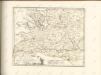

Sect. 10: Bromberg, uit: Geologische Karte des Deutschen Reichs in 27 Blaettern / [von] Richard Lepsius ; Red. von C. Vogel
1 : 500000 Annotatie: Blad 18 ontbreekt; Een aantal bladen op linnen; Een aantal bladen gereviseerd 1913-1914; Annotatie geografische gegevens: Met schaalstokken o.a. in kilometers; Legenda Carl Vogel 1828-1897 Gotha : Justus Perthes
Bromberg
1 : 600000 Opitz, Carl Solbrig
Provinz Posen
1 : 1200000 Provinz Posen
Posen.
1 : 810000 Radefeld, Carl Christian Franz, 1788-1874
Palatinatus Posnaniensis. In Majori Polonia Primarii Nova Delinatio [Karte], in: Novus atlas absolutissimus, Bd. 1, S. 96.
1 Karte aus Atlas Janssonius Offizin
Languages in Prussian Poland
1 : 600000 First World War map of Languages in Prussian Poland. War Office
Provinz Posen
Grosser Hand-Atlas über alle Theile der Erde in 170 Karten Meyer, J. Verlag des Bibliographischen Instituts
Die polnische Curve in Westpreußen
Polen Westpreußen Polen Bevölkerung
Provinz Westpreussen
1 : 1250000 Westpreußen
Kreise der Provinz Posen 1864
Preußen, Provinz Posen, Verwaltungsgliederung Kunz, Andreas ; Moeschl, Joachim Robert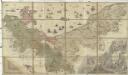
Ducatus Pomeraniae citerioris et ulterioris principatibus, comitatibus urbibus suis definitae nova et ampla descriptio
1 : 257000 Pomořansko (Německo a Polsko) Lotter, Tobias Conrad T. C. Lotter
Provinz Westpreussen
1 : 472000 Gdaňsk (Polsko) Handtke, Friedrich Carl Flemming
Danzig, Colberg, Thorn
1 : 750000 Gdaňsk (Polsko : oblast) Konrad, A. K. u. k. Militärgeographisches Institut


