Cataloged map
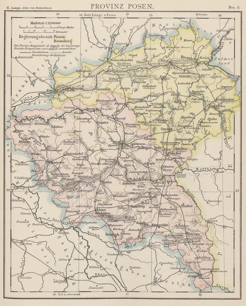
Provinz Posen

Full title:Provinz Posen
Depicted:1886
Pubdate:1886
Physical Size:20 x 30 cm
Map scale:1:1 200 000
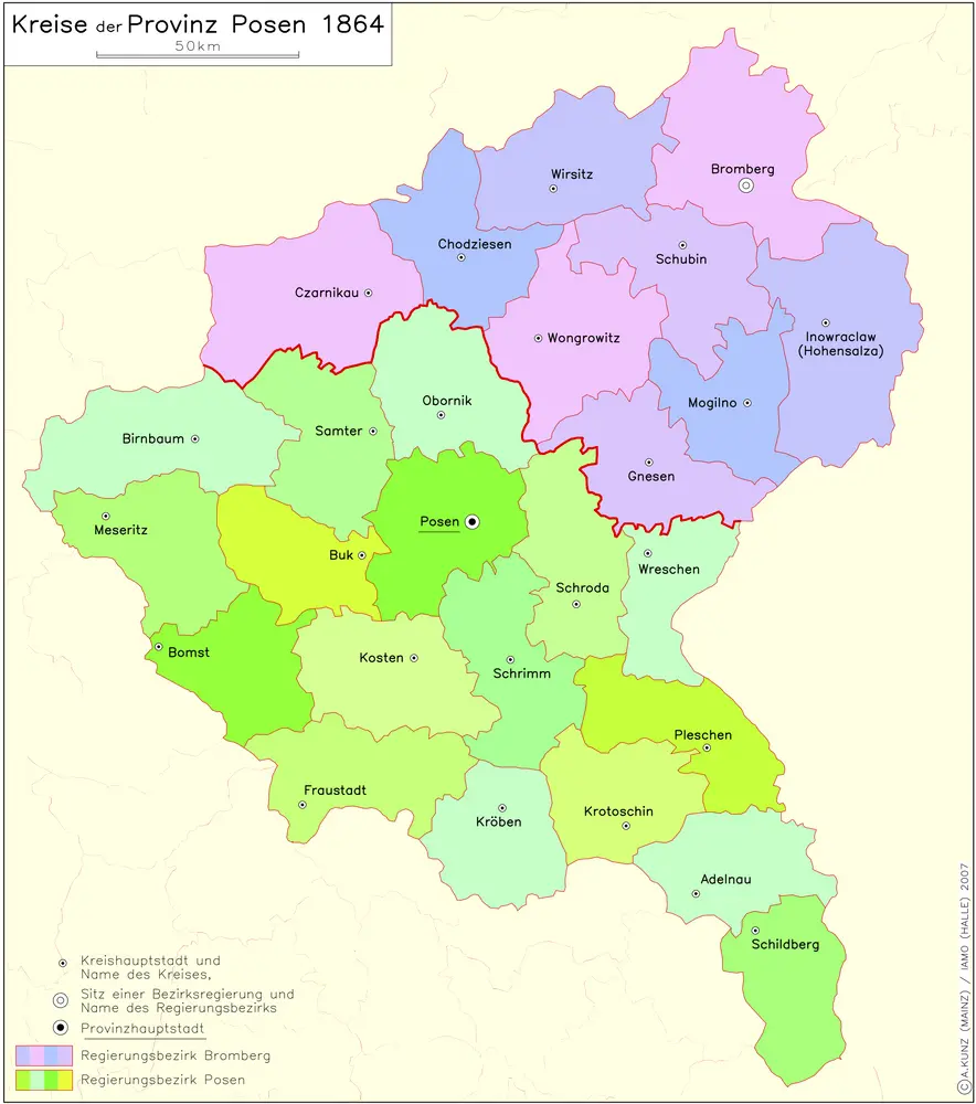
Kreise der Provinz Posen 1864
1864
Kunz, Andreas ; Moeschl, Joachim Robert
Provinz Posen
1886
1:1m
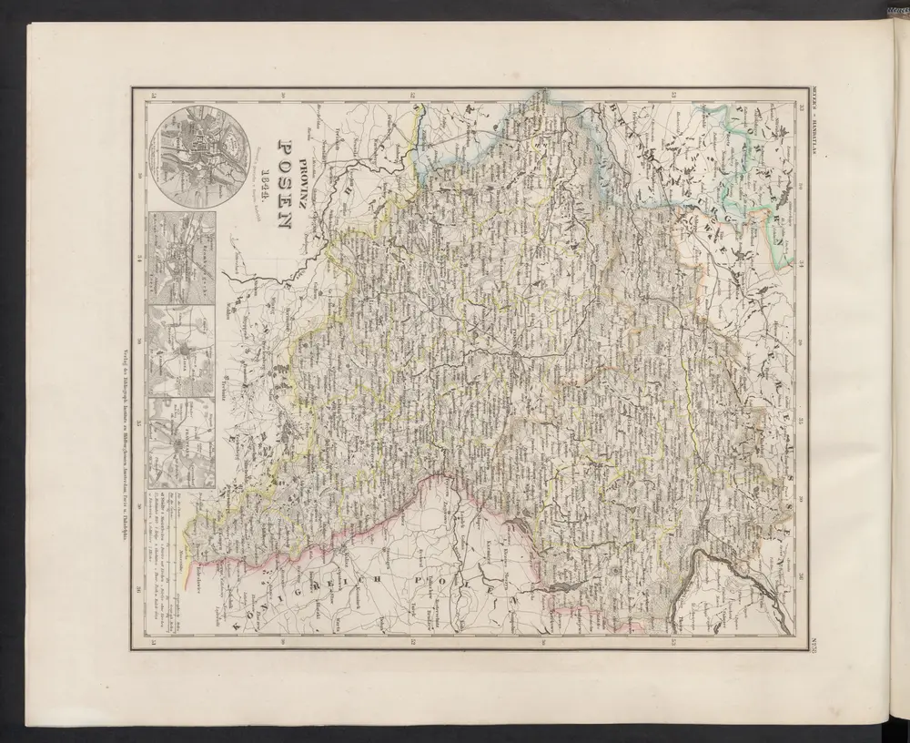
Provinz Posen
1860
Meyer, J.
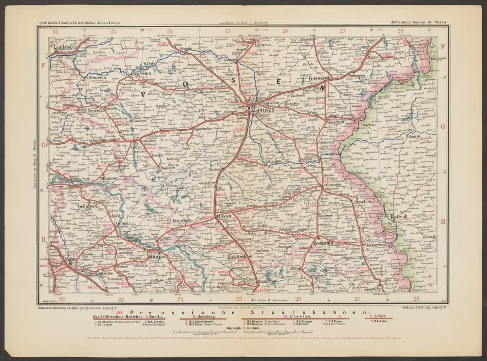
Posen
1893
Opitz, Carl
1:600k
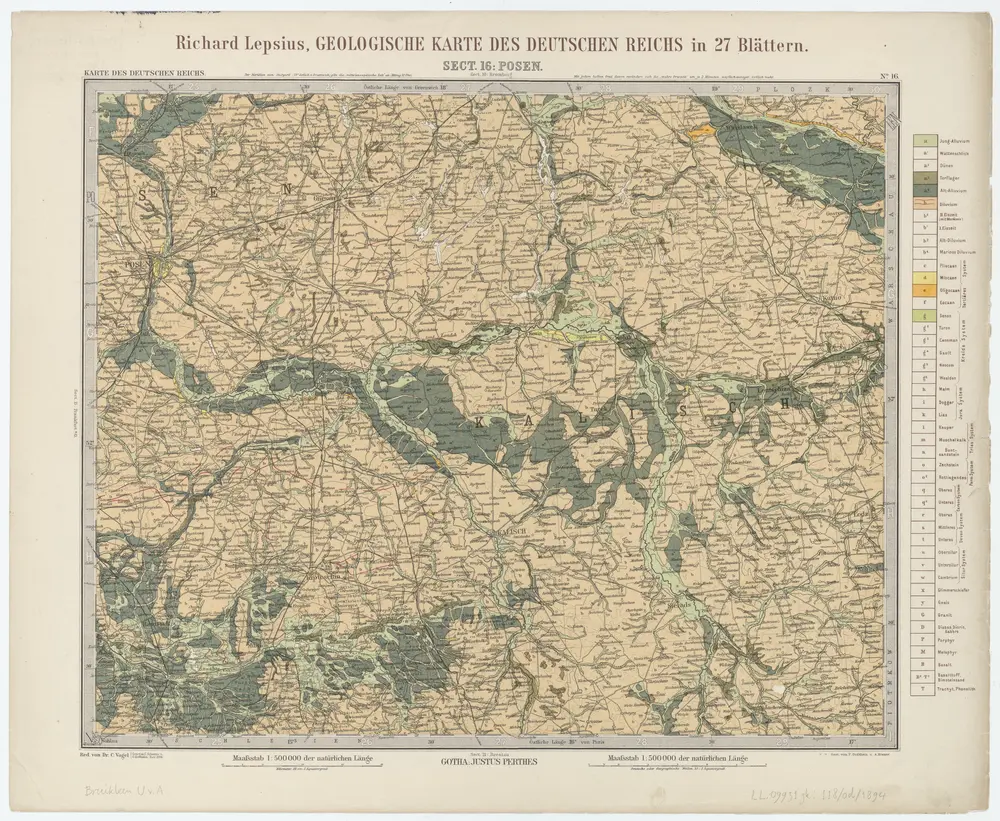
Sect. 16: Posen, uit: Geologische Karte des Deutschen Reichs in 27 Blaettern / [von] Richard Lepsius ; Red. von C. Vogel
1894
Carl Vogel 1828-1897
1:500k
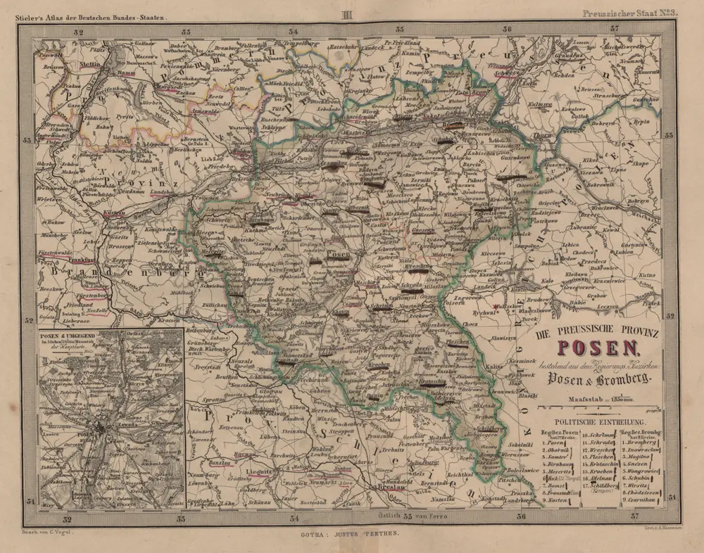
Die Preussische Provinz Posen, bestehend aus den Regierungs-Bezirken: Posen & Bromberg
1858
1:2m
Posen, Glogau, Schweidnitz, Oppeln, Kalisz
1916
K. u. k. Militärgeographisches Institut
1:750k
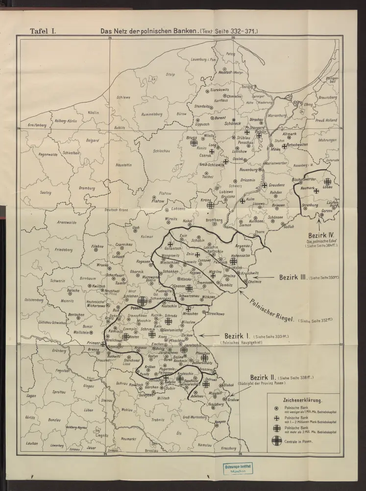
Das Netz der polnischen Banken
1910
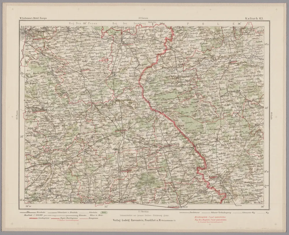
Kalisch 63, uit: Special-Karte von Mittel-Europa / nach amtlichen Quellen bearbeitet von W. Liebenow
1899
Johannes Wilhelm Liebenow 1822-1897
1:300k
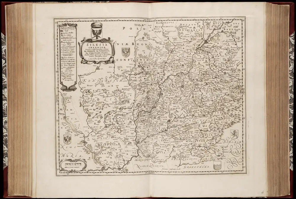
Silesia inferior : sereniss. ac celsiss. principibus ac dominis Dn. Georgio, Dn. Lvdovico, Dn. Christiano, fratribus : ducibus Silesiae ligniciens. ac Bergensibus, dominis gratiosissimis dicata / à Jona Sculteto Sprotta-Silesio ; Johannes Janssonius excud
1644
Jonas Scultetus 1603-1664; Johannes Janssonius 1588-1664
1:2m