Maps of Metropolitan France

Europe, intermediate century.
1 : 22500000 Fenner, Rest.
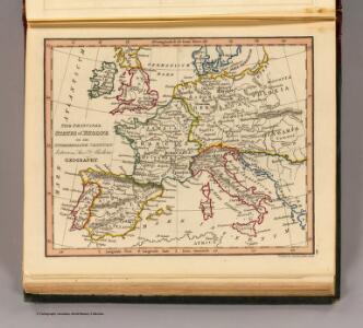
Germanie, France, Italie, Espagne, Isles Britanniques.
1 : 5200000 Anville, Jean Baptiste Bourguignon d, 1697-1782
Europa zur Zeit Napoleons
Europa Napoleon I., Frankreich, Kaiser
Kriegszusammenhänge III (1700 - 1721)
1 : 20000000 Europa Nordischer Krieg <1700-1721>, Türkenkriege
Západní a střední Evropa v době absolutismu až do konce francouzské revoluce
Das Reich Karl des Großen
Europa Karl I., Heiliges Römisches Reich, Kaiser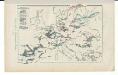
Kriegszusammenhänge V (1788 - 1815)
1 : 20000000 Europa Napoleonische Kriege, Koalitionskriege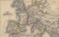
Das Zeitalter der Hohenstaufen
Mitteleuropa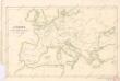
Evropa v době humdsko - germánské od 4. do 6. stol.

Karte von mittel und sued Europa
Evropa Hauslab, Franz von Artaria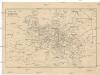
Cestovní spoje v Evropě
Evropa
Landtaflen
1 Atlas [von Johannes Stumpf] Christoffel Froschower, Zürych
[Personifizierte Europa als Königin mit Reichsapfel und Zepter, Hispania bildet den Kopf]
1 Karte : Holzschnitt ; 16 x 26 cm Münster, Sebastian [Sebastian Münster]
[Personifizierte Europa als Königin mit Reichsapfel und Zepter, Hispania bildet den Kopf]
1 Karte : Holzschnitt ; 16 x 26 cm Münster, Sebastian [Sebastian Münster]
Europa im Zeitalter Napoleons
1 : 15000000 Europa Napoleon I., Frankreich, Kaiser
Europa Prima Nova Tabula [Karte], in: Geographia universalis vetus et nova complectens Claudii Ptolemaei Alexandrini enarrationis libros VIII, S. 302.
1 Karte aus Atlas Münster, Sebastian [und Ptolemaeus, Claudius]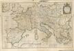

Carte Routiere et Postale de la France

Europa im Zeitalter Wilhelms I.
1 : 15000000 Europa Wilhelm I., Deutsches Reich, Kaiser
Nová mapa vysílacích stanic Evropy
Evropa Hlaváček, Josef Orbis
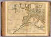
Europe
1 : 4000000 Evropa Andriveau-Goujon, E. E. Andriveau-Goujon
Mitteleuropa zur Napoleonischen Zeit

Europa Saeculo XVIII. Usque ad Annum 1789 (1795)
Europa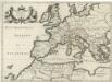
Patriarchatus Romanus
1 : 11100000 Mollova mapová sbírka Sanson, Nicolas Covens, Johannes I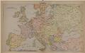
Mittel-Europa
Europa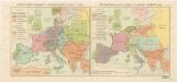
Rozsah panství Habsburků ... za Karla V. (1555) Říše Napoleonova (1810) a Evropa po kongresu Vídeňském (1815)

Carte Generale des Chemin de Fer Europeens.
1 : 3200000 Migeon, J.
Europe Historique.
Andriveau-Goujon, J.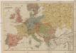
Neueste Geschäfts u. Reisekarte von Europa
1 : 5000000 Evropa Brandes, H. Moritz Perles