Maps of Mediterranean Sea
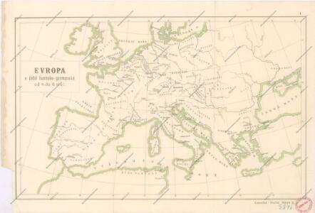
Evropa v době humdsko - germánské od 4. do 6. stol.
Západní a střední Evropa v době absolutismu až do konce francouzské revoluce

Europa im Zeitalter Napoleons
1 : 15000000 Europa Napoleon I., Frankreich, Kaiser
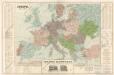
Europa im Zeitalter Wilhelms I.
1 : 15000000 Europa Wilhelm I., Deutsches Reich, Kaiser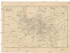
Cestovní spoje v Evropě
Evropa
Europa Saeculo XVIII. Usque ad Annum 1789 (1795)
Europa
Mitteleuropa zur Napoleonischen Zeit

Kriegszusammenhänge III (1700 - 1721)
1 : 20000000 Europa Nordischer Krieg <1700-1721>, Türkenkriege
Europe Historique.
Andriveau-Goujon, J.
Europa Prima Nova Tabula [Karte], in: Geographia universalis vetus et nova complectens Claudii Ptolemaei Alexandrini enarrationis libros VIII, S. 302.
1 Karte aus Atlas Münster, Sebastian [und Ptolemaeus, Claudius]
Europa im 16. Jahrhundert (1559)
1 : 15000000 Europa
Europa im 17. und 18. Jahrhundert (1740)
1 : 15000000 Europa
23. Europa im 17. und 18. Jahrhundert (1740)
1 : 15000000 Europa
Nová mapa vysílacích stanic Evropy
Evropa Hlaváček, Josef Orbis
Europa Prima Nova Tabula [Karte], in: Claud. Ptolemaeus. Geographia lat. cum mappis [...], S. 332.
1 Karte aus Atlas Münster, Sebastian [und Ptolemaeus, Claudius]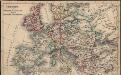
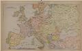
Europa seit Friedrich dem Grossen bis zur französ. Revolution
Europa
The Mountain Systems of Europe
The physical atlas Johnston, Alexander Keith William Blackwood & Sons
20. Europa im 16. Jahrhundert (1559)
1 : 15000000 Europa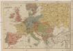
Neueste Geschäfts u. Reisekarte von Europa
1 : 5000000 Evropa Brandes, H. Moritz Perles
Esquisse orographique de l'Europe
1 : 6543100 par J.H. Bredsdorff & O.N. Olsen, en 1824 gravée par P.J. Seehusen. Copenhaque : C. A. Reitzel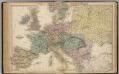
Map of Europe.
1 : 6300000 Walling, H. F.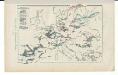
Kriegszusammenhänge V (1788 - 1815)
1 : 20000000 Europa Napoleonische Kriege, Koalitionskriege
Europe Centrale en 1920
1 : 4200000 titelvariant: Nouvelle carte de l'Europe Centrale; Annotatie: Titel linksboven: Nouvelle carte de l'Europe Centrale Paris : Taride
Carte Routiere et Postale de la France
Evropa
Mittel-Europa
Europa
Kriegszusammenhänge II (1672-1699)
1 : 25000000 Europa Englisch-Niederländischer Seekrieg <1672-1674>, Türkenkriege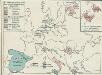
4. Friedensschlüsse nach dem span. Erbfolgekriege 1713/1714. nach d. Nord. Kriege 1719/21. Passarowitz 1718
1 : 30000000 Europa Nystad / Friede, Požarevac / Friede