Maps of Mediterranean Sea

[Personifizierte Europa als Königin mit Reichsapfel und Zepter, Hispania bildet den Kopf]
1 Karte : Holzschnitt ; 16 x 26 cm Münster, Sebastian [Sebastian Münster]
[Personifizierte Europa als Königin mit Reichsapfel und Zepter, Hispania bildet den Kopf]
1 Karte : Holzschnitt ; 16 x 26 cm Münster, Sebastian [Sebastian Münster]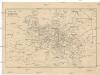
Cestovní spoje v Evropě
Evropa
Europe
1 : 4000000 Evropa Andriveau-Goujon, E. E. Andriveau-Goujon
The Mountain Systems of Europe
The physical atlas Johnston, Alexander Keith William Blackwood & Sons
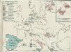
Carte Routiere et Postale de la France

Nová mapa vysílacích stanic Evropy
Evropa Hlaváček, Josef Orbis
Mitteleuropa zur Napoleonischen Zeit

Europa Saeculo XVIII. Usque ad Annum 1789 (1795)
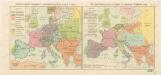
Europa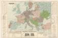
Evropa
Rozsah panství Habsburků ... za Karla V. (1555) Říše Napoleonova (1810) a Evropa po kongresu Vídeňském (1815)
4. Friedensschlüsse nach dem span. Erbfolgekriege 1713/1714. nach d. Nord. Kriege 1719/21. Passarowitz 1718
1 : 30000000 Europa Nystad / Friede, Požarevac / Friede
Europa im Zeitalter Wilhelms I.
1 : 15000000 Europa Wilhelm I., Deutsches Reich, Kaiser
Kriegszusammenhänge III (1700 - 1721)
1 : 20000000 Europa Nordischer Krieg <1700-1721>, Türkenkriege
Europe Historique.
Andriveau-Goujon, J.
Europa im Zeitalter Napoleons
1 : 15000000 Europa Napoleon I., Frankreich, Kaiser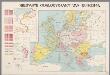
Nieuwste oorlogskaart van Europa
1 : 6000000 A[mster]dam : Meulenhoff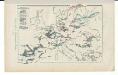
Kriegszusammenhänge V (1788 - 1815)
1 : 20000000 Europa Napoleonische Kriege, Koalitionskriege
Landtaflen
1 Atlas [von Johannes Stumpf] Christoffel Froschower, Zürych
Carte d'Europe indiquant le canal maritime de l'océan à la Méditerranée
1 : 16000000 Perrin, Maurice [Paris] : [éditeur inconnu]
Carte itinéraire de l'Europe indiquant les limites actuelles des etats
1 : 3760000 Evropa Dufour, A. H. Simonneau, Charles Ch.les Simonneau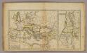
Roman Empire, Palestine.
1 : 15200000 Worcester, Joseph E.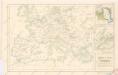
Západní a střední Evropa v době absolutismu až do konce francouzské revoluce

Europa im 16. Jahrhundert (1559)
1 : 15000000 Europa
Europa temporibus expeditionum sacrarum
Evropa Kunst u geogr. Anstalt von Serz & C.ie
Europa im 17. und 18. Jahrhundert (1740)
1 : 15000000 Europa
23. Europa im 17. und 18. Jahrhundert (1740)
1 : 15000000 Europa
Oorlogskaart van Europa : met vermelding der voornaamste gebeurtenissen van af 28 juni 1914 tot 29 januari 1916 / samengest. en get. door Ph.L. Battefeld
1 : 2600000 Annotatie: Met lijst van: Datums en feiten; Annotatie geografische gegevens: Met schaalstok Ph.L. Battefeld Delft : Hillen's Sigaren en Tabaksfabriek / (Amsterdam : drukkerij Senefelder)
Karte von mittel und sued Europa
Evropa Hauslab, Franz von Artaria
![[Personifizierte Europa als Königin mit Reichsapfel und Zepter, Hispania bildet den Kopf]](https://images-2.georeferencer.com/images/iiif/012643717534/full/,300/0/native.jpg)

