Maps of Mediterranean Sea

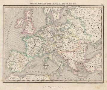
Europa Saeculo XVIII. Usque ad Annum 1789 (1795)
Europa
Europa im Zeitalter Wilhelms I.
1 : 15000000 Europa Wilhelm I., Deutsches Reich, Kaiser
Europa im Zeitalter Napoleons
1 : 15000000 Europa Napoleon I., Frankreich, Kaiser
Mitteleuropa zur Napoleonischen Zeit

Europa im 17. und 18. Jahrhundert (1740)
1 : 15000000 Europa
23. Europa im 17. und 18. Jahrhundert (1740)
1 : 15000000 Europa
Nieuwste oorlogskaart van Europa
1 : 6000000 A[mster]dam : Meulenhoff
Österreich-Ungarn und Bosnien-Hercegovina
Eberle, Joseph
20. Europa im 16. Jahrhundert (1559)
1 : 15000000 Europa
Carte d'Europe indiquant le canal maritime de l'océan à la Méditerranée
1 : 16000000 Perrin, Maurice [Paris] : [éditeur inconnu]
Europa seit Friedrich dem Grossen bis zur französ. Revolution
Europa
Europe Historique.
Andriveau-Goujon, J.
Europa temporibus expeditionum sacrarum
Evropa Kunst u geogr. Anstalt von Serz & C.ie
Europe Centrale en 1920
1 : 4200000 titelvariant: Nouvelle carte de l'Europe Centrale; Annotatie: Titel linksboven: Nouvelle carte de l'Europe Centrale Paris : Taride

Kriegszusammenhänge II (1672-1699)
1 : 25000000 Europa Englisch-Niederländischer Seekrieg <1672-1674>, Türkenkriege
Europa's letzte fünfundzwanzig Jahre 1815-1840 zur Uebersicht der Geschichte der neuesten Zeit
Balkánský poloostrov Loewenberg, Julius Silber v. J.J. Weber
Incursions of barbarians.
1 : 23500000 Mitchell, Samuel Augustus
Karte IV: Panslawistische Karte von Europa
Europa Panslawismus Nach Komarov-Sarjanto
4. Friedensschlüsse nach dem span. Erbfolgekriege 1713/1714. nach d. Nord. Kriege 1719/21. Passarowitz 1718
1 : 30000000 Europa Nystad / Friede, Požarevac / Friede
Paasche's Frontenkarte, Nr. 11 Europäische Kriegsschauplätze

Europa Temporibus Expeditionum Sacrarum
Europa Kreuzzüge
Napoleons Heereszüge : von seinem Auftreten als Ober-General der Armee von Italien 1796 bis zu seiner Thron-Entsagung nach der Schlacht bey Waterloo 1815
Entworfen von F.W. Benicken gravirt v. C. Halle Weimar : im Verlage des Landes Industrie-Comptoirs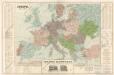
Evropa

Invasion des Barbares.
Andriveau-Goujon, J.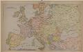
Mittel-Europa
Europa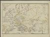
[Hierographie, oder topographisch-synchronistische Darstellung der Geschichte der christlichen Kirche] : XII. Von den Päpsten in Avignon bis zur Reformation J. 1305-1517
1 : 8400000 W.A. Möller Lith. bey Arnz & Co. in Düsseldorf Elberfeld : Büschler
Cestovní spoje v Evropě
Evropa
Eisenbahn- Post- und Dampfschiffahrts-Karte von Europa
1 : 8000000 Evropa Denk, L. Lith. Anst. v. L. Mohn's Witwe