Maps of Metropolitan France

Composite: Frankreich in 4 Blattern.
1 : 1500000 Vogel, C.
Karte von Frankreich
1 : 2056000 Francie Mollo, Tranquillo T. Mollo
Karte von Frankreich
1 : 2056000 Francie Müller, Franz T. Mollo
Karte von Frankreich
1 : 2060000 Francie Mollo, Tranquillo T. Mollo und Comp.
Karte von Frankreich
1 : 2060000 Francie Mollo, Tranquillo T. Mollo und Comp.
Karte von Frankreich
1 : 2060000 Francie Mollo, Tranquillo T. Mollo und Comp.
Frankreich
1 : 3640000 Francie Mollo, Florian Florian Mollo
Frankreich
1 : 3640000 Francie Florian Mollo
France en 1789.
1 : 3000000 Levasseur, E.
Frankreich
Grosser Hand-Atlas über alle Theile der Erde in 170 Karten Meyer, J. Verlag des Bibliographischen Instituts
Königreich Frankreich
Francie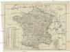
Königreich Frankreich
1 : 3500000 Francie
Karte von Frankreich
1 : 4260000 Francie Amon, Anton J. Riedls Kunsthandlung
Karte von Frankreich
1 : 4260000 Francie Amon, Anton J. Riedls Kunsthandlung
Carte pittoresque et maritime de la France : indiquant la division politique et administrative ... / par A.M. Perrot ; revue et augm. par A. Vuillemin
1 : 1350000 Annotatie: Met aansluitende inzet van Corsica; Met afb. van bezienswaardigheden; Annotatie geografische gegevens: Grenzen en spoorlijnen gekleurd Perrot, A. M.; Vuillemin, A. Paris : Fatout

Frankreich
1 : 541000 Francie Schönfelder, F. Edl. von
Nieuwe kaart van Vrankrijk, volgens de nieuwste waarnemingen van de Koningl. Parijsche Academie
1 : 5750000 [S.l.] : [s.n.]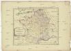
Allgemeine Postkarte von Frankreich zur Uebersicht
Francie Müller, Franz im von Reillyschen Landkarten und Kunstwerke Verschleiss Komptoir
Frankreich

Carte Physique et Mineralogique de la France.
1 : 3500000 Malte-Brun, Conrad, 1775-1826
France Provinces en 1789
Vidal de La Blache, Paul
La France
1 Karte : Kupferdruck ; 51 x 64 cm Jaillot; Cordier chez le Sr. Jaillot
A new map of France, in which the post stages are exactly express'd
1 Karte : Kupferdruck ; 46 x 57 cm Rocque; Kitchin s.n.
France, Suisse.
1 : 2100000 Levasseur, E.


France.
1 : 3500000 Malte-Brun, Conrad, 1775-1826
Carte de la France
1 : 3200000 Francie Poirson Jean M.d d'Estampes


