Maps of Balkan Pen.

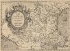
Turkey in Europe.
1 : 4000000 Colton, G.W.
Map of the Balkan States
Balkanhalbinsel
Turkey in Europe.
1 : 2533000 Johnston, W. & A.K.
Turkey in Europe.
1 : 3000000 Colton, G.W.
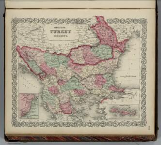
Turkey in Europe.
1 : 4000000 Colton, G.W.
Turkey in Europe.
1 : 2533000 Johnston, Alexander Keith
Turkey in Europe.
1 : 2533000 Johnston, Alexander Keith
Turkey In Europe.
1 : 3600000 Colton, G.W.
Schul-Atlas für die alte Erdbeschreibung : zur allgemeinen Schul-encyclopädie gehörig
J. H. Campe Zusammensetzung und Zeichnung von [...] Dufour, unter Leitung von Heusinger ; gestochen von Frentzel. Braunschweig : Schulbuchhandlung
Turkey In Europe.
1 : 4942080 Tallis, J. & F.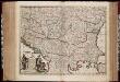
Nova totius Hungariae, Transilvaniae, Serviae, Romaniae, Bulgariae, Walachiae, Moldaviae, Sclavoniae, Croatiae, Bosniae, Dalmatiae, maximaeq[ue] partis Danubii fluminis, descriptio / emendata a F. de Wit
1 : 2600000 Annotatie: Tekst impressum in het Nederlands; Rechtsboven: 21; Kaart toont Hongarije, omliggende landen en een belangrijk deel van de loop van de Donau; Origineel is Blad 129 in atlas factice; Annotatie geografische gegevens: Schaalstok linksonder cartouche: Milliaria Germanica communia 15 uni gradui = Gemeene Duytsche Mylen van 15 in een graedt Frederick de Wit 1630-1706 Amsterdam : gedruckt by Frederick de Wit inde Kalverstraet by den Dam inde Witte Pascaert
Die Transhumanz der dakorumänischen, aromunischen, meglenorumänischen und istrorumänischen Hirten
Balkanhalbinsel Transhumanz, Walachen Willing, P.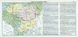
Nr. 17. Bulgarien und die Nationen des Balkans
Balkanhalbinsel, Bulgarien
Carte de la Turquie d'Europe
1 : 1270000 Evropa jihovýchodní Konrad, Al. Palma, G. chez Artaria et Compagnie
Romaniae, (quae olim Thracia dicta) Vicinarumque Regionum, Uti Bulgariae, Walachiae, Syrfiae, Etc. Descriptio. [Karte], in: Theatrum orbis terrarum, S. 283.
1 Karte aus Atlas Ortelius, Abraham
Ethnographische Übersicht des europäischen Orients
Bospor (Turecko : průliv) Kiepert, Heinrich D. Reimer
[Karte der Balkan-Halbinsel]
Balkánský poloostrov
Composite: Europ. Turkey.
1 : 1740000 Grassl, J. (Joseph)
Das osmanische Europa oder die europaeische Türkey
1 : 3000000 Balkánský poloostrov Weiland, Karl Ferdinand Boué Geographisches Institut
Das osmanische Europa oder die europaeische Türkey
1 : 3000000 Bospor (Turecko : průliv) Weiland, Karl Ferdinand Boué Geographisches Institut
Das osmanische Europa oder die europaeische Türkey
1 : 3000000 Bospor (Turecko : průliv) Weiland, Karl Ferdinand im Verlage des Geograph. Instituts
Das osmanische Europa oder die europaeische Türkey
1 : 3000000 Dardanely (Turecko : průliv) Weiland, Karl Ferdinand im Verlage des Geograph. Instituts
Das osmanische Europa oder die europaeische Türkey
1 : 3000000 Dardanely (Turecko : průliv) Weiland, Karl Ferdinand Geograph. Institut
Das osmanische Europa oder die europaeische Türkey
1 : 3000000 Dardanely (Turecko : průliv) Weiland, Karl Ferdinand Ciliax, L. Geograph. Institut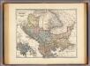
Pannonia, Illyricum, Dacia, Moesia, Thracia, Macedonia, Epirus.
1 : 4000000 Menke, Th.
Romaniae, (quae olim Thracia dicta) Vicinarumque Regionum, Uti Bulgariae, Walachiae, Syrfiae, Etc. Descriptio. [Karte], in: Theatrum orbis terrarum, S. 378.
1 Karte aus Atlas Ortelius, Abraham Vrients, Jan Baptista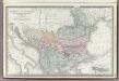
Turkey in Europe.
1 : 3300000 Rand McNally and Company
Karte der Balkan Halbinsel
1 : 3000000 Balkánský poloostrov Schlachter, J. J. Schlachter