Maps of Balkan Pen.
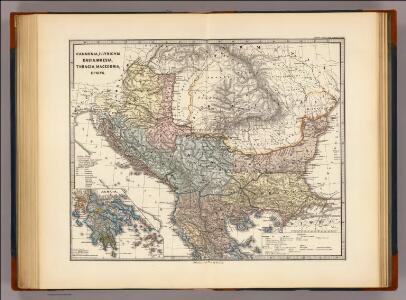
Pannonia, Illyricum, Dacia, Moesia, Thracia, Macedonia, Epirus.
1 : 4000000 Menke, Th.
Carte de la Turquie d'Europe
1 : 1270000 Evropa jihovýchodní Konrad, Al. Palma, G. chez Artaria et Compagnie
Thracia, Macedonia, Illyricum, Moesia, Pannonia & Dacia
1 : 4000000 Dácie Spruner, Karl von Alt, Wilhelm Justus Perthes
Sedes belli Christianos inter & Turcas, seu tota Hvngaria & Graecia cum vicinis exparte regnis
1 : 5600000 Maďarsko
Oorlogskaart van Zuid-Oostelijk Europa : (Italië tot de Dardanellen)
1 : 2500000 Annotatie: Ondertitel op omslag: Italiaansch-Oostenrijksche grenzen, gebied der Adriatische Zee, Roemeensch-Hongaarsche grenzen, de Dardanellen Amsterdam : Van Holkema & Warendorf
Regiones Danvbianae, Pannoniae Dacia ?oesiae cum Vicino Illyrico
1 : 4100000 Mollova mapová sbírka Weigel, Christoph Weigel, Christoph I.

Die Transhumanz der dakorumänischen, aromunischen, meglenorumänischen und istrorumänischen Hirten
Balkanhalbinsel Transhumanz, Walachen Willing, P.
Theatrum Antiqvitatum Romanarum in Hungaria: sive Mappa Geographica Regionum Danubio Circumjacentium, Pannoniarum, Daciarum, Mysiar: Etc. in Qvibus Antiqvitates Romanae Svis Singulae Figuris in Hoc Tomo Descriptae Reperiuntur
1 : 4700000 Mollova mapová sbírka Marsili, Luigi Ferdinando
Novissima tabula regni Hungariae et regionum quondam ei unitarum ut Transilvaniae, Valachiae, Moldaviae, Serviae, Romaniae, Bulgariae, Bessarabiae, Croatiae, Bosniae, Dalmatiae, Slavoniae, Morlachiae et reipublicae Ragusanae : accedit pars magna dominii Veneti [...]
1 : 2000000 auctore Reinier & Josua Ottens geographe Amstelodamensi J. Keyser sculpsit Te Amsterdam : by Reinier & Iosua Ottens [...]
Turkey In Europe.
1 : 4942080 Tallis, J. & F.
Accurate Landkarte Des Königreichs Hungarn des Fürstenthümer Siebenbürge; Moldau und Wallachey, wie auch Griechenlandes und Morea Samt dem Weltberüffnene Donau-Throm
1 : 4000000 Mollova mapová sbírka
Composite: Europ. Turkey.
1 : 1740000 Grassl, J. (Joseph)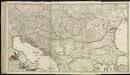
[79][79]Regni Hungariae, ..., uit: Atlas sive Descriptio terrarum orbis
Annotatie: Gedigitaliseerde versie. Amsterdam. Heiloo : Picturae (vervaardiger), 2015. tiff-bestand. Gedigitaliseerd: 07-01-2015; Origineel: Universiteitsbibliotheek Vrije Universiteit (XL.05127.-) ; Netherlands; Titelpagina ontbreekt Wit, Frederik de Amsterdam : Frederick de Wit
Fluviorum in Europa principis DANUBII
1 : 4190000 Dunaj-oblast Homann, Johann Baptist Ioh Baptista Homanno
Südosteuropa mit den von 1919 bis 1938 geltenden Staatsgrenzen
Südosteuropa Grenzen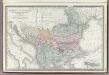
Turkey in Europe.
1 : 3300000 Rand McNally and Company
Die Europäische Türkey, Griechenland, Dalmatien und die Republik Montenegro
Schul-Atlas in 36 Karten Völter, Daniel Verlag der J.M. Dannheimer'schen Buchhandlung
Südosteuropa 1862
Südosteuropa, Balkanhalbinsel Kunz, Andreas ; Röss, Wolf ; Johnen, Bettina ; Moeschl, Joachim Robert
Europaeische Türkey, Griechenland und die Jonischen Inseln
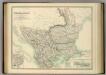
Turkey in Europe.
1 : 2533000 Johnston, Alexander Keith
Turkey in Europe.
1 : 4000000 Colton, G.W.
Südosteuropa 1993
Südosteuropa, Balkanhalbinsel Kunz, Andreas ; Treiling, Thomas ; Moeschl, Joachim
Südosteuropa 1992
Südosteuropa, Balkanhalbinsel Kunz, Andreas ; Treiling, Thomas ; Moeschl, Joachim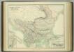
Turkey in Europe.
1 : 2533000 Johnston, W. & A.K.
Südosteuropa 2003
Südosteuropa, Balkanhalbinsel Kunz, Andreas ; Treiling, Thomas ; Moeschl, Joachim
Südosteuropa 1908
Südosteuropa, Balkanhalbinsel Kunz, Andreas ; Röss, Wolf ; Johnen, Bettina ; Moeschl, Joachim Robert
Pohraničí Rakousko-Uherska, Rumunska, Srbska a Bulharska
1 : 1250000 Bulharsko
Südosteuropa 2007
Südosteuropa, Balkanhalbinsel Kunz, Andreas ; Moeschl, Joachim Robert