Maps of Scandinavia

Suede, Norvege, Danemark.
1 : 4500000 Brue, Adrien Hubert, 1786-1832

Schweden, Norwegen.
1 : 6000000 Andree, Richard
Scandia, Scandinavia.
1 : 3050000 Faden, William, 1750?-1836
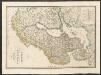
Composite: Courones du nord.
1 : 2500000 L'Isle, Guillaume de, 1675-1726
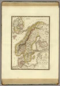
Suede, Norvege, et Danemark.
1 : 5900000 Monin, C.V.
Sweden & Norway.
1 : 7480000 Tanner, Henry S.
Sweden, Denmark, Norway
1 : 7500000 Bowen, Frances
Composite: Courones du Nord.
1 : 2600000 L'Isle, Guillaume de, 1675-1726
Skandinavien oder Schweden und Norwegen
Schul-Atlas in 36 Karten Völter, Daniel Verlag der J.M. Dannheimer'schen Buchhandlung
Nordeuropa 1991
Nordeuropa Kunz, Andreas ; Treiling, Thomas
Atlas für Handel und Industrie: Für Kaufleute, Fabrikante u. Gewerbetreibende, Handlungs- u. Gewerbe-Schulen

Scandinavien bis zur calmarischen Union, 1397.
1 : 6000000 Spruner von Merz, Karl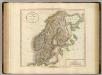
Sweden, Denmark and Norway.
1 : 4550000 Cary, John, ca. 1754-1835
Zweiter Theil der Karte von Europa welcher Dænemark, und Norwegen, Schweden, und Russland enthælt, 2
1 Blatt : 72 x 54 cm F.A. Schrämbl
Seconde partie de la carte d'Europe contenant le Danemark et la Norwege, la Suède et la Russie (a l'exeption de l'Ukraine), 2
1 Blatt : 71 x 53 cm chez l'auteur
Schweden, Norwegen.
1 : 6400000 Flemming, Carl
Statistikk 42: Døgnets normaltemperatur i Skandinavia, oktober måned
1 : 4000000
Nordeuropa 1867
Nordeuropa Kunz, Andreas ; Röss, Wolf ; Johnen, Bettina ; Moeschl, Joachim Robert
Schweden, Norwegen und Dänemark
Schul-Atlas über alle Theile der Erde nach dem neuesten Zustande, und über das Weltgebäude Stieler, Adolf Justus Perthes
Statistikk 42: Døgnets normaltemperatur i Skandinavia, juli måned
1 : 4000000
Skandinavien
Plastischer Schul-Atlas über alle Theile der Erde : in 24 Karten Woldermann, G Verlag von P. Eckerlein
Schweden, Norwegen und Dänemark
Schul-Atlas über alle Theile der Erde nach dem neuesten Zustande, und über das Weltgebäude Stieler, Adolf bei Justus Perthes
[Scandinavien und Dänemark]
[Allgemeiner Atlas über alle Theile der Erde in 29 Blättern] Ziegler, Jakob Melchior Top. Anstalt v. J. Wurster u. Comp.
Statistikk 42: Døgnets normaltemperatur i Skandinavia, januar måned
1 : 4000000
Sweden and Norway.
1 : 7950000 Lucas, Fielding Jr.
Statistikk 42: Døgnets normaltemperatur i Skandinavia, april måned
1 : 4000000
[Schweden und Norwegen oder Scandinavische Halbinsel Königreich Daenemark]
Geographischer Atlas über alle Theile der Erde Ziegler, Jakob Melchior Verlag von Dietrich Reimer
Suede, Norvege, Danemark.
1 : 5400000 Garnier, F. A., 1803-1863