Maps of Czech Republic
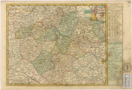
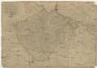
Das Königreich Böhmen
České království
1 : 720000
Bohemia Nova Descriptio Tabula XVII. [Karte], in: Claud. Ptolemaeus. Geographia lat. cum mappis [...], S. 407.
1 Karte aus Atlas Münster, Sebastian [und Ptolemaeus, Claudius]
Karten - Skizzen für die Schul - Praxis
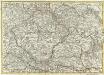
Königreich Böhmen
1 : 670000 Čechy (Česko) Mollo, Tranquillo T. Mollo
La Boheme
1 : 1600000 Česko Slaart, Pieter van der Pierre Vander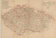
Mapa o stavu čs. silnic
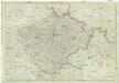
Königreich Böhmen nach der neusten Beobachtungen
1 : 680000 Čechy (Česko) Reiffer, F. T. Mollo
Podrobné mapy zemí Koruny české v měřítku 1:75.000 a mapa vzdáleností všech míst při silnici ležících - Přeštice - Švihov - Klatovy. Průvodce statisticko-historický po všech místech na těchto mapách uvedených a rejstřík věcný názvů hor, potoků, řek, rybníků atd. Sešit 41. List 22,
1 : 75000
Karten zur Statistik des Königreiches Böhmen...

[Böhmen, Mähren, Herzth Schleisien, Prov: Schlesien, Königr: Sachsen]
Schul-Atlas in 36 Karten Völter, Daniel Verlag der J.M. Dannheimer'schen Buchhandlung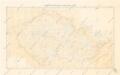
Přehledná mapa meteorologických stanic v Čechách, na Moravě a ve Slezsku

Charte der Böhmischen Laender oder des Königreichs Böhmen der Markgrafschaft Maehren und des Herzogthums Schlesien Österreichischen Antheils
1 : 1350000 Mollova mapová sbírka Hard, Martin Withalm, Andreas
Charte der Böhmischen Laender oder des Königreichs Böhmen der Markgrafschaft Maehren und des Herzogthums Schlesien Österreichischen Antheils
1 : 1350000 Mollova mapová sbírka Hard, Martin Withalm, Andreas
Politické rozdělení Československé republiky
Vojenský zeměpisný ústav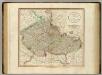
Bohemia, Moravia.
1 : 915000 Cary, John, ca. 1754-1835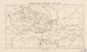
Český stát v letech 1742 - 1918
Mappa Geographica summo labore, accurate et novissime exarata, exhibens Circulos aliquot Germaniae, praesertim illos ubi Bellum nunc Geritur
1 : 1300000 Mollova mapová sbírka Lotter, Tobias Conrad Lotter, Tobias Conrad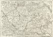
Carte Generale d'Allemagne
1 : 1300000 Mollova mapová sbírka Eisenschmidt, Johann Caspar Julien, Roch Joseph
[Andere Metalle]
1 : 750000 Protektorát Čechy a Morava
Administrative Gliederung der Sudetenländer 1930
1 : 750000 Protektorát Čechy a Morava
[Andere Metalle]
1 : 750000 Protektorát Čechy a Morava
[Eisen- und Stahlindustrie]
1 : 750000 Protektorát Čechy a Morava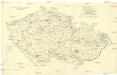
[Eisen- und Stahlindustrie]
1 : 750000 Protektorát Čechy a Morava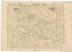
Poštovní mapa korunních zemí Čechy, Morava Slezsko
Česko Rašín, Jan náklad Farského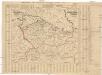
Poštovní mapa korunních zemí Čechy, Morava Slezsko
Česko Rašín, Jan náklad Farského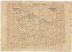
Poštovní mapa korunních zemí Čechy, Morava Slezsko
Česko Rašín, Jan náklad Farského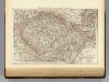
Bohemia, Moravia, Austrian Silesia.
1 : 1500000 Andree, Richard; Times (London, England)
La Royaume de Boheme...