Maps of Czech Republic

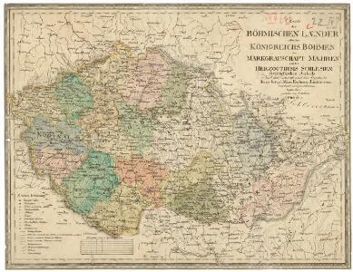
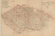
Charte der Böhmischen Laender oder des Königreichs Böhmen der Markgrafschaft Maehren und des Herzogthums Schlesien Österreichischen Antheils
1 : 1350000 Mollova mapová sbírka Hard, Martin Withalm, Andreas
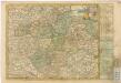
Charte der Böhmischen Laender oder des Königreichs Böhmen der Markgrafschaft Maehren und des Herzogthums Schlesien Österreichischen Antheils
1 : 1350000 Mollova mapová sbírka Hard, Martin Withalm, Andreas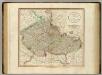
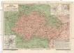
Bohemia, Moravia.
1 : 915000 Cary, John, ca. 1754-1835
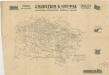
Podrobné mapy zemí Koruny české v měřítku 1:75.000 a mapa vzdáleností všech míst při silnici ležících - Přeštice - Švihov - Klatovy. Průvodce statisticko-historický po všech místech na těchto mapách uvedených a rejstřík věcný názvů hor, potoků, řek, rybníků atd. Sešit 41. List 22,
1 : 75000
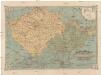
Carte de la Boheme, et de la Moravie
1 : 1200000 Česko Mentelle, Edme Tardieu, Pierre François
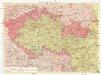
Karte vom Königreiche Boehmen der Markgrafschaft Maehren und des Herzogthumes Schlesien
1 : 991000 Česko Fried, Franz Artaria und Compag.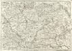
Carte Generale d'Allemagne
1 : 1300000 Mollova mapová sbírka Eisenschmidt, Johann Caspar Julien, Roch Joseph
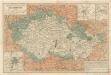
Čechy, Morava a Slezsko též i země pohraničné [sic]
Česko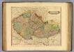
Bohemia, Moravia.
1 : 930000 Lizars, Daniel
Železniční a národopisná mapka zemí koruny České a Rakouska-Uherska s vyznačením diecésáních hranic...
Mapa zemí koruny České
Železniční a národopisná mapka zemí koruny české
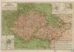
Übersichtskarte von Böhmen, Mähren und Schlesien
Mapa o stavu čs. silnic
Das Königreich Böhmen
Mapa zemí Koruny české
Česko Kolisko, Hugo Theodor Schwihlik, F.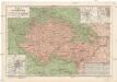
Mapa zemí Koruny české
Česko Kolisko, Hugo Theodor Schwihlik, F. Julius Grégr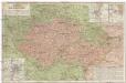
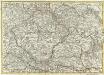
Mapa zemí Koruny české
Česko Kolisko, Hugo Theodor Schwihlik, F.
Bohemia & Moravia
1 : 960000 Česko Lizars, D. D. Lizars
Země kor[uny české]
1 : 1000000 Česko Wagner, Jan Eduard F. Kytka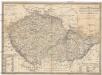
Karte vom Königreich Boehmen der Markgraschaft Maehren und des Herzogthumes Schlesien
1 : 980000 Česko Fried, Franz Artaria
Hallstattzeit
Böhmen, Mähren, Archäologie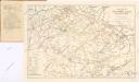
Železniční síť Čech, Moravy, Slezska a zemí sousedních
Mappa Geographica summo labore, accurate et novissime exarata, exhibens Circulos aliquot Germaniae, praesertim illos ubi Bellum nunc Geritur
1 : 1300000 Mollova mapová sbírka Lotter, Tobias Conrad Lotter, Tobias Conrad
[České království]
1 : 1300000 Česko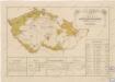
Přehled sokolských jednot česko-moravských počátkem července 1869
Sudetenland
1 : 600000 Sudety (Česko) Kartogr. Anstalt G. Freytag & Berndt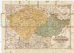
Geschäfts- und Reisekarte von Böhmen, Mähren & Schlesien und den angrenzenden Ländern
1 : 600000 Rakousko Erben, Josef Karl Janský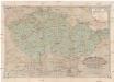
Geschäfts- und Reisekarte von Böhmen, Mähren & Schlesien und den angrenzenden Ländern
1 : 600000 Rakousko Erben, Josef Karl Janský