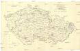
Maps of Czech Republic
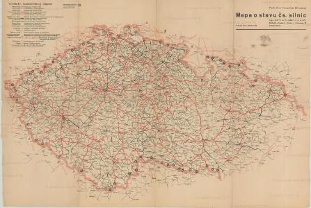
Mapa o stavu čs. silnic
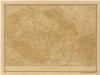
Übersichtskarte von Böhmen, Mähren und Schlesien
Administrative Gliederung der Sudetenländer 1930
1 : 625000 Protektorát Čechy a Morava
Carte Generale d'Allemagne
1 : 1300000 Mollova mapová sbírka Eisenschmidt, Johann Caspar Julien, Roch Joseph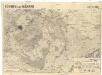
Böhmen und Mähren
1 : 750000 Česko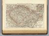
Bohemia, Moravia, Austrian Silesia.
1 : 1500000 Andree, Richard; Times (London, England)
[České království]
1 : 1300000 Česko
Podrobné mapy zemí Koruny české v měřítku 1:75.000 a mapa vzdáleností všech míst při silnici ležících - Přeštice - Švihov - Klatovy. Průvodce statisticko-historický po všech místech na těchto mapách uvedených a rejstřík věcný názvů hor, potoků, řek, rybníků atd. Sešit 41. List 22,
1 : 75000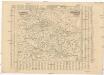
Poštovní mapa korunních zemí Čechy, Morava Slezsko
Česko Rašín, Jan náklad Farského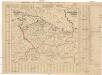
Poštovní mapa korunních zemí Čechy, Morava Slezsko
Česko Rašín, Jan náklad Farského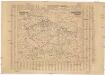
Poštovní mapa korunních zemí Čechy, Morava Slezsko
Česko Rašín, Jan náklad Farského
[Böhmen, Mähren, Herzth Schleisien, Prov: Schlesien, Königr: Sachsen]
Schul-Atlas in 36 Karten Völter, Daniel Verlag der J.M. Dannheimer'schen Buchhandlung
Železniční a národopisná mapka zemí koruny české
Přehledná mapa meteorologických stanic v Čechách, na Moravě a ve Slezsku
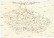
Bez titulu: Slepá mapa horstev Čech a Moravy

Sachsen, Schlesien, Böhmen, Mähren, Ober- u. Nieder-Österreich
1 : 1900000 Dolní Rakousko (Rakousko) Kocen, Blaž Eduard Hölzel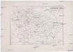
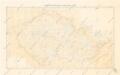
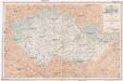
Země Koruny české
země Koruny české Hercík, Emanuel Mikuláš & Knapp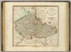
Bohemia, Moravia.
1 : 915000 Cary, John, ca. 1754-1835
Jüngeres Neolithikum
Böhmen, Mähren, Archäologie
Äneolithikum
Böhmen, Mähren, Archäologie
La Boheme
Železniční mapka zemí koruny české [sic]
země Koruny české F.B. Batovec
Äneolithikum
Böhmen, Mähren, Archäologie
Géographie. croquis n5, Bohême et Moravie
1 : 1000000 Molard, Jules, Commandant [Paris] : Service Géographique de l'Armée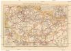
Cestovní mapa železniční pro země Koruny české
1 : 800000 Slovensko Loutocký, Josef J. Loutocký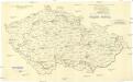
[Andere Metalle]
1 : 750000 Protektorát Čechy a Morava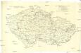
Administrative Gliederung der Sudetenländer 1930
1 : 750000 Protektorát Čechy a Morava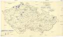
[Andere Metalle]
1 : 750000 Protektorát Čechy a Morava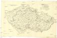
[Eisen- und Stahlindustrie]
1 : 750000 Protektorát Čechy a Morava