Maps of Czech Republic
České království
1 : 720000
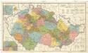
Das Königreich Böhmen
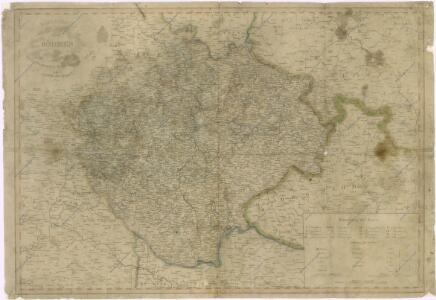
Königreich Böhmen
1 : 670000 Čechy (Česko) Mollo, Tranquillo T. Mollo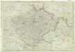
Königreich Böhmen nach der neusten Beobachtungen
1 : 680000 Čechy (Česko) Reiffer, F. T. Mollo
Karten zur Statistik des Königreiches Böhmen...
Bohemia Nova Descriptio Tabula XVII. [Karte], in: Claud. Ptolemaeus. Geographia lat. cum mappis [...], S. 407.
1 Karte aus Atlas Münster, Sebastian [und Ptolemaeus, Claudius]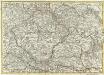
Mappa Geographica summo labore, accurate et novissime exarata, exhibens Circulos aliquot Germaniae, praesertim illos ubi Bellum nunc Geritur
1 : 1300000 Mollova mapová sbírka Lotter, Tobias Conrad Lotter, Tobias Conrad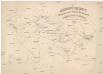
Übersichtskarte der evangelischen Kirche Augsb. und Helv. Confession
1 : 864000 Morava (Česko) Strehl, Anton k. k. evangel. Oberkirchenrathe
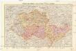
Geologische Übersichtskarte des Österreichischen Monarchie
1 : 576000 Rakousko-Uhersko Hauer, Franz Beck'schen Universitäts Buchhandlung (A. Hölder)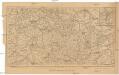
Železniční mapa zemí koruny české
1 : 1000000 Česko nákladem Al. Hynka
La Royaume de Boheme...
Český stát v letech 1742 - 1918
Protektorat Böhmen und Mähren
1 : 750000 Protektorát Čechy a Morava Edvard Fastr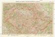
Protektorat Böhmen und Mähren
1 : 750000 Protektorát Čechy a Morava Edvard Fastr
Karten - Skizzen für die Schul - Praxis


Le Royaume de Boheme divisée en ses douze cercles : carte reduite sur celle de 25 feuilles
I.C. Muller capit. et ingen. à Amsterdam : chez Pierre Schenk, l'Entrée du Ness, dans le Atlas de N. Visscher
[Böhmen, Mähren, Herzth Schleisien, Prov: Schlesien, Königr: Sachsen]
Schul-Atlas in 36 Karten Völter, Daniel Verlag der J.M. Dannheimer'schen Buchhandlung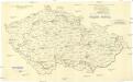
[Andere Metalle]
1 : 750000 Protektorát Čechy a Morava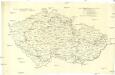
Administrative Gliederung der Sudetenländer 1930
1 : 750000 Protektorát Čechy a Morava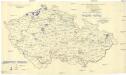
[Andere Metalle]
1 : 750000 Protektorát Čechy a Morava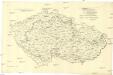
[Eisen- und Stahlindustrie]
1 : 750000 Protektorát Čechy a Morava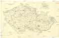
[Eisen- und Stahlindustrie]
1 : 750000 Protektorát Čechy a Morava
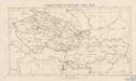
Charte der Böhmischen Laender oder des Königreichs Böhmen der Markgrafschaft Maehren und des Herzogthums Schlesien Österreichischen Antheils
1 : 1350000 Mollova mapová sbírka Hard, Martin Withalm, Andreas
Charte der Böhmischen Laender oder des Königreichs Böhmen der Markgrafschaft Maehren und des Herzogthums Schlesien Österreichischen Antheils
1 : 1350000 Mollova mapová sbírka Hard, Martin Withalm, Andreas
Podrobné mapy zemí Koruny české v měřítku 1:75.000 a mapa vzdáleností všech míst při silnici ležících - Přeštice - Švihov - Klatovy. Průvodce statisticko-historický po všech místech na těchto mapách uvedených a rejstřík věcný názvů hor, potoků, řek, rybníků atd. Sešit 41. List 22,
1 : 75000
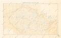
Bohemia et Provinciae huic Regno unitae
Přehledná mapa meteorologických stanic v Čechách, na Moravě a ve Slezsku
Česká obec sokolská před vzplanutím světové války v r. 1914
1 : 170000 Dolní Rakousko (Rakousko) Musil, Ladislav V. Neubert