Maps of Canterbury
Kent XXXVI.5 (includes: Hoath; Sturry) - 25 Inch Map
1 : 2500 Topographic maps Ordnance Survey Ordnance Survey
Kent XXXVI.5 (includes: Hoath; Sturry) - 25 Inch Map
1 : 2500 Topographic maps Ordnance Survey Ordnance Survey
Kent XXXVI.5 (includes: Hoath; Sturry) - 25 Inch Map
1 : 2500 Topographic maps Ordnance Survey Ordnance Survey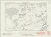
Kent XXXVI.NW - OS Six-Inch Map
1 : 10560 Topographic maps Ordnance Survey Ordnance Survey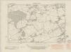
Kent XXXVI.NW - OS Six-Inch Map
1 : 10560 Topographic maps Ordnance Survey Ordnance Survey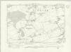
Kent XXXVI.NW - OS Six-Inch Map
1 : 10560 Topographic maps Ordnance Survey Ordnance Survey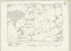
Kent XXXVI.NW - OS Six-Inch Map
1 : 10560 Topographic maps Ordnance Survey Ordnance Survey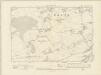
Kent XXXVI.NW - OS Six-Inch Map
1 : 10560 Topographic maps Ordnance Survey Ordnance Survey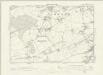
Kent XXXVI.NW - OS Six-Inch Map
1 : 10560 Topographic maps Ordnance Survey Ordnance Survey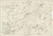
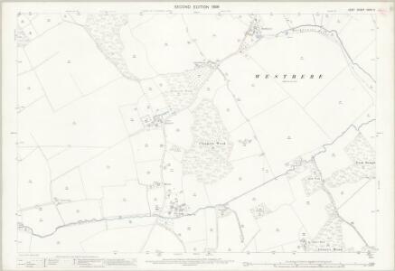
Kent XXXVI - OS Six-Inch Map
1 : 10560 Topographic maps Ordnance Survey Ordnance Survey
Boughton Street, Kent(002OSD000000015U00371000)
Drawing showing Boughton Street, Whitstable & Herne Bay in north Kent. Pencil lines cover this drawing, Radiating from elevated sites where the surveyor took angular measurements to plot topographical features. Several corrections have been made in black ink. Windmills are drawn in elevation at Millstrood, In the centre of the sheet.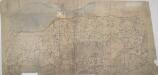
Boughton Street, Kent(002OSD000000015U00372000)
The lack of detail shows this to be an unfinished drawing. Buildings are drawn in outline only. Woodland is indicated by a general representation of tree tops en masse.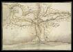
North East Corner of Kent
This is a map of the north east corner of Kent. It forms part of an atlas that belonged to William Cecil Lord Burghley, Elizabeth I’s Secretary of State. Burghley used this atlas to illustrate domestic matters. It is though to be by William Lambard. Lambard is known to have been working in Kent during the 1580s and 1590s, producing a map of the beacon network of Kent in 1585. Here the waterways are the dominant feature. These were the most effective mode of transport and knowledge of them was vital in order to protect the country as they made it possible to manoeuvre troops and weaponry in large quantities relatively fast. Given the fact that Lambard was engaged in producing a map of the beacon network of the area, it is likely that this map was also produced with the idea of defence in mind. The threat from Spain reached it climax in the 1580s with the events of the Sapnish Armada in 1588. The earlier years of the decade saw defensive preparations take place and the proximity of this area to London would have made a detailed understanding of its communication routes vital. Lord Burghley has written on the reverse of the map: "River of Stowre betwixt Sandwych and Fordwych" highlighting that the important feature of the map is indeed the waterways. [Lambard, William]
A topographical-map, of the county of Kent, 9
1 Blatt : 54 x 70 cm A. Dury, W. Herbert
A topographical-map, of the county of Kent, 14
1 Blatt : 54 x 71 cm A. Dury, W. Herbert
Faversham (Hills) - OS One-Inch Revised New Series
1 : 63360 Topographic maps Ordnance Survey Ordnance Survey
Faversham (Outline) - OS One-Inch Revised New Series
1 : 63360 Topographic maps Ordnance Survey Ordnance Survey
Partie de l'Angleterre
1 : 110000 Anglie jižní Fricx, Eugene Henry Harrewyn, Jacques chez Eugene Henry Fricx
East Kent - OS One-Inch Map
1 : 63360 Topographic maps Ordnance Survey Ordnance Survey
To the Right Honorable the Master, Wardens, and Elder Brethren, of the Trinity House, this chart of the Downs and Margate Roads is ... dedicated
1 : 56000 Heather, W. (William) Heather, W. (William)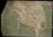
Mouths of the Thames and Medway from Ipswich to Sandwich and Maldon and Rochester to the Sea
This is a map showing the mouths of the Thames and the Medway from Ipswich to Sandwich and Maldon and Rochester to the sea. It dates from around 1544 and is annotated Rycherd Cavendishe made this carde’. Richard Cavendish was a master gunner who had supervised new defence works at Berwick and Wark in 1522-3. The map seems to have been made with the purposes of defence and navigation in mind. Coastal forts and navigational channels are shown. The shoreline is exaggerated in order to illustrate clearly how an enemy might move ashore and how they might be stopped. In this case the enemy was England’s ancient adversary France, with whom hostilities had resumed in 1542. This map of the vulnerable south east coast, was made against this historical background. The fear of a French invasion was very real. In 1514 the French had invaded Brighton, and in 1545 French ships entered the Solent and landed on the Isle of Wight. The lines which cover the sea areas of the map are called rhumb lines. These are lines of constant bearing that radiate from compass roses and allow the sailor to plot a course from harbour to harbour using dividers and straight edge. Vignettes of several towns are included on this map, Sandwich, Rochester and Canterbury are shown. The view of Essex is possibly derived from a survey Cavendish made in 1520. Other settlements are formalized showing rows of red roofed houses with a church in the centre. A scale bar annotated by 3’ is included, however, as this occupies a green painted area it is likely that this was added later. Cavendish, Richard
Kent, Sheet 31 - Bartholomew's "Half Inch to the Mile Maps" of England & Wales
1 : 126720 Topographic maps Bartholomew, John George John Bartholomew & Co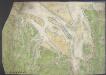
Chart of the mouth of the River Thames, c1540
This map, showing parts of Kent and Sussex, comes from a 16th-century portfolio of coastal charts and drawings It incorporates miniature copies of town plans that are now lost including what are probably the earliest plans of Canterbury, Rochester and Sandwich The mapmaker was Sir Richard Cavendish With its emphasis on sandbanks and beaches, the map was evidently intended for navigation and defence purposes The decorative quality of the map suggests it was meant for the eyes of the king, Henry VIII North is to the left of the map and East to the top, making the map appear on its side to modern eyes Cavendish, Sir Richard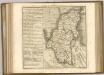

Cantium vernacule Kent
1 : 130000 Amstelodami : apud Joannem Janssonium
CANTIVM | Vernacule | KENT.
[Amsterdam : Joan Blaeu]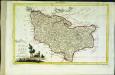
Provincia di Kent
1 Karte : Kupferdruck ; 18 x 29 cm Zatta; Zuliani; Pitteri presso Antonio Zatta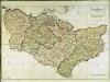
A map of the county of Kent
1 Karte : Kupferdruck ; 49 x 70 cm Kitchin; Dury; Andrews; Herbert A. Dury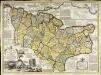
An accurate map of the county of Kent
1 Karte : Kupferdruck ; 50 x 69 cm Bowen; Hinton sold by J. Hinton at the Kings Arms in St. Pauls Church Yard