Maps of Lustleigh
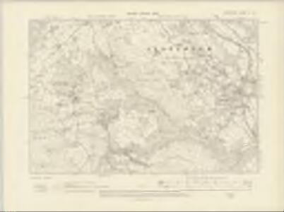
Devonshire C.NE - OS Six-Inch Map
1 : 10560 Topographic maps Ordnance Survey Ordnance Survey
Devonshire C.NE - OS Six-Inch Map
1 : 10560 Topographic maps Ordnance Survey Ordnance Survey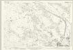
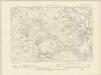
Devon C.4 (includes: Bovey Tracey; Lustleigh) - 25 Inch Map
1 : 2500 Topographic maps Ordnance Survey Ordnance Survey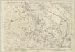
Devon C.4 (includes: Bovey Tracey; Lustleigh) - 25 Inch Map
1 : 2500 Topographic maps Ordnance Survey Ordnance Survey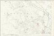
Devon C.4 (includes: Bovey Tracey; Lustleigh) - 25 Inch Map
1 : 2500 Topographic maps Ordnance Survey Ordnance Survey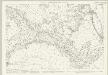
Devon C.8 (includes: Bovey Tracey; Lustleigh; Manaton) - 25 Inch Map
1 : 2500 Topographic maps Ordnance Survey Ordnance Survey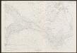
Devon C.8 (includes: Bovey Tracey; Lustleigh; Manaton) - 25 Inch Map
1 : 2500 Topographic maps Ordnance Survey Ordnance Survey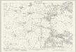
Devon C.7 (includes: Lustleigh; Manaton) - 25 Inch Map
1 : 2500 Topographic maps Ordnance Survey Ordnance Survey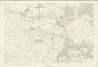
Devon C.7 (includes: Lustleigh; Manaton) - 25 Inch Map
1 : 2500 Topographic maps Ordnance Survey Ordnance Survey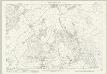
Devon C.3 (includes: Lustleigh; Manaton; North Bovey) - 25 Inch Map
1 : 2500 Topographic maps Ordnance Survey Ordnance Survey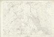
Devon C.3 (includes: Lustleigh; Manaton; North Bovey) - 25 Inch Map
1 : 2500 Topographic maps Ordnance Survey Ordnance Survey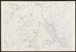
Devon C.3 (includes: Lustleigh; Manaton; North Bovey) - 25 Inch Map
1 : 2500 Topographic maps Ordnance Survey Ordnance Survey
Bovey Tracey
The military impetus of the Ordnance Survey is evident in the draughtsmen's preoccupation in detailing the lie of the land, not just its topographical features. Relief is indicated here by shading and the use of short disconnected lines drawn in the direction of the slopes - a technique called hachuring. Woods are coloured green. Red crosses and dots around the outer edge of the landmass indicate observation stations, which were used to plot distinctive features of the land being surveyed. The main roads are marked at mile intervals. Hewitt, John
Dartmoor Prison, Devon
Her Majesty's Prison at Dartmoor in Devon was built in 1802 for French captives. It appears at the top left of this drawing, alongside the words 'Prison of War'. The map is not conventionally orientated with north at the top. A turnpike road running from Moretonhampstead to Randlestown, coloured yellow, forms the upper boundary. The mileage from Moretonhampstead is noted along its route. This map follows the military practice of showing stone and brick structures in red or brown, and those built from less permanent materials, such as wood, in black or sepia. Individual stones are drawn in brown ink at the numerous 'tor' (hill) sites in this section of Dartmoor Forest. Hamilton Beacon ('Hameldown Beacon') is a pinprick mark surrounded by a pencil circle on Hamilton Down ('Hamel Down'). This may have been used as an observation or triangulation station. Hewitt, John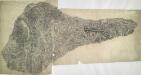
Oakhampton, Devon
1 : 31680 This dirty and worn plan is made from two pieces of paper conjoined. Place names are difficult to read. High Willhays (High Willhayse) and Yes Tor, two of Dartmoor's highest points, are badly obscured by the dense drawing style used to represent relief. A green wash indicates Dartmoor Forest. The remains of Oakhampton Castle are marked by a crosshatched mound. A red line passes through the drawing on the left edge. Two crosses may mark observation or triangulation points.
Torquay - OS One-Inch Map
1 : 63360 Topographic maps Ordnance Survey Ordnance Survey
Plymouth - OS One-Inch Map
1 : 63360 Topographic maps Ordnance Survey Ordnance Survey
Okehampton - OS One-Inch Map
1 : 63360 Topographic maps Ordnance Survey Ordnance Survey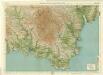
South Devon, Sheet 36 - Bartholomew's "Half Inch to the Mile Maps" of England & Wales
1 : 126720 Topographic maps Bartholomew, John George John Bartholomew & Co
Sheets 11-12. (Cary's England, Wales, and Scotland).
1 : 360000 Cary, John, ca. 1754-1835
Een gedeelte vant Kanaal van Kingsbudg tot Big Berrij
England Gerard van Keulen
Devonshire
1 : 640000 Devon (Anglie) Hall, Sid. by Chapman & Hall
Devoniae descriptio = The description of Devon-Shire
1 : 180000 Amstelodami : apud Joannem Janssonium
DEVONIAE COMITAT
This map of Devon is from the 1583 edition of the Saxton atlas of England and Wales. This atlas was first published as a whole in 1579. It consists of 35 coloured maps depicting the counties of England and Wales. The atlas is of great significance to British cartography as it set a standard of cartographic representation in Britain and the maps remained the basis for English county mapping, with few exceptions, until after 1750. During the reign of Elizabeth I map use became more common, with many government matters referring to increasingly accurate maps with consistent scales and symbols, made possible by advances in surveying techniques. Illustrating the increasing used of maps in government matters, Lord Burghley, Elizabeth I’s Secretary of State, who had been determined to have England and Wales mapped in detail from the 1550s, selected the cartographer Christopher Saxton to produce a detailed and consistent survey of the country. The financier of the project was Thomas Seckford Master of Requests at the Court of Elizabeth I, whose arms appear, along with the royal crest, on each map. The decorative scale bar houses the name of Saxton and of the Flemish engraver Remigius Hogenberg who prepared the copper plate for this map. This is the only map in the atlas that features a compass rose as well as the cardinal points in the borders, seeming to indicate the Devon has been turned slightly clockwise to fit the plate. Two ships engaging in battle are depicted off the coast of Plymouth, perhaps making reference to the vulnerability of this section of south coast and the location of naval bases. Saxton, Christopher Ryther, Augustine
DEVONIAE COMOTAT
This map of Devon is by Christopher Saxton and dates from 1575. It forms part of an atlas that belonged to William Cecil Lord Burghley, Secretary of State to Elizabeth I. Burghley used this atlas to illustrate domestic matters. This map is actually a proof copy of one which forms part of Christopher Saxton’s Atlas of England and Wales. This atlas was first published as a whole in 1579. It consists of 35 coloured maps depicting the counties of England and Wales. The atlas is of great significance to British cartography as it set a standard of cartographic representation in Britain and the maps remained the basis for English county mapping, with few exceptions, until after 1750. During the reign of Elizabeth I map use became more common, with many government matters referring to increasingly accurate maps with consistent scales and symbols, made possible by advances in surveying techniques. This map was produced under the patronage of Thomas Seckford, a Master of Requests to Elizabeth I, who had commissioned Saxton’s atlas of county maps, a project overseen by Lord Burghley, Secretary of State, whose administration increasingly involved the use of maps. This map is interesting as there are several notes in the margins. In the lower right hand margin: 'A Note of hir maties Store of Ordonnaunce, powder and match, lead,&c.,remayningin ye L. Lieutenauntes, &c. hands'. In the upper right hand margin 'A Note what powder and match was appointed to be kept in store in every corporate towne'. In the left hand margin 'A Breef Note of ye places of Descent. . . yt are most daungerous and require greatest regard and assistaunce'. These annotations were most probably made by an assistant of Lord Burghley’s, and show the concern felt about coastal areas in the face of the threat from Spain which culminated in 1588 with the events of the Spanish Armada. Saxton, Christopher Hogenbergius, Remigius
A new map of the County of Devon
London : C. Smith
DEVONIA | vulgo | DEVON-SHIRE.
[Amsterdam : Joan Blaeu]
An accurate map of Devon Shire
1 Karte : Kupferdruck ; 50 x 65 cm Bowen; Tinney sold by I. Tinney at the Golden Lion in Fleet street
Devonia vulgo Devon-Shire
1 Karte : Kupferdruck ; 38 x 49 cm Blaeu Joan Blaeu